With 42 sites spread across concrete pads and gravel areas, this Army Corps of Engineers campground operates year-round on the Warrior River. Sites range from $25-45 per night and accommodate RVs up to 153 feet with full hookups available. Reservations can be made through the standard Corps system.
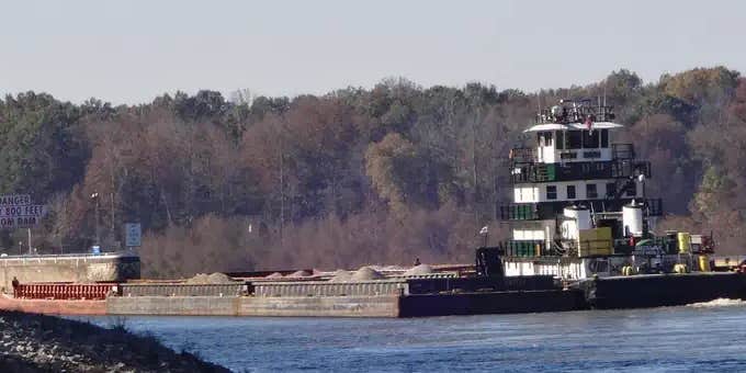
Most sites face either the river or interior water features, with four premium spots positioned directly on the Warrior River that fill quickly during peak periods. Liz H. notes "trees around but great views from most sites either of river or water." Commercial barge traffic passes regularly during daylight hours. Each site includes a picnic table, fire ring, and fish cleaning station, with many offering boat access alongside standard drive-in entry.
The campground sits within three miles of town but maintains a rural feel along the waterway. Paved roads and walking paths connect throughout the property, extending roughly 2.5 miles around the grounds and down to the lock and dam area. The facility includes clean restrooms, a playground, and a dump station. A 10 PM gate closure requires coordination with rangers for late arrivals or departures.
This setup works well for RV campers seeking river access and those planning extended stays, with many long-term residents during warmer months. For additional options in the area, see campgrounds around Demopolis.
Description
Overview
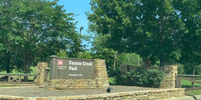
Foscue Creek Campground is nestled on the forested lake shore of Demopolis Lake, the largest lake on the Black Warrior-Tombigbee Waterway. Demopolis Lake offers 10,000 acres of water to explore. The region is excellent for hunting, and game is plentiful. Foscue Creek Campground offers a peaceful retreat for families, anglers, boaters and those who want to get away any time of year.
Recreation
Fishing and hunting are the most popular activities in the area. Whether fishing by boat or along the bank of the park, anglers can fish for bass, crappie, bream, catfish and other species. Day-use visitors and campers alike can enjoy a boat ramp and hiking trail at the campground. Foscue Creek Nature Trail takes walkers and joggers along the shoreline and provides benches for wildlife viewing and trail markers for tree identification.
Facilities
This facility has both a day-use area and a campground. There are four shelters for group picnics of between 25 to 80 people. The 54 campsites feature picnic tables, lantern holders and campfire rings with grill. Campsites are spacious, private and located near or close to the water.
Natural Features
The campground lies south of the confluence of the Black Warrior and Tombigbee Rivers. The Black Belt region of Alabama is a diverse area of dense conifer stands and rolling meadows that feature colorful wildflower displays. Wood ducks, bald eagles, blue birds and many other species of wildlife inhabit the lake area. Black Warrior-Tombigbee Waterway consists of six lakes with a total length of 457 miles and 39,800 surface acres of water.
Contact Info
For facility specific information, please call (334) 402-1608.
RV Road Trip Guides


Map & DirectionsFoscue Creek is located in Alabama near Demopolis
Directions
From Demopolis, Alabama, drive three miles west on U.S. Highway 80, and turn right at Maria Street. Go approximately two miles and follow signs to the campground entrance. It is strongly recommended not to follow GPS directions to the campground when traveling U.S. Highway 43 South to Jackson Street. Jackson Street is not conducive for camper/motorhome travel. The best travel option is utilizing U.S. Highway 80 to Maria Street as stated above.DO NOT FOLLOW GPS DIRECTIONS TO FOSCUE CREEK. These directions are not favorable when pulling a camping unit.Recommended Directions:Traveling from the north on Highway 43 south - in Demopolis take a (left) on truck route Highway 43, then a (right) on Highway 80 west, then a (right) on Maria Ave., then merge to your (left) onto Lock and Dam Road, cross two sets of railroad tracks and 1800 Lock and Dam Road/park entrance will be on the right.Traveling in from the south on Highway 43 north - in Demopolis take a (left) on Highway 80 west, then a (right) on Maria Ave., then merge to your (left) onto Lock and Dam Road, cross two sets of railroad tracks and 1800 Lock and Dam Road Park/ entrance will be on your right.Traveling in from the east on Highway 80 west make a (right) on Maria Ave., then merge to your (left) onto Lock and Dam Road, cross two sets of railroad tracks and 1800 Lock and Dam Road/park entrance will be on your right.Traveling in from the west on Highway 80 east - make a (left) on Maria Ave., then merge to your (left) onto Lock and Dam Road, cross two sets of railroad tracks and 1800 Lock and Dam Road/park entrance will be on your right.
Address
1800 Lock and Dam Road
Demopolis, AL 36732
Coordinates
32.5155556 N
87.8694444 W
Connectivity
 T-MobilePossible CoverageVerified by 12 usersLast on 6/21/26
 VerizonLTEGood CoverageVerified by 16 usersLast on 6/21/26
- AT&T5GGood CoverageVerified by 1 user
Connectivity
- T-MobilePossible CoverageVerified by 12 usersLast on 6/21/26
- VerizonLTEGood CoverageVerified by 16 usersLast on 6/21/26
- AT&T5GGood CoverageVerified by 1 user
Access
- Drive-InPark next to your site
- Boat-InSites accessible by watercraft.
Site Types
- Tent Sites
- RV Sites
- Standard (Tent/RV)
- Group
Features
For Campers
- Trash
- Firewood Available
- Phone Service
- Reservable
- Drinking Water
- Electric Hookups
- Toilets
- Alcohol
- Pets
- Fires
For Vehicles
- Sanitary Dump
- Sewer Hookups
- Water Hookups
- 50 Amp Hookups
- Big Rig Friendly
Drive Time
- 1 hr 28 min from Tuscaloosa, AL
- 1 hr 40 min from Birmingham, AL
- 1 hr 41 min from Montgomery, AL
- 2 hrs from Hattiesburg, MS


