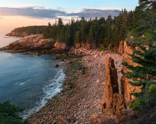
Reid Lake Foot Travel Area is located near a mix of forested terrain and open spaces. Temperatures range from lows in the 20s Fahrenheit during winter to highs in the 80s during summer. Nearby, visitors can explore the scenic Reid Lake and the Huron National Forest, offering opportunities for hiking and wildlife observation.
Description
Reid Lake The Reid Lake Area is a little over 3,000 acres in size. The forest in the area is primarily hardwoods and creates a small, remote, lake environment. The lake is a small, 13-acres, with a variety of fish. Twelve miles of gently rolling trail will lead you around Reid lake. The trails are open for back-country skiing in the winter, and are not groomed. Difficulty on the trails ranges from easy to more difficult. Flickr Photo Album
RV Road Trip Guides
Location
Public CampgroundReid Lake Foot Travel Area is located in Michigan
Directions
From Harrisville - M-72 Parking/Trailhead Travel west on M-72 for 19 miles. Turn left and travel south on FR 4243 to parking lot. Fowler Road Parking/Trailhead Travel west on M-72 for 14 miles. Turn left and travel south on Stout Rd. for 2 miles. Turn right and travel west on Fowler Rd.for 2 miles to parking are.
Coordinates
44.65296888 N
83.6754174 W
Connectivity
- T-MobileNo Coverage
- VerizonLTESome Coverage
- AT&TLTESome Coverage
Connectivity
- T-MobileNo Coverage
- VerizonLTESome Coverage
- AT&TLTESome Coverage
Access
Site Types
- Tent Sites
Features
Drive Time
- 1 hr 32 min from Bay City, MI
- 1 hr 42 min from Saginaw, MI
- 1 hr 42 min from Midland, MI
- 1 hr 56 min from Traverse City, MI


