Public Campground
Meadows ORV Campground — Huron Manistee National Forests
Warning 2 Alerts are In Effect
There are 2 alerts for this campground. Camp safely!
Warning 2 Alerts are In Effect
There are 2 alerts for this campground. Camp safely!
The water at our facility has been shutoff for the winter season. Please bring all the water youll need for your visit, including drinking water.
Thank you for your interest in Meadows ORV Campground. We will not be accepting reservations at this facility for the 2026 camping season. All sites will be available on a first-come, first-served basis. We apologize for any inconvenience this may cause. For more information, please contact the Mio Ranger Station at (989) 826-3252.
Meadows ORV Campground is located in the Huron-Manistee National Forests, featuring flat terrain with dense forest surroundings. Temperatures range from 20°F in winter to 80°F in summer. Nearby attractions include the Au Sable River and Hartwick Pines State Park, offering opportunities for hiking and exploring nature.
Description
Overview
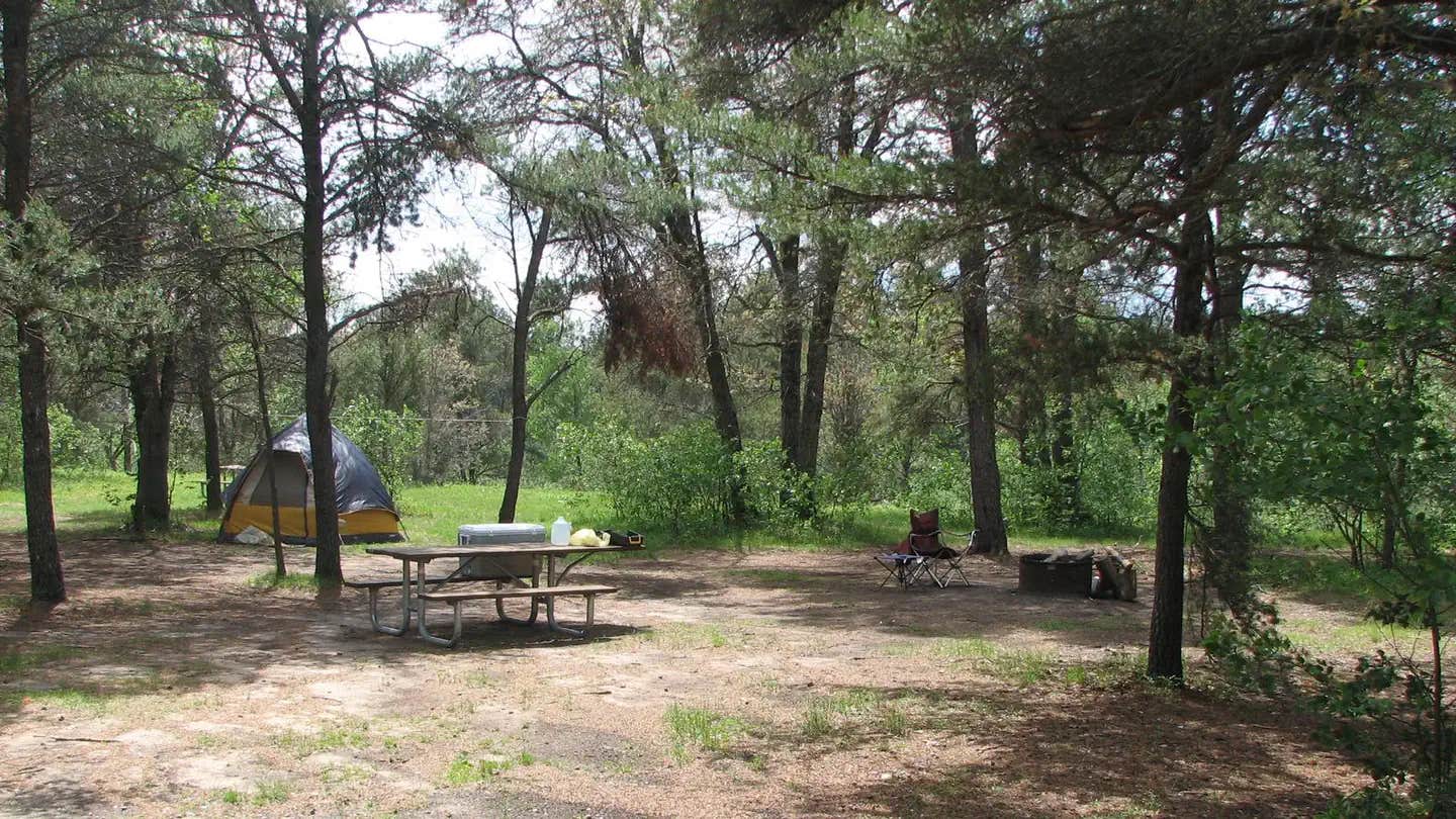
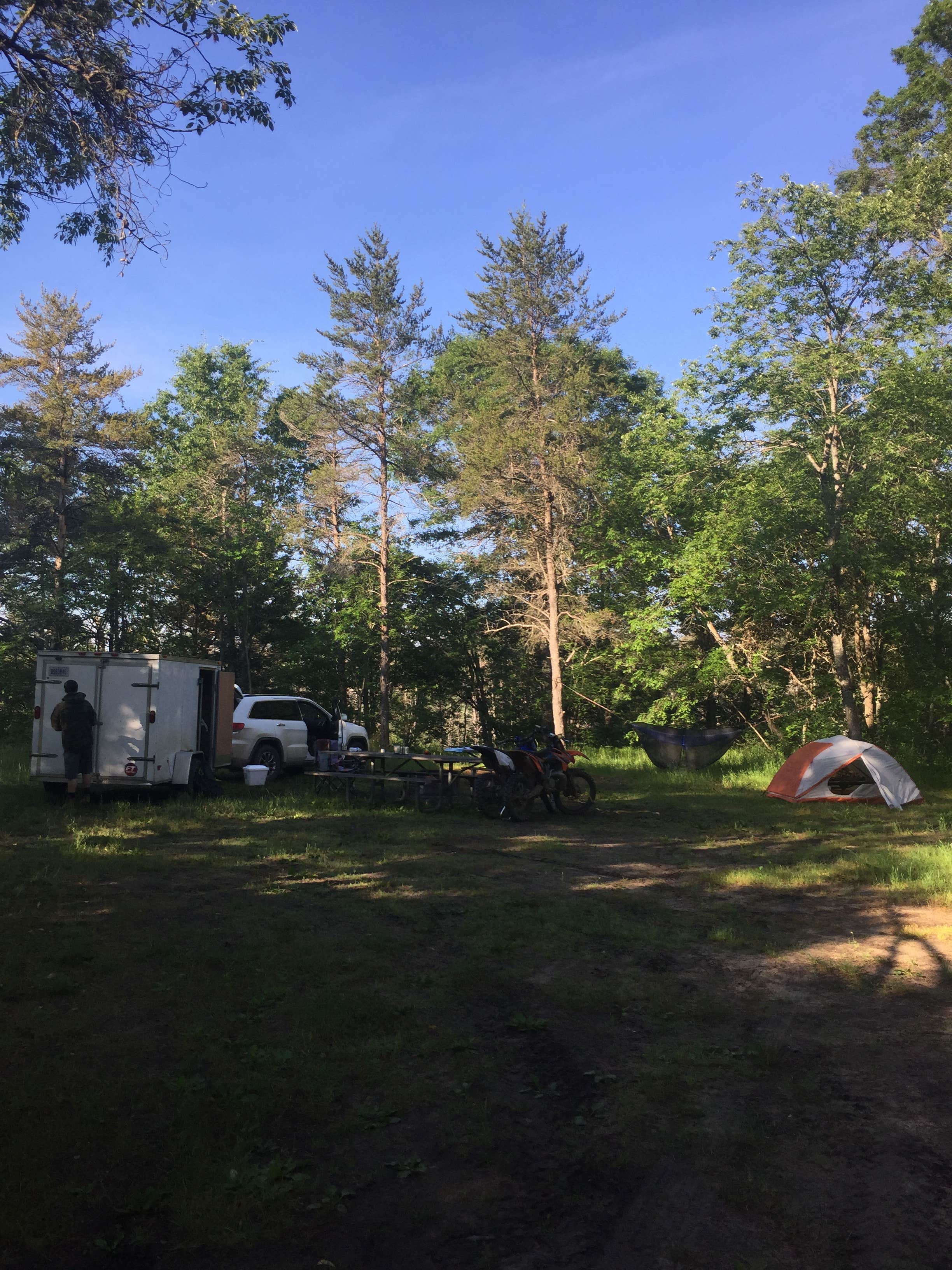
Meadows ORV Campground is a small, 12 single site area primarily used by OHV riders. The sites accomodate trailers/RV's up to 25 feet in length.
Recreation
ORV Riding: Passing just long the south edge of the campground is the Meadows ORV Trail System. This trail system was developed for vehicles 50 inches of less. The Meadows ORV trail connects to the Mack Lake Trail System and Bull Gap Hill Climb . The trail ranges anywhere from 0 to 10% grades with some short stretches of 30%. Confidence markers are orange triangles.
Facilities
Meadows ORV Campground provides visitors with a handpump well for drinking water, several vault toliets, and garbage collection services. Individual campsites provide a picnic table, a campfire ring, and a lantern post.
Natural Features
Meadows ORV Campground is nestled amoungst a pine and hardwood forest. The west branch of Big Creek is crossed by Meadows West Trail just to the southwest of the campground. Meadows ORV Campground is isolated from nearby light sources making it an excellent location for star gazing.
Contact Info
This location is unstaffed. To speak with our main office for general information, please call: (989) 826-3252.
Charges & Cancellations
All reservation changes, cancellations, and refunds are managed through Recreation.gov.
Location
Meadows ORV Campground — Huron Manistee National Forests is located in Michigan
Directions
From Grayling: Travel east on M-72 for 22 miles. Turn right and travel south on Deeter Rd. for 2 miles. Turn left and travel south on Durfee Rd./FR 4541 for 3 miles. The site is located on the left.
Coordinates
44.559264 N
84.309164 W
Connectivity
- T-MobileNo Coverage
- VerizonLTESome Coverage
- AT&TNo Coverage
Connectivity
- T-MobileNo Coverage
- VerizonLTESome Coverage
- AT&TNo Coverage
Access
- Drive-InPark next to your site
Site Types
- Tent Sites
- RV Sites
- Standard (Tent/RV)
- Group
Features
For Campers
- Phone Service
- Reservable
- Pets
- Fires
For Vehicles
- Water Hookups
Drive Time
- 1 hr 43 min from Bay City, MI
- 1 hr 50 min from Traverse City, MI
- 1 hr 53 min from Saginaw, MI
- 1 hr 53 min from Midland, MI


