Verified
Private Campground
Teton Corners Private River Preserve on the Teton River west of Rexburg, ID
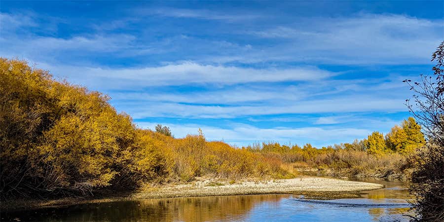
Teton Corners Private River Preserve is located near the Teton River west of Rexburg, ID. The area features flat terrain with river access, offering temperatures that range from lows in the 20s Fahrenheit during winter to highs in the 80s during summer. Nearby attractions include the Teton Dam Site and Museum and the St. Anthony Sand Dunes, providing opportunities for exploration and learning.
Description
Teton Corners has been a favorite fishing and stayover spot for generations, and we felt we should step up and adopt it since we didn't want to see it developed, ripped apart or closed off. Know that by staying here, you are helping preserve this small piece of natural beauty in Idaho. It may not be the biggest preserve, but you have to start somewhere. Come stay a night!
Learn more about this land:
Come to our riverside getaway at Teton Corners. This 3 acre peninsula into the Teton River provides amazing trout fishing right from your tent door (licenses issued just 1 mile down the road). This gorgeous nature area is minutes from town, with easy access to HWY20 and HWY33. Deer, moose, bald eagles and osprey frequent the area year round, as well as beaver, waterfowl and night owls. RV dumps right down the road, as well as a 27 hole golf course, if that's your thing. Or just relax, dip your feet in the Teton River and listen to the water pass by.
Note: River levels fluctuate over the season. We've tried to take pictures of all water seasons for reference.
Location
Teton Corners Private River Preserve on the Teton River west of Rexburg, ID is located in Idaho
Directions
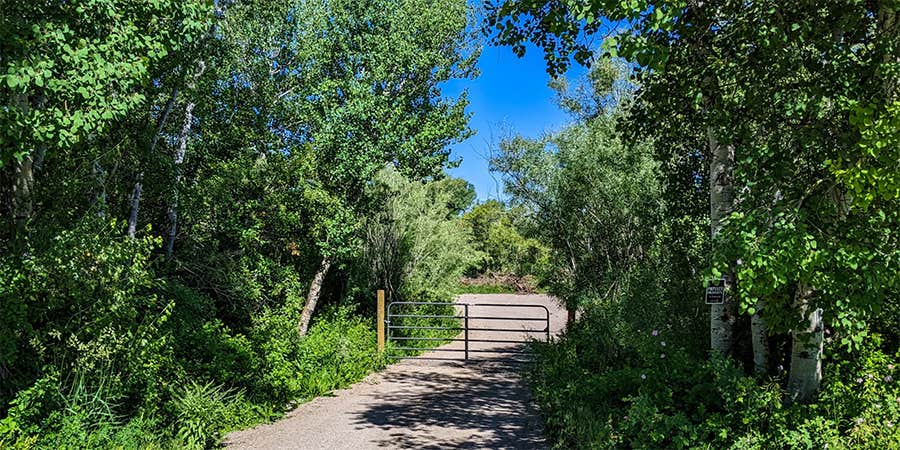
Directions from Hwy 20: Take the Rexburg Main Street/Hwy 33 exit and head west (away from town.) In 1.5 miles from the exit, you will come to 3000 W. Take a right and the entrance is north 900 ft, just past the bridge and turn left after the road turnout. You will see an entrance gate down a small driveway. You can also follow this link to the exact Google Maps location: https://goo.gl/maps/DQLzhE69KUYapZNf8 You will be setting up your rig in the 3rd area, C3. Once you enter the gate, follow the gravel road all the way to the end. You may explore the whole peninsula on foot, but please keep any motorized vehicles in your own camp area.
Coordinates
43.82560713865033 N
111.83793196321666 W
Connectivity
- T-Mobile5GExcellent CoverageVerified by 2 usersLast on 2/2/26
- Verizon5GExcellent CoverageVerified by 2 usersLast on 2/2/26
- AT&T5GExcellent Coverage
Connectivity
- T-Mobile5GExcellent CoverageVerified by 2 usersLast on 2/2/26
- Verizon5GExcellent CoverageVerified by 2 usersLast on 2/2/26
- AT&T5GExcellent Coverage
Access
- Drive-InPark next to your site
Site Types
- Tent Sites
Features
For Campers
- Trash
- Picnic Table
- Phone Service
- Reservable
- Toilets
- Fires
Drive Time
- 22 min from Idaho Falls, ID
- 1 hr 5 min from Pocatello, ID
- 2 hrs 26 min from Logan, UT
- 2 hrs 52 min from Bozeman, MT


