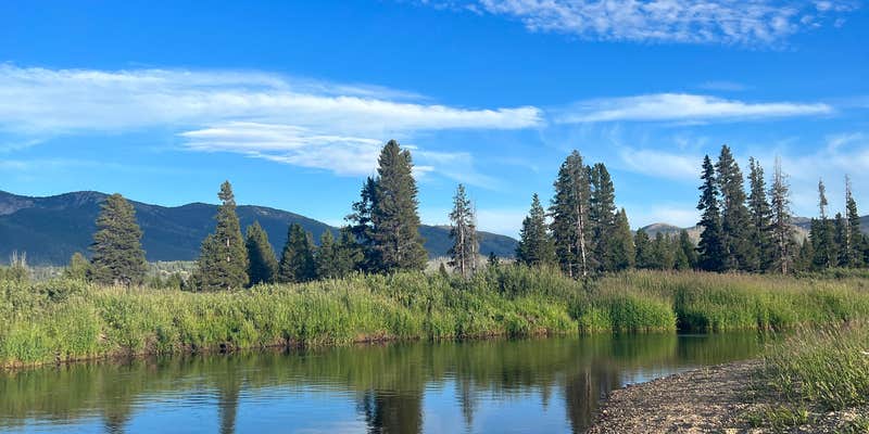
Mosquitoes come with the territory at this Forest Service campground, but reviewers consistently note the trade-off for solitude along Bear Valley Creek. The campground operates seasonally from mid-June through September, accommodating RVs up to 40 feet on forested sites that provide room for multiple families to share a spot.
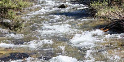
"We ended up being the only ones camping there, it was nice and secluded," reports one camper who visited during Memorial Day weekend. The pit toilets stay clean and stocked, though they may not open immediately at season start. Fallen logs and branches provide ample firewood for evening campfires. Full weekends do occur, particularly during peak summer months when boaters arrive to navigate the creek's challenging waters with downed trees.
Bear Valley Creek runs directly through the camping area, offering water access for those willing to work around natural obstacles. The campground provides drinking water and toilet facilities but no trash service, requiring campers to pack out all waste. Cell service appears limited in this forested setting. Traffic passes occasionally on the nearby road but doesn't significantly impact the quiet atmosphere most visitors experience.
Campers wanting closer proximity to services can check Tennessee Creek Campground less than a mile west.
Description
Overview: Bear Valley Campground is located along Bear Valley Creek which is one of the major headwater streams for the Middle Fork of the Salmon River. The campground is well shaded by a stand of lodgepole pine. However, many of the trees in the area are beginning to die due to a mountain pine beetle infestation. Use is moderate to high during the summer months and hunting season, and the campground is often full on weekends. Access to the campground is normally not available until June. There is no trash service, please pack it out!!! (Driveway lengths for RVs are limited. However, two sites will easily accommodate larger RV's and trailers.)
RV Road Trip Guides

Map & DirectionsBear Valley is located in Idaho near Stanley
Directions
In Stanley, ID, at the intersection of State Rts. 75 and 21, take Rt. 21 west 21.4 miles to Bruce Meadows and Forest Rt. 579 sign. Turn right at sign onto Rt. 579 (gravel) and go 12.4 miles to campground sign. Turn right at sign into campground.
Coordinates
44.41100066 N
115.3700004 W
Connectivity
 T-MobileNo Coverage
- VerizonNo Coverage
- AT&TNo Coverage
Connectivity
- T-MobileNo Coverage
- VerizonNo Coverage
- AT&TNo Coverage
Access
Site Types
- Tent Sites
- RV Sites
Features
For Campers
- Drinking Water
- Toilets
Drive Time
- 2 hrs 56 min from Boise, ID
- 4 hrs 30 min from Idaho Falls, ID
- 4 hrs 31 min from Twin Falls, ID
- 6 hrs from Lewiston, ID


