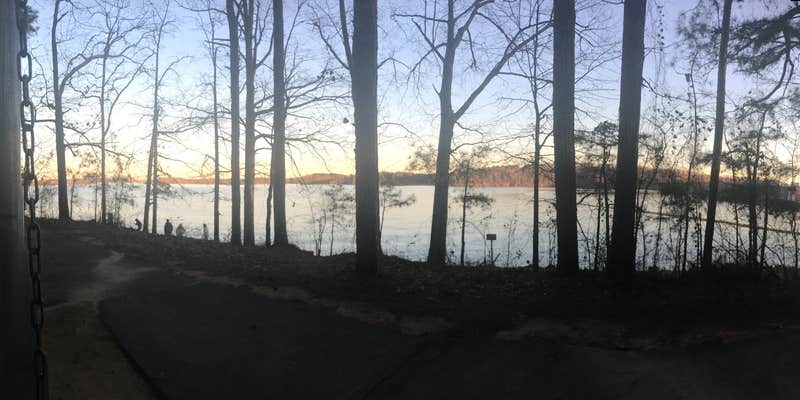
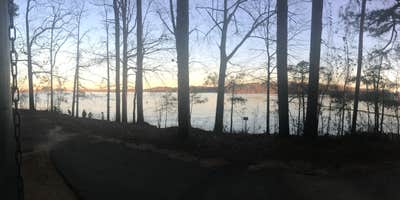
Within Sidney Lanier Recreation Area, Buford Dam Park Shelters operates as an Army Corps of Engineers facility accessible only by boat or on foot. The campground sits in forested terrain near both the Chattahoochee River and Lake Lanier, with parking located close to the main road and paths leading down to the lakeside.
Campers should note that bathroom facilities may be locked during certain periods, and the nearest convenience store requires a 20-30 minute drive. The area typically sees heavy day-use traffic from visitors driving through, though several pull-in spots accommodate smaller vehicles. Fishing is permitted with proper permits, and a seasonal swimming area features sand, though Georgia's red clay will likely stain clothing. For additional options, consider campgrounds around Cumming or the nearby Sawnee campground.
Description
Overview
Buford Dam Park lies just north of Buford Dam on Lake Sidney Lanier. The site features beautiful views of the lake as well as excellent access to swimming, picnicking and boating.
The lake, named for the poet, Sidney Lanier, is well known for its aqua-blue colored water, spectacular scenery and variety of recreational activities. Each year, over 7.5 million people come to visit.
Natural Features:
Lake Lanier boasts 38,000 surface acres, 690 miles of shoreline and over 100 small islands. Its location in the forested foothills of the Georgia Blue Ridge Mountains, makes for a beautiful backdrop to any activity.
Recreation:
Visitors can access the Laurel Ridge Hiking Trail from multiple locations and parks. The trail is a 3.5 mile loop that offers great views of the lake and Chattahoochee River. Fisherman can expect to catch a variety of species including bass, catfish and panfish. Activities include fishing, swimming, wake boarding, kayaking and hiking.
Facilities:
Bolding Mill Park offers access to a designated swim beach and the Laurel Ridge Hiking Trail. The park also offers a basketball court, soccer field, playground, picnic areas and restrooms.
Nearby Attractions:
Nearby attractions include boat ramps, other USACE parks, and Lake Lanier Islands.
RV Road Trip Guides


Map & DirectionsBuford Dam Park Shelters (GA) is located in Georgia near Cumming
Directions
<p>From Georgia Highway 400, take exit 14 to Highway 20 east, turn left onto Sanders Road, at first stop sign turn right on Buford Dam Road. After crossing the dam, turn left when you see a “Lanier Project Management Office” sign.</p><p>From Interstate 85, take exit 111 and head north on Lawrencville-Suwanee Road. Continue approximately 10 miles to Buford Dam Road. Turn left on Buford Dam Road, turn right at the “Lanier Project Management Office” sign.</p>
Coordinates
34.16748665000001 N
84.0615164 W
Connectivity
 T-Mobile5GExcellent Coverage
- Verizon5GExcellent Coverage
 AT&T5GGood Coverage
Connectivity
- T-Mobile5GExcellent Coverage
- Verizon5GExcellent Coverage
- AT&T5GGood Coverage
Access
- Walk-InPark in a lot, walk to your site.
- Boat-InSites accessible by watercraft.
Site Types
- Tent Sites
- Group
Features
For Campers
- ADA Access
- Trash
- Picnic Table
- Phone Service
- Reservable
- Toilets
- Alcohol
- Pets

