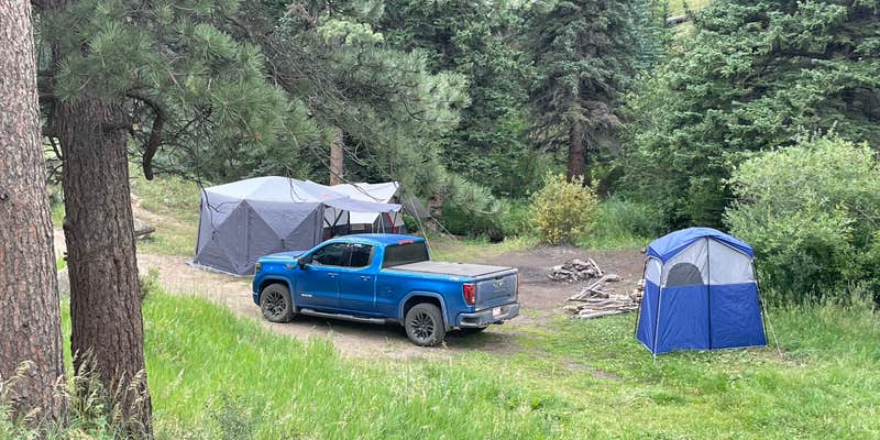
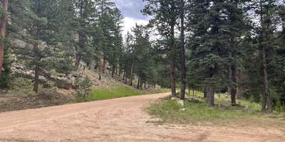
Hikers seeking mountain trail access will find Pingree Road Dispersed Camping offers free camping along a well-maintained gravel road in Roosevelt National Forest. The dispersed sites begin appearing after the first cattle grid, with approximately 10 camping spots scattered along the roadway and extending up Crownpoint Road. Most sites feature established fire rings and accommodate various vehicle types, from low-clearance sedans to big rigs.
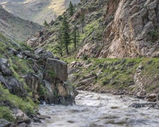
The camping area sits alongside Bennett Creek, with sites distributed on both sides of the road within the first mile or two. Several spots provide elevated positions with sunset viewing opportunities from rocky outcrops. Voyager D. notes the rocks on the hillside "are from another world" and calls one location the "best sunset spot by far." The forested setting includes some areas affected by previous burn scars, though many sites remain well-shaded.
Weekday visits tend to be quieter, while weekends bring heavier traffic and larger groups. Target shooting activity occurs in the area, particularly on Fridays and weekends. Cell service is unavailable throughout the canyon. The nearby Flowers Trail provides hiking access, though most trail options require 30-45 minutes of driving to reach trailheads. For additional camping options in the region, explore campgrounds around Roosevelt National Forest.
Description
Free camping (dispersed) is allowed on most national forest lands except in highly developed areas - such as trailheads, campgrounds and picnic sites - and in some of our most visited places. Be sure to check for regulations in advance and look for signs in the area to indicate if camping is allowed.
Some areas allow camping in designated sites only.
Know Before You Go
Check the weather and road closures before heading up. Follow Leave No Trace principles. There are no facilities or trash receptacles. Pack out what you pack in. Make sure camping is allowed. Many lands within the national forest boundary are private or otherwise owned. Check that you’re on National Forest lands: maps. Don't stay too long. Camping is limited to 14 days within any continuous 30-day period at any location within the same 20-mile radius. See Order Plan on building a campfire? Campfire restrictions can occur any time of year. Check for fire restrictions and if you build a campfire, know how to extinguish it.
RV Road Trip Guides

Map & DirectionsPingree Road Dispersed Camping is located in Colorado near Red Feather Lakes
Coordinates
40.65411947963148 N
105.52688998243224 W
Connectivity
 T-MobileNo Coverage
- VerizonNo Coverage
- AT&TNo Coverage
Connectivity
- T-MobileNo Coverage
- VerizonNo Coverage
- AT&TNo Coverage
Access
- Drive-InPark next to your site
- Walk-InPark in a lot, walk to your site.
Site Types
- Tent Sites
- RV Sites
- Standard (Tent/RV)
- Dispersed
- Group
Features
For Campers
- Toilets
- Alcohol
- Pets
- Fires
For Vehicles
- Big Rig Friendly
DISPERSED CAMPING
Enjoy dispersed camping on government land and leave no trace. Pack in and pack out. No (or limited) services at this camping area. Permit may be required.
PERMIT might be REQUIRED
We curate permit requirements across the US for our PRO members. Try PRO to see if Pingree Road Dispersed Camping needs a permit.
Drive Time
- 1 hr 8 min from Fort Collins, CO
- 1 hr 34 min from Greeley, CO
- 1 hr 38 min from Cheyenne, WY
- 1 hr 52 min from Boulder, CO


