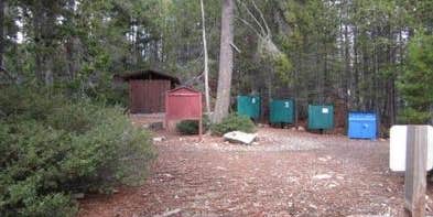
This group campground requires reservations and sits within Tahoe National Forest, accessible by a rough road that demands higher clearance vehicles. The Forest Service manages this site with basic amenities including toilets, picnic tables, and trash service, plus allows both campfires and pets. Campers report finding solitude here, with one reviewer noting they rarely encounter other groups despite visiting for years.
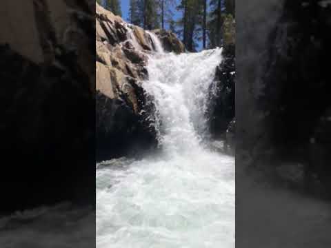
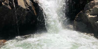
The challenging access road keeps crowds away, creating opportunities for quiet camping among pines near Faucherie Lake. Paddlers can launch directly from the campground, while hikers find trails leading to pools and waterfalls. Night temperatures can drop significantly even in summer, reaching freezing levels that caught some visitors unprepared. For additional options, see campgrounds near Emigrant Gap.
Description
NOT CURRENTLY ACCEPTING RESERVATIONS. Recreation Facilities Natural Features ADA Access: N
Warning 1 Alert is In Effect
There is 1 alert for this campground. Camp safely!
Warning 1 Alert is In Effect
There is 1 alert for this campground. Camp safely!
FAUCHERIE Campground will no longer be hosted on Recreation.gov as management of the facility has changed. Existing reservations will be honored. For future reservations, please contact the Nevada Irrigation District at (530) 265-5302.
RV Road Trip Guides

Map & DirectionsFaucherie Lake Group Campground is located in California near Emigrant Gap
Directions
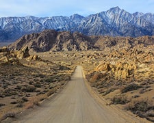
At the Bowman Lake Dam, the road continues along the north shore but becomes a primitive road not recommended for low-clearance vehicles. If you want to access the area above Bowman Lake with small trailers/RVs or low-clearance vehicles, roads from the east via Jackson Meadow Reservoir are somewhat better but still remote (see East Slope and Grouse Ridge Maps).<br><br>To get to Jackson Meadows Reservoir, from Truckee, take Highway 89 north for 17 miles. Turn right (west) off Highway 89 at Little Donner Summit. Follow Jackson Lake Road (Forest Road 07) for 16 miles. The road to Faucherie Lake continues southeast from Jackson Creek Campground, but is not recommended for low clearance vehicles. Drive 3.7 miles south on rough road from Jackson Creek Campground. Fording the creek above the campground is not advisable for anyone during high water.
Coordinates
39.43167051 N
120.59972055 W
Connectivity
 T-MobileNo Coverage
- VerizonNo Coverage
- AT&TNo Coverage
Connectivity
- T-MobileNo Coverage
- VerizonNo Coverage
- AT&TNo Coverage
Access
- Drive-InPark next to your site
- Boat-InSites accessible by watercraft.
Site Types
- Tent Sites
- Group
Features
For Campers
- Trash
- Picnic Table
- Reservable
- Toilets
- Pets
- Fires