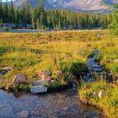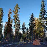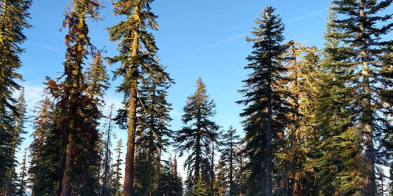

Within Shasta National Forest, Panther Meadows Walk-In Campground operates as a US Forest Service facility near the base of Mount Shasta. Campers carry gear to sites scattered across open terrain and forested areas, with some spots positioned close to Panther Creek. The campground provides basic toilet facilities but no water hookups or developed amenities.
Traffic moves along the access road throughout day and night hours as climbers head to the Bunny Flat trailhead for Mount Shasta ascents. Reviewers suggest selecting sites away from the main road to reduce vehicle noise. The walk-in format means campers can choose from available spots rather than reserved sites. Those planning technical climbs above 10,000 feet need summit permits, which cost around $25.
Description
Description : This is a walk-in campground located near timberline on Mt. Shasta at 7500 feet. There are 15 sites, all within a short walk of your vehicle. Tables, fire-rings, and vault toilet. Bring your own water or purify the creek water nearby. 3 day limit. No fee. No reservations. Self-register on site. Usually opens around July 1st, depending on winter snowpack, and closes November 1st. Features : Highest campground on the mountain with open views and vistas. There are two small sub-alpine heather meadows a short distance from the campground. Because of the fragile nature of the meadows, great care must be given by all who visit not to incur damage. In recent years, a major effort has been made by local tribes, volunteers, and the Forest Service to re-vegetate the native species and improve the trail system to minimize erosion.
RV Road Trip Guides


Map & DirectionsPanther Meadows Walk-In Campground is located in California near Mount Shasta
Directions
From the Mt. Shasta Ranger Station, head east on Alma Street (towards the mountain). Cross the railroad tracks and turn right at the signal onto Mt. Shasta Blvd. Continue two blocks to the next signal at Lake Street and turn left. Stay on Lake Street. You will climb a hill and veer to the left. You are now on Everitt Memorial Highway. Stay on this road through the four way stop, past the school (on the right) and over the railroad tracks. You will leave town and begin driving up the mountain. In 12 miles, you will arrive at Bunny Flat Trailhead. Continue another 1.7 miles past Bunny Flat and you will see a sign on your right for Panther Meadows Campground. Turn right into the unpaved parking lot. The campsites are a short walk from the park
Coordinates
41.35500079 N
122.20200055 W
Connectivity
 T-Mobile5GExcellent CoverageVerified by 12 usersLast on 7/30/26
 VerizonLTESome CoverageVerified by 3 usersLast on 7/30/26
- AT&T5GExcellent CoverageVerified by 1 userLast on 7/30/26
Connectivity
- T-Mobile5GExcellent CoverageVerified by 12 usersLast on 7/30/26
- VerizonLTESome CoverageVerified by 3 usersLast on 7/30/26
- AT&T5GExcellent CoverageVerified by 1 userLast on 7/30/26
Access
- Walk-InPark in a lot, walk to your site.
Site Types
- Tent Sites
Features
For Campers
- Picnic Table
- Toilets
- Pets
Drive Time
- 2 hrs 21 min from Redding, CA
- 3 hrs 46 min from Medford, OR
- 4 hrs 13 min from Grants Pass, OR