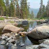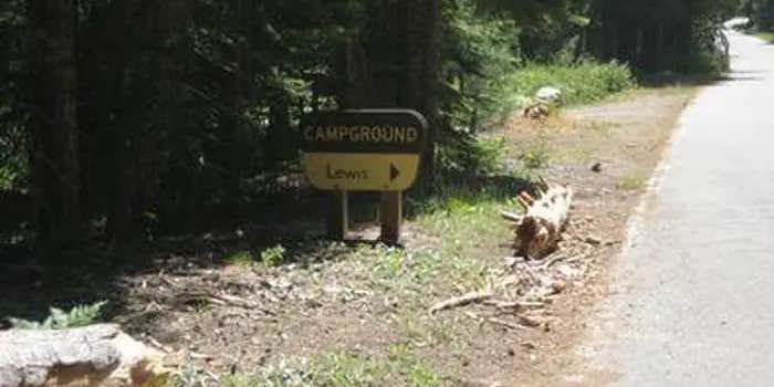
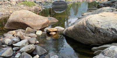
Tahoe National Forest's French Meadows Reservoir area sits roughly 40 miles of winding mountain road from the nearest small town, making Lewis Campground one of the more remote drive-in sites managed by the US Forest Service in the region. The campground runs from late May through mid-September, with flush toilets, potable water, and trash service on-site. Hosts are present and actively helpful. Drought conditions can leave the reservoir section nearest the campground dry, with water access requiring a mile's drive to the boat launch. Anglers and paddlers should check reservoir levels before planning a trip. Ahart Campground sits about a mile northeast for campers weighing nearby alternatives, and camping near Tahoe National Forest covers a wider range of options across the forest.
Description
Overview
Lewis Campground is located on French Meadows Reservoir in the Tahoe National Forest, 40 miles east Foresthill. Visitors enjoy the area for its fishing, boating and trail opportunities.
Recreation
Popular activities on the reservoir include boating, canoeing, fishing and swimming. McGuire boat ramp is located within a mile of the campground. The Middle Fork American River can be accessed nearby and provides fishing and swimming. A variety of hiking and biking trails are found in the surrounding area, including the Western States Trail, Tevis Cup Trail, and some that provide access to the nearby Granite Chief Wilderness.
Facilities
The campground offers single-family campsites, a few of which are accessible. Each site is equipped with a picnic table and a grill. Flush and vault toilets and drinking water are provided. Roads and parking spurs are paved.
Natural Features
The campground sits on the north shore of French Meadows Reservoir in a coniferous forest. The reservoir is on the Middle Fork of the American River and is the western gateway to the Granite Chief Wilderness.
Nearby Attractions
Lewis Campground is a recreation site within the French Meadows Recreation Area which includes many other recreation facilities. The Granite Chief Wilderness can be accessed nearby at Talbot Trailhead and access to the Western States Trail and Tevis Cup Trail also can be accessed nearby. Other recreation opportunities include many hiking, equestrian, mountain biking, and motorcycle singletrack trails, Duncan Canyon, Duncan Peak Lookout, Robinson Flat historic ranger station, Placer County Big Tree Grove Botanical Area, and Grouse Falls Scenic Area.
Warning 1 Alert is In Effect
There is 1 alert for this campground. Camp safely!
Warning 1 Alert is In Effect
There is 1 alert for this campground. Camp safely!
Stage 2 Fire Restrictions are in place on the Tahoe National Forest beginning August 14, 2026, due to increasing fire danger. All campfires and charcoal BBQs are prohibited on Tahoe National Forest lands and recreation areas except within certain campgrounds maintained by a campground host. Please visit the link below to review Forest Order 17-26-19:Tahoe National Forest | Stage 2 Fire Restrictions | Forest Service
RV Road Trip Guides

Map & DirectionsLewis Campground is located in California near Alpine Meadows
 Public Campground
Directions
\_\_High clearance vehicles may take Foresthill Rd to the 43 Rd (Robinson Flat Rd) to Mosquito Ridge Rd, snow permitting. Access from Soda Springs and the 43 Rd is not recommended for trucks with trailers, motorhomes/RV's or passenger vehicles that are not high clearance vehicles with four wheel drive. It is 6 miles around the lake to the north shore, Lewis Campground will be on the right.
Address
22830 Foresthill Road
Foresthill, CA 75631
Coordinates
39.132125 N
120.416891 W
Connectivity
 T-MobileNo Coverage
- VerizonNo Coverage
- AT&TNo Coverage

Connectivity
- T-MobileNo Coverage
- VerizonNo Coverage
- AT&TNo Coverage
Access
- Drive-InPark next to your site
Site Types
- Tent Sites
- RV Sites
- Standard (Tent/RV)
Features
For Campers
- Trash
- Reservable
- Drinking Water
- Toilets
- Alcohol
- Pets
For Vehicles
- Big Rig Friendly
Drive Time
- 2 hrs 27 min from Sacramento, CA
- 2 hrs 46 min from Yuba City, CA
- 3 hrs 22 min from Reno, NV
- 3 hrs 53 min from Carson City, NV