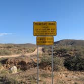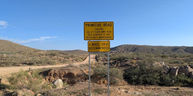
Highway noise from nearby Interstate 17 provides a constant backdrop at this Bureau of Land Management dispersed camping area along Bloody Basin Road. Campers access the site via Exit 259, where a well-maintained gravel road leads to the first left turn that opens up larger camping spots with expansive desert views. The road surface remains manageable for most vehicles down to this initial junction.
Rock hounding opportunities abound across the open terrain, and campers can pull off at numerous spots along the access road to set up camp. No established sites exist, giving visitors flexibility to choose their preferred location within the monument boundaries. Cell service reaches the area, and both campfires and pets are permitted under BLM regulations. The location works well for RV and tent campers comfortable with dispersed camping and moderate road noise.
RV Road Trip Guides


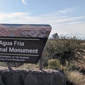
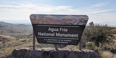
Map & DirectionsAqua Fria National Monument is located in Arizona near Cordes Junction
Coordinates
34.280037960943 N
112.11442361580394 W
Access
- Drive-InPark next to your site
Site Types
- Tent Sites
- RV Sites
- Dispersed
- Group
Features
For Campers
- Phone Service
- Alcohol
- Pets
- Fires
For Vehicles
- Pull-Through Sites
DISPERSED CAMPING
Enjoy dispersed camping on government land and leave no trace. Pack in and pack out. No (or limited) services at this camping area. Permit may be required.