
Within Pictured Rocks National Lakeshore, Hurricane River Campground operates as a rustic National Park Service facility with just 21 sites split between upper and lower sections. The lower section sits closer to Lake Superior's shoreline, while the upper section provides additional space for RVs up to 42 feet. Reservations are required year-round, with same-day bookings accepted when sites remain available.
The campground maintains a wooded setting with sites spaced well apart for privacy. Each site includes a fire ring, picnic table, and lantern pole, though no hookups are available. Roger W. notes the campground operates in "a delightful forest" with generator-free zones that keep nights quiet. Two vault toilets serve the facility, and drinking water comes from a spigot near the entrance kiosk.
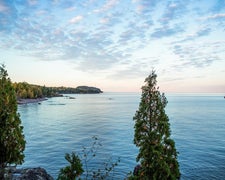
Lake Superior access requires a short walk down steps to a rocky beach from the lower section. The Au Sable Lighthouse sits 1.5 miles away via shoreline trail, passing shipwreck remains along the route. Cell service remains limited throughout the campground, though coverage improves near the lighthouse. Wildlife sightings include bears, which reviewers report seeing while driving through the park.
The campground road connects directly to Hurricane River Road, providing drive-in access though some sites accommodate walk-in camping. Summer months see the facility fill completely, with arrival timing critical for securing sites. Nona A. recommends arriving early and suggests "Little Beaver Lake Campground and Twelvemile Beach Campground are a couple that are close by" as backup options.
For campers wanting developed amenities, Twelvemile Beach Campground — Pictured Rocks National Lakeshore provides another lakeside option three miles southwest.
Description
Overview
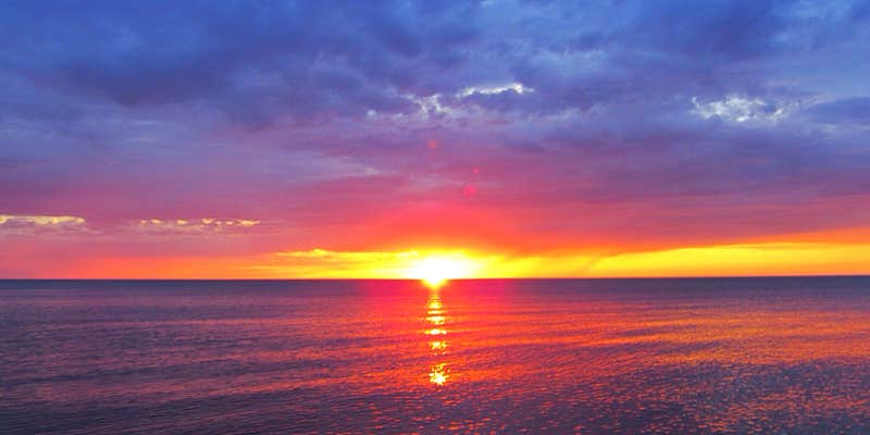
Pictured Rocks National Lakeshore hugs the Lake Superior shoreline for more than 40 miles along Michigan's northern coast. Lake Superior is the largest, deepest, coldest, and most pristine of all the Great Lakes. Camping at Pictured Rocks National Lakeshore is a great way to relax and enjoy the beauties the lakeshore has to offer. Campgrounds are rustic, and do not provide electric or sewer hookups. Campers, trailers, and RVs are welcome, note there are generator free areas. Cell phone reception is limited, so unplug, unwind, and enjoy the serenity Pictured Rocks National Lakeshore Campgrounds has to offer. Hurricane River Campground is located 12 miles (19 km) west of Grand Marais and is divided into two separate sections off County Highway (H-) 58, Hurricane River Upper, and Hurricane River Lower. The Upper Campground has 10 sites and the Lower Campground has 12. Campground amenities include water, pit toilets, picnic tables, fire rings, and handicap accessible sites. Hurricane River Lower Campground is the trailhead for the Au Sable Light Station, which is a 3-mile (5 km) round trip stroll to the lighthouse with views of Lake Superior, Jacobsville Sandstone, and Shipwreck remains. Upper Hurricane River is tucked back in the woods with beautiful deciduous trees between sites allowing for the woodsy experience of Northern Michigan.
Recreation
Pictured Rocks National Lakeshore offers 100 miles (161 km) of hiking trails leading to waterfalls, beaches, forest wilderness, cultural sites, and breathtaking cliff-top views of Lake Superior. Whether you have only a few minutes, hours, or days to see a portion of the lakeshore, one of these hikes may be for you. Lake Superior's rugged shoreline invites boaters to explore the beautiful Pictured Rocks National Lakeshore with its miles of colorful sandstone cliffs and long stretches of sandy beaches. Peaceful inland lakes also invite boaters to linger in the northwoods. Check the marine weather forecast before venturing out. Watch the weather carefully while on the lake. The weather can change suddenly and unexpectedly. Just because it's calm in Munising Bay or Grand Marais Harbor does not mean it is calm along the more distant shores. The Pictured Rocks cliffs rise 50 to 200 feet (15 to 61 m) directly from the lake, offering precious few protected places if the wind and waves increase.
Facilities
Pictured Rocks National Lakeshore drive-in campsites are rustic and do not have electric, water, or sewer hookups. Campsites provide a picnic table, fire ring with grill grate, and tent pad. The campgrounds have vault toilets and well water. Tent-style enclosures for campsite portable toilets are strictly prohibited. Typically there is no cell phone reception.
Natural Features
Sandstone cliffs, beaches, sand dunes, waterfalls, inland lakes, deep forest, and wild shoreline beckon you to visit Pictured Rocks National Lakeshore. The power of Lake Superior shapes the park's coastal features and affects every ecosystem, creating a unique landscape to explore. Hiking, camping, sightseeing, and four-season outdoor opportunities abound.
Nearby Attractions
Kayak and Other Guided Tours and Pictured Rocks Boat Cruises within the national lakeshore are offered by authorized private companies. Pontoon boat and other rentals for use on Lake Superior are available in nearby communities.
Fee Info
All campsites are $25.00 per day by reservation only. Senior Pass and Access Pass holders receive a 50% discount. The pass number must be entered when making reservation
Warning 1 Alert is In Effect
There is 1 alert for this campground. Camp safely!
Warning 1 Alert is In Effect
There is 1 alert for this campground. Camp safely!
Air Quality at this campground may currently be unhealthy for sensitive groups.
RV Road Trip Guides

Map & DirectionsHurricane River Campground is located in Michigan near Grand Marais
Directions
Pictured Rocks NL is located on the south shore of Lake Superior in Michigan's Upper Peninsula, between the towns of Munising (west) and Grand Marais (east). Access the west side of the park via Michigan highways M-28 and M-94 to Munising. State highway M-77 leads to Grand Marais on the east side. Alger County Road H-58 runs parallel and through the park, providing access to spur roads that lead to scenic overlooks, trailheads, campgrounds, beaches, etc. Many roads are closed in winter due to snow.
Coordinates
46.663953 N
86.166158699 W
Connectivity
 T-MobileNo Coverage
- VerizonNo CoverageVerified by 2 usersLast on 7/14/26
 AT&TLTESome Coverage
Connectivity
- T-MobileNo Coverage
- VerizonNo CoverageVerified by 2 usersLast on 7/14/26
- AT&TLTESome Coverage
Access
- Drive-InPark next to your site
- Walk-InPark in a lot, walk to your site.
- Hike-InBackcountry sites.
Site Types
- Tent Sites
- RV Sites
- Standard (Tent/RV)
Features
For Campers
- Trash
- Firewood Available
- Phone Service
- Reservable
- Drinking Water
- Toilets
- Alcohol
- Pets
- Fires
Contact
General Info
Reservations
Drive Time
- 4 hrs 2 min from Green Bay, WI
- 4 hrs 16 min from Traverse City, MI
- 4 hrs 21 min from Appleton, WI
- 5 hrs 13 min from Wausau, WI


