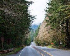
With six first-come, first-serve sites designed for equestrian camping, Keenes Horse Campground operates from June through September in Gifford Pinchot National Forest. The campground sits adjacent to Forest Road 23, though a large pothole forces passing traffic to slow considerably. Campers report challenging road conditions with washouts, downed trees, and deep dips that can damage low-clearance vehicles.
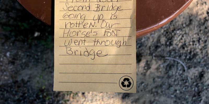
Sites accommodate horses and provide direct access to multiple horse trails departing from the campground. The facility includes vault toilets and trash service, though pets are not permitted. A creek runs alongside the camping area, and wildflowers bloom at this elevation well into August. The campground typically has availability when other area facilities fill up, partly due to its roadside visibility. Horseshoe Lake sits less than a mile away, while Takhlakh Lake makes an accessible day trip about eight miles down the road.
Description
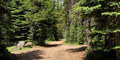
This campground is located in a high elevation stand of lodgepole pine and mixed conifers.__There are 13 sites,__26 hi-line posts, one__mounting ram__and two__manure bins. Water for stock is available.__Bring your own drinking water.Mt. Adams Wilderness is just outside the campground to the south. Numerous trails are nearby including the High Lakes Trail #116, Keenes Trail #120 and Muddy Meadows Trail #13. Be sure to fill out a Wilderness Permit before riding in the Wilderness.
RV Road Trip Guides

Map & DirectionsKeenes Horse Campground is located in Washington near Trout Lake
Directions
From Randle, Washington travel south on State Highway 131 (Forest Roads 23 and 25). Veer left in 1 mile at the Y of Forest Road 23 and Forest Road 25. Continue to follow Forest Service Road 23 for 18.5 miles then turn left onto Forest Road 21. Follow Forest Road 21 for 4.6 miles and turn right onto Forest Road 56. Follow Forest Road 56 for 3 miles and turn right onto Forest Road 5603. Follow Forest Road 5603 for 5.2 miles and turn right onto Forest Road 2329. Follow Forest Road 2329 for 2.5 miles and arrive at the campground on your left.
Coordinates
46.309038 N
121.54626 W
Connectivity
 T-MobileNo Coverage
- VerizonNo Coverage
- AT&TNo Coverage
Connectivity
- T-MobileNo Coverage
- VerizonNo Coverage
- AT&TNo Coverage
Access
Site Types
- Tent Sites
- Equestrian
Features
For Campers
- Trash
- Toilets
- Alcohol
Drive Time
- 2 hrs 56 min from Yakima, WA
- 3 hrs 7 min from Longview, WA
- 3 hrs 9 min from Olympia, WA
- 3 hrs 13 min from Portland, OR


