Mt. Baker National Forest manages Excelsior Group Camp as a reservable group site outside Maple Falls, with nightly rates running $135 to $160. The site sits in mixed forested and open terrain near a creek, river, and lake, and access roads are rough enough that drivers should plan accordingly. RVs are limited to 30 feet. Pets are welcome, campfires are permitted, and fishing is available nearby. This camp works best for groups that can self-organize and don't mind a bumpy approach.
Description
Overview
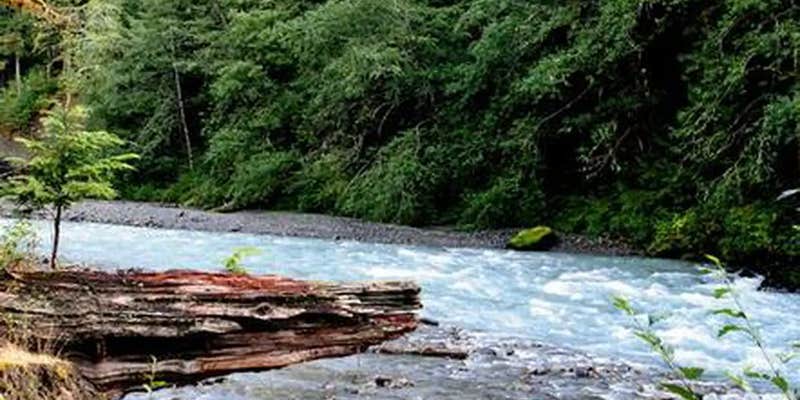
Located near the rushing Nooksack River in Mt. Baker-Snoqualmie National Forest, Excelsior Group Camp offers access to numerous recreational activities popular in the north Cascades Mountains in Washington state.
Recreation
The area surrounding the campground is prime location for hiking, fishing and picnicking in summer and early fall. Hikers and backpackers are especially fortunate to have access to a variety of trails near the campground and in the surrounding areas. Horseshoe Bend Trail is an easy forest hike along the Mt. Baker Scenic Byway, highlighting old-growth forests, gushing whitewater rapids and forest wildflowers. The trail follows the North Fork of the Nooksack River upstream to a stunning view of East Church Mountain. The trailhead can be accessed from the nearby Douglas Fir campground. Another popular hike in the Mt. Baker Ranger District is the Skyline Divide Trail. This trail climbs steadily for two miles through forest into lush, open, flower-filled meadows with stellar views of glacier-draped Mt. Baker. The trail then wanders along Skyline Divide for another 1.5 miles, offering views of rivers, forests and countless peaks.
Facilities
There are two large group sites in the campground. Site A will sleep 50 people and has a group fire ring along with picnic tables ant fire pits at the tent sites. Site B accommodates 50 people and has picnic tables and fire pits. Vault toilets are also provided.
Natural Features
The Mt. Baker-Snoqualmie National Forest showcases rugged peaks, sparkling alpine lakes and old-growth forests. Mt. Baker, the most prominent feature of the nearby Mt. Baker Wilderness, rises to an elevation of 10,781 feet. This active volcano is perpetually snow-capped and mantled with an extensive network of creeping glaciers. Mt. Baker's summit, Grant Peak, is actually a 1,300-foot-deep mound of ice, which hides a massive volcanic crater. Fed by the high snowfields and glaciers of Mt. Baker, Mt.Shuksan and the Twin Sisters range, the Nooksack River system provides habitat for many species. Wildlife in the area includes five native salmon species, elk, bald eagles and black tailed deer. Migratory birds and black bears find ample habitat in the surrounding ecosystems.
Contact Info
For facility specific information, please call (360) 386-8214.
Nearby Attractions
Visitors enjoy hiking, picnicking and photography in the Heather Meadows area located along the upper reaches of the Mt. Baker Scenic Byway, SR 542. Many popular hikes and climbing routes are located in the surrounding Mt. Baker Wilderness and backpackers enjoy visiting the northern reaches of North Cascades National Park.
RV Road Trip Guides

Map & DirectionsExcelsior Group Camp is located in Washington near Maple Falls
Directions
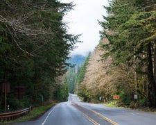
From Seattle, Washington, go north on I-5 to Bellingham. Take exit 255 onto Sunset Drive/Mt. Baker Highway SR 542. Turn right (east) on SR 542 and continue past the town of Glacier near mile 33. Continue past Glacier approximately 7 miles to the campground. The sign for the campground is located on the left (north) side of the highway. The campground access road is on the right (south) side of the highway, just before mile post 40. Turn right on the access road and then take the first right through the gated entrance of the campground. Site B is the first site on the left. Site A is the loop at the end of the driveway.
Coordinates
48.908801 N
121.821982 W
Connectivity
 T-MobileNo Coverage
- VerizonNo Coverage
- AT&TNo Coverage
Connectivity
- T-MobileNo Coverage
- VerizonNo Coverage
- AT&TNo Coverage
Access
- Drive-InPark next to your site
Site Types
- Tent Sites
- RV Sites
- Standard (Tent/RV)
- Group
Features
For Campers
- Reservable
- Pets
- Fires
Drive Time
- 49 min from Bellingham, WA
- 1 hr 12 min from Mount Vernon, WA
- 2 hrs 5 min from Seattle, WA
- 3 hrs 3 min from Bremerton, WA

