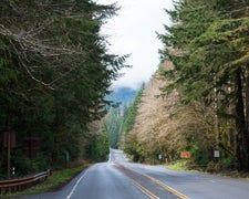
Managed by the US Forest Service within Umatilla National Forest, Kelly Camp Trailhead provides a forested camping experience near Anatone. This established campground serves as a launching point for forest exploration and backcountry access. The forested setting offers natural shade and a woodland atmosphere typical of the national forest system.
Campers seeking additional options in the region can explore camping near Anatone. For those wanting a different forest experience, Misery Spring Campground sits just one mile east.
Description
Provides access to: July Ridge Trail #3120 which enters Wenaha-Tucannon Wilderness. Directions: From Pomeroy, WA, take 15th Street south from State Highway 12. Follow this street out of town and continue for 15 miles to the National Forest boundary. At the forest boundary a cattle guard is crossed and the road will turn to gravel (Forest Road 40). Continue south on Forest Road 40 for 15 miles to the Misery intersection (there is a sign 50 feet before the intersection). Turn right (westerly direction) on forest road 4030. Follow Forest 4030 Road for 2 miles to the trailhead. Minimal parking.
RV Road Trip Guides

Map & DirectionsKelly Camp Trailhead is located in Washington near Anatone
Coordinates
46.1206166 N
117.50565067 W
Connectivity
 T-MobileNo Coverage
- VerizonNo Coverage
- AT&TNo Coverage
Connectivity
- T-MobileNo Coverage
- VerizonNo Coverage
- AT&TNo Coverage
Access
Site Types
- Tent Sites
Features
Drive Time
- 1 hr 59 min from Lewiston, ID
- 2 hrs 57 min from Walla Walla, WA
- 3 hrs 29 min from Kennewick, WA
- 3 hrs 44 min from Spokane, WA

