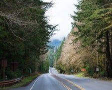
Campers accessing this Forest Service site navigate a winding route that drops into a valley where recent timber operations have left fallen trees scattered across the landscape. Misery Spring Campground sits within the Umatilla National Forest with limited midday shade due to the cleared areas. The site prohibits pets, which campers should factor into their planning.
One visitor noted encountering large horse flies during their midday arrival, prompting them to relocate to higher elevation dispersed camping where consistent breezes provided relief. The campground's valley location may contribute to insect activity during warmer parts of the day. For additional options, campers can explore places to camp near Umatilla National Forest.
Description
Providing panoramic views from Ray Ridge into the W enaha-Tucannon Wilderness. Misery Spring Campground offers hunting and hiking recreational opportunities. Please Leave-No-Trace.
RV Road Trip Guides

Map & DirectionsMisery Spring Campground is located in Washington near Anatone
Directions
<p><strong>From Pomeroy, Washington (90 minutes):</strong> Starting at Main Street, take 15th Street headed south from State Highway 12. Follow this street out of town and continue for 15 miles to the National Forest boundary. At the forest boundary a cattle guard is crossed and the road will turn to gravel (Forest Road 40). Continue south on Forest Road 40 for 15 miles to the Misery intersection (there is a sign 50 feet before the intersection). Turn right (westerly direction) on forest road 4030. Follow Forest Road 4030 and turn left onto 4030-20 and follow to Misery Spring Campground. </p>
Coordinates
46.12030295 N
117.485097 W
Connectivity
 T-MobileNo Coverage
- VerizonNo Coverage
- AT&TNo Coverage
Connectivity
- T-MobileNo Coverage
- VerizonNo Coverage
- AT&TNo Coverage
Access
Site Types
- Tent Sites
Features
Drive Time
- 1 hr 54 min from Lewiston, ID
- 2 hrs 52 min from Walla Walla, WA
- 3 hrs 25 min from Kennewick, WA
- 3 hrs 39 min from Spokane, WA
