Dispersed camping sites around Del Rio, Tennessee range from creek-side locations to forest service road pull-offs at elevations between 1,500-3,000 feet. Summer temperatures average 75-85°F during day and 55-65°F at night, with frequent afternoon thunderstorms from June through August. Winter camping requires preparation for temperatures that can drop below freezing, particularly at higher elevations where wind exposure increases.
What to do
Waterfall exploration: 0.5-mile hike to a small cascade near FS 289 Pull Off. One camper reported, "The creek is only a few feet away from the campsite," making it convenient to cool off during summer months.
Trout fishing: Access mountain streams throughout the region. At Wash Creek Dispersed Campsites, a camper noted it has "a beautiful trout stream close by" which provides both recreation and ambient sound.
Mountain biking: Nearby trail networks connect to multiple camping areas. A visitor to Pisgah National Forest Dispersed commented, "Free sites, first come first serve... Great launch pad for hiking and mountain biking."
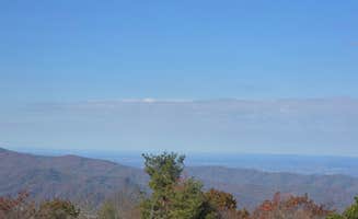
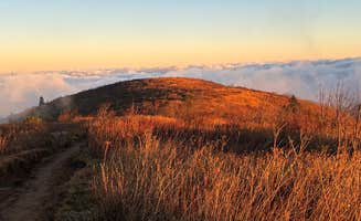
Sunrise viewing: Plan early morning hikes for spectacular views. At Black Balsam Knob, campers report that "It's an easy 20-30min hike to the top of the mountain with tall grass and a wide open view to see the sunrise and sunset!"
What campers like
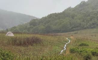
Natural sound barriers: Stream-side sites provide privacy from neighboring campers. A visitor to Blue Ridge Roadside Campsites shared, "Even if people are camping near you the stream creates a nice sound barrier so you don't really hear them. Very nice to fall asleep to the sound of the stream."
Star-gazing opportunities: Low light pollution areas offer excellent night sky viewing. At Wash Creek Dispersed Pull-Off, a camper noted, "Very low light pollution and the bare trees allowed for some great star gazing."
Secluded spots: Explore beyond main roads for quieter camping experiences. A visitor to Victor Road Dispersed described it as "Perfectly Secluded" and mentioned, "A small creek nearby provided a peaceful backdrop. No one around and only saw one other vehicle driving by."
Wildlife viewing: Early morning opportunities to observe native species. One camper at Pisgah National Forest mentioned, "There is free camping all through out these woods & plenty of water access. Trails out the wazoo! Our doggies love the trails & there are quite a few family friendly paths."
What you should know
Road conditions vary significantly: Forest service roads can deteriorate quickly after rain. For Black Balsam Knob, a visitor warned, "expect wind gusts that are capable of snapping tent poles. There is very little wind coverage at the top of the mountain."
Limited site availability: Arrive early on weekdays when possible. At Paint Creek Corridor, a camper reported, "I was only able to locate one [site] and luckily it was vacant."
Security concerns at some locations: Don't leave valuables unattended. A Wash Creek camper advised, "there are signs about being a high crime area and they are not kidding. While I was out picking up a few things at ingles someone came by and took my tent and sleeping bag."
Cell service is extremely limited: Plan communications accordingly. A camper noted, "I have T mobile and I lost service about 10 mins from the campground and had no signal while staying there."
Be prepared to clean sites: Unfortunately, trash left behind is common. A visitor to Pisgah observed, "I pulled 30 pounds of trash off the hillside of my campground the last time I was there."
Tips for camping with families
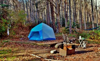
Choose lower elevation sites: Mountain tops experience extreme weather. At Pisgah National Forest Dispersed, a family noted, "We enjoyed the night/day with our kids! Sites are kind of small but absolutely beautiful surroundings."
Scout locations before committing: Some sites appear larger online than in reality. One camper at Blue Ridge Roadside observed, "There are two campsites with fire rings, but I wasn't lucky enough to get one."
Pack entertainment options: Limited activities during rainy weather. A visitor reported, "Weather was far from good so I quickly decided this site would work... My mistake was not paying attention to where the runoff was. This morning I had a small stream running through my camp."
Prepare for temperature swings: Nighttime can drop 20-30°F below daytime highs. A camper warned, "This campsite is fairly high in elevation, so it gets cool at night. Don't make the mistake of taking a summer sleeping bag."
Tips from RVers
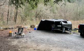
Vehicle capability assessment: Be realistic about your vehicle's limitations. At Victor Road Dispersed, a camper shared, "Great place by Blue Ridge Pkwy. Not very far off Pkwy, we had no problem getting there with our Artic Fox truck camper and pulling a Jeep."
Park strategically: Consider exit strategies if weather changes. One RVer advised, "There are parking spaces that you can park in overnight in front of hunting shelters. Just be mindful of how you park and don't take up handicapped parking."
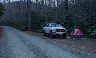
Advance route planning essential: Many roads narrow unexpectedly. A visitor mentioned, "The road is a little rough in spots, but I had zero issues in my Honda Accord."
Avoid tight turns: Several campsites have limited turnaround space. A camper noted, "The narrow road to go up/down is alittle sketchy but we made it."