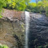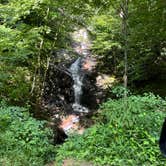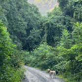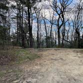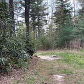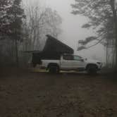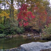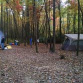

Free dispersed camping in Pisgah National Forest runs along a long dirt road accessible from Ranger Road, with roughly four to five viable spots scattered across a significant stretch of mountain terrain. No reservations, no fees. The catch: reviewers consistently flag the road as requiring four-wheel drive, and at least one notes that Google Maps routes drivers directly to a private driveway with a sign reading "no camping, your app is wrong, turn around now." Navigate by staying on Ranger Road and continuing up the mountain rather than following default navigation.
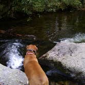
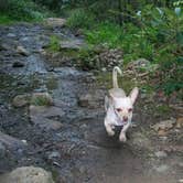
Sites sit far enough apart that the main sounds campers report are the numerous creeks flowing off the mountain. Water access is a recurring theme in reviews. "Easy access to water," notes Adam B., and the creek running alongside many spots draws anglers after trout. One reviewer found a small stream cutting through their campsite after overnight rain, a reminder to read the terrain before pitching. Sites are not formally designated, though fire pits mark spots that see regular use. Pets are welcome on the trails, and dogs reportedly handle the paths well.
Hiking is the other main draw. The dirt road passes several waterfalls along the way, and a notable trail with a waterfall sits at the road's end. Big Ivy Primitive Camping lies nearby for campers who want a slightly more established base in the same drainage. Anglers, hikers, and mountain bikers all show up here, and the area also provides a reasonable staging point for free camping near Pisgah National Forest more broadly.
Trash is a documented issue. Jeff F. pulled "30 pounds of trash off the hillside" on one visit, and multiple reviewers mention cleaning up before settling in. Arriving early in the week gives the best chance of finding a spot and avoiding the weekend crowds that can post up for days at a time. Cell service is listed as available, though mountain terrain can be unpredictable. This area works best for self-sufficient campers with capable vehicles who are comfortable with informal, first-come sites and don't mind doing a little housekeeping on arrival.
Description
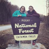
The Pisgah National Forest is a land of mile-high peaks, cascading waterfalls, and heavily forested slopes. Comprised of over 500,000 acres, the Pisgah is primarily a hardwood forest with whitewater rivers, waterfalls and hundreds of miles of trails. This national forest is home of the first tract of land purchased under the Weeks Act of 1911 which led to the creation of the national forests in the eastern United States. It is also home of the first school of forestry in the United States, now preserved at the Cradle of Forestry in America historic site, and boasts two of the first designated wilderness areas in the east. The Pisgah, Grandfather and Appalachian Ranger Districts are scattered along the eastern edge of the mountains of western North Carolina and offer visitors a variety of opportunities for outdoor recreation and enjoying the natural beauty of the mountains. Camping and Day-use Information Enjoy camping or a picnic at one of the many day-use areas. A list of camping and day-use areas in the Pisgah National Forest can be found here Recreation Maps Nantahala & Pisgah National Forest Maps Directions to Frequently Requested Places NC Arobretum and Bent Creek Area Blue Ridge Parkway South Blue Ridge Parkway North Pisgah Ranger District Cradle of Forestry Cradle of Forestry (Scenic Route) The Biltmore House Mt. Mitchell Be Safe The national forests in North Carolina offer a wide variety of outdoor recreation opportunities. From the mountains to the sea, there are many exciting adventures awaiting your visit to these national forests. Please keep in mind that all outdoor recreational activities on the Croatan, Pisgah, Nantahala and Uwharrie national forests, including activities at recreation sites, have inherent risks due to the natural setting in which they occur. Always remember, your safety is your responsibility. Waterfall Safety for the Summer.
RV Road Trip Guides
Map & DirectionsPisgah National Forest Dispersed is located in North Carolina near Barnardsville
Coordinates
35.76618904 N
82.36545018 W
Connectivity
 T-MobileNo Coverage
 VerizonLTESome CoverageVerified by 2 usersLast on 7/28/26
- AT&TNo CoverageVerified by 2 usersLast on 7/1/26
Connectivity
- T-MobileNo Coverage
- VerizonLTESome CoverageVerified by 2 usersLast on 7/28/26
- AT&TNo CoverageVerified by 2 usersLast on 7/1/26
Access
- Drive-InPark next to your site
- Walk-InPark in a lot, walk to your site.
Site Types
- Tent Sites
- Dispersed
- Group
Features
For Campers
- ADA Access
- Phone Service
- Drinking Water
- Alcohol
- Pets
- Fires
DISPERSED CAMPING
Enjoy dispersed camping on government land and leave no trace. Pack in and pack out. No (or limited) services at this camping area. Permit may be required.
PERMIT might be REQUIRED
We curate permit requirements across the US for our PRO members. Try PRO to see if Pisgah National Forest Dispersed needs a permit.
Drive Time
- 37 min from Asheville, NC
- 1 hr 5 min from Johnson City, TN
- 1 hr 22 min from Kingsport, TN