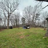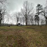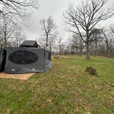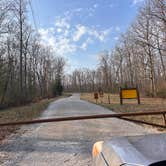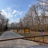
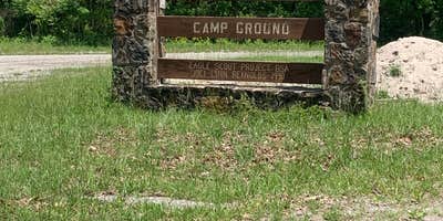
This free dispersed camping area within Catoosa Wildlife Management Area requires navigating rough dirt roads to reach approximately 10-15 individual sites scattered across open terrain. The Tennessee Wildlife Resources Agency manages this hunter-focused location where campers can pitch tents or park RVs, though the washboard access road may challenge larger rigs. Sites sit within view of each other across the clearing, with established fire rings at most spots.
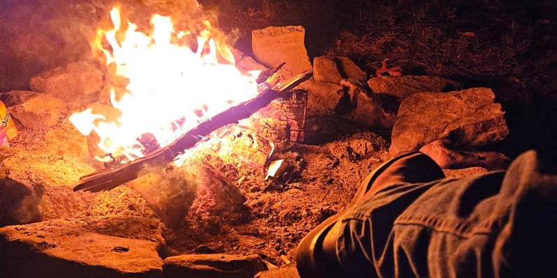
Wildlife activity defines the overnight experience here. Robert W. notes "lots of wildlife sounds at night," while wandering cattle herds occasionally pass through the camping area. Hunters frequent the location, particularly during rifle season, creating a social atmosphere where visitors often gather around evening fires. The area provides plenty of natural shade, though campers should pack all water since none is available on-site.
A creek runs several miles down the road for those willing to explore further. Cell service reaches the area, making this accessible for campers who need connectivity. The location serves as a staging point for exploring places to camp around Catoosa Wildlife Management Area, with Rock Creek Campground located northeast for those seeking developed facilities.
Check current hunting seasons before arrival, as temporary closures may restrict access during special hunts.
Description
82,000 acres of wild land on the upper Cumberland Plateau in both Morgan and Cumberland counties. This area offers some of the best hunting in East Tennessee! This area is home to deer, wild turkey, wild boar, fox squirrels, gray squirrels, ruffed grouse, raccoons, quail, rabbits, and mourning doves. For your fishermen, the game include smallmouth bass, rock bass, bluegill, and muskellunge. Although the area is funded by hunters and fishermen, it is popular with all outdoor enthusiasts! Backpacking is very popular in the area, as well as whitewater rafting! The area has many deep cut canyons created by the rivers and streams, and offers access to beautiful scenery unlike anywhere else. The many trails allow access to the back country, but perhaps the best known path is the Cumberland Trail which passes through the area.
Overnight camping is allowed on designated areas. The area is closed to entry between sunset and sunrise.
Bicolor Entrance N 35.993 W -84.678
RV Road Trip Guides


Map & DirectionsBi-Color Campground (Catoosa WMA) is located in Tennessee near Lancing
Coordinates
36.02367608584931 N
84.69426592186804 W
Connectivity
 T-MobileNo Coverage
- VerizonNo Coverage
 AT&TLTESome Coverage
Connectivity
- T-MobileNo Coverage
- VerizonNo Coverage
- AT&TLTESome Coverage
Access
- Drive-InPark next to your site
- Walk-InPark in a lot, walk to your site.
Site Types
- Dispersed
Features
For Campers
- Phone Service
- Alcohol
- Pets
- Fires
For Vehicles
- Big Rig Friendly
DISPERSED CAMPING
Enjoy dispersed camping on government land and leave no trace. Pack in and pack out. No (or limited) services at this camping area. Permit may be required.
PERMIT might be REQUIRED
We curate permit requirements across the US for our PRO members. Try PRO to see if Bi-Color Campground (Catoosa WMA) needs a permit.
Drive Time
- 57 min from Knoxville, TN
- 1 hr 28 min from Cleveland, TN
- 1 hr 36 min from Chattanooga, TN
- 1 hr 38 min from Morristown, TN