SUMMARY PRESENTED BY
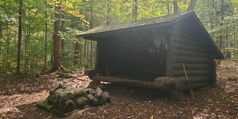
This free lean-to site sits along the Blueberry Trail within High Peaks Wilderness, managed by the New York State Department of Environmental Conservation. Accessible only by hiking in, the campground provides a lean-to shelter, privy, fire pit, picnic table, and water source. The location puts campers close to trailheads for Seward, Donaldson, and Emmons peaks, making it a practical base for High Peaks hiking. Ward Brook Campsite offers another lean-to option less than a mile away for those seeking alternatives in the area.
RV Road Trip Guides


Map & DirectionsBlueberry lean-to campground is located in New York near Ray Brook
Coordinates
44.18276 N
74.18468 W
Connectivity
 T-MobileNo Coverage
- VerizonNo Coverage
- AT&TNo Coverage
Connectivity
- T-MobileNo Coverage
- VerizonNo Coverage
- AT&TNo Coverage
Access
- Hike-InBackcountry sites.
Site Types
- Tent Sites
- Dispersed
- Group
Features
For Campers
- Picnic Table
- Drinking Water
- Toilets
- Fires
FREE established camping
Enjoy camping on government land. Limited or no services at this camping area.
Drive Time
- 2 hrs 41 min from Burlington, VT
- 2 hrs 42 min from Glens Falls, NY
- 2 hrs 47 min from Watertown, NY
- 3 hrs 13 min from Utica, NY

