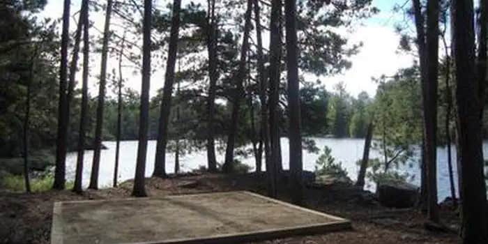
This free National Park Service campground provides water and sewer hookups along with boat-in, drive-in, and hike-in access options. Reservations are available and recommended during summer months when sites typically fill up. The forested and open terrain sits near both river and lake waters within Voyageurs National Park.
Campers should prepare for rough access roads when driving to the area. Site R67 offers sunrise and sunset views from its island location, accessible by kayak in about an hour from the mainland. Each site includes a picnic table and in-ground pit toilet, with sandy areas for watercraft docking. Bug spray is essential, and the park works best for visitors with their own boats or kayaks. For different camping experiences, consider Sand Point Lake Frontcountry Camping nearby.
Description
Overview
** PLEASE READ IMPORTANT INFORMATION BELOW TO UNDERSTAND HOW TO CAMP AT VOYAGEURS NATIONAL PARK **All frontcountry and backcountry campsites require travel by private watercraft or water taxi to access.Click on any campsite name when searching sites to view boating distances.You can type in a specific campsite number or campsite/lake name when searching site availability.Voyageurs National Park has 143 frontcountry, 14 backcountry, and 2 primitive campsites for visitors wanting an authentic Northwoods camping experience._PRIMITIVE CAMPSITES (Red Pine & Blueberry Ridge) are the only campsites that are located on the mainland and DO NOT require a boat to access. They are hike-in sites along the Kab-Ash Trail and are equipped only with fire rings and cleared areas for tents. Leave No Trace Principles apply in these areas.FRONTCOUNTRY CAMPSITES are located on the large lakes (Rainy, Kabetogama, Namakan, Sandpoint). You can boat directly to them from any park visitor center boat ramp. They offer fire rings, tent pads, picnic tables, bear lockers for safe food storage, and outdoor privies. Ten of the frontcountry sites throughout the park are available on a one-week booking window to accommodate short-term trip planners.BACKCOUNTRY CAMPSITES are located on the park's interior lakes and offer a more remote and secluded camping experience consisting of fire rings, tenting areas, an outdoor privy, a bear pole for safe food storage, and a canoe. These sites first require travel by private watercraft or local water taxi service to a remote trailhead and then hiking up to several miles to the backcountry lakes. All backcountry campsite reservations include the use of one canoe and an access code will be provided in your confirmation email. Some campsites can be hiked to directly while others require paddling after hiking. Canoes on backcountry lakes are provided by the park and remain stationed at these lakes. Personal watercrafts of any kind cannot be portaged into backcountry due to the threat of Aquatic Invasive Species.Chain of Lakes (Locator, War Club, Quill, and Loiten Lakes): Reservations at these sites automatically include one canoe because a canoe is required to reach them. In this area only, up to 2 additional canoes can be added on a first come, first served basis to any camping reservation.Shoepack & Little Shoepack Lakes: The campsites on these two lakes come reserved together (for the cost of one) because the one canoe on Little Shoepack is required to reach the campsite on Little Shoepack and/or the portage to Shoepack Lake. Shoepack Lake has its own separate canoe - please leave the canoes on their respective lakes.__Ek, Agnes, Jorgens, Quarter Line, Cruiser, Brown, Peary, Oslo and Ryan Lakes: These backcountry campsites can be hiked to directly after boating to a trailhead and have one canoe located at each site.__DAY USE BACKCOUNTRY CANOE RENTALS: The Chain of Lakes is the only backcountry area with an additional inventory of canoes that are available for single day use. Use of these canoes first requires travel by private watercraft or local water taxi service to the Locator trailhead and then hiking two miles to where the rental canoes are stationed. To reserve a day use canoe in the Chain of Lakes area, click on the Reserve Day Use button on this page to view availability. To use the canoe at any other backcountry site for day use, that campsite must be reserved for one overnight.DAY USE & VISITOR DESTINATION SITES: With 27 Day Use sites and 7 Visitor Destination sites, Voyageurs National Park has plenty of areas to enjoy for visitors who are out for a day trip on the lakes. Each Day Use site has picnic tables, fire rings and vault privies, while the Visitor Destination sites offer short trails with wayside exhibits, picnic areas and comfort stations. No reservations are required for Day Use or Destination sites. You can view a map of day use sites here .Keep Voyageurs National Park Wild for Future Generations: The Voyageurs Conservancy is the park's official nonprofit partner representing a community of people who care about the ongoing stewardship of Voyageurs National Park. VNPA works to fund projects and programs that will help sustain the park's waters, wild character, and visitor experience for generations to come. Become a member today , follow them on Facebook and Instagram , or sign up for their e-newsletter .
Recreation
From spring through fall, explore Voyageurs National Park on land by stopping in at a visitor center or hiking any of our 52 miles (84 km) of scenic hiking trails. To explore the vastness of the same lakes the Voyageurs and Ojibwe Indians once traversed, leave your car behind and explore park waters by kayak, canoe, sailboat, motorboat, houseboat or tour boat. Public boat launch ramps are available at park visitor centers, the Crane Lake ranger station and the two state forest campgrounds - Woodenfrog and Ash River. With scheduled programs and boat tours, you can paddle a canoe on the Voyageurs Highway, watch wildlife by day and stars by night, and explore historic Kettle Falls Hotel, Hoist Bay and Ellsworth Rock Gardens. Check the Things to Do page on the park website for a current list of these activities and many more, or speak with a park ranger at one of the Voyageurs National Park visitor centers. Many of our programs offer reservations. Visit the Voyageurs National Park Tours or the Voyageurs National Park Special Interpretive Programs pages (reservations are highly recommended for boat tours).
Facilities
Voyageurs National Park has three visitor centers, which offer area information, exhibits, a park movie, bookstore, Junior Ranger programs, boat ramps, hiking trials and more. All visitor centers are open daily in the summer, and re open limited hours in the fall, winter, and spring.Raniy Lake Visitor Center (218) 286-5258Kabetogama Lake Visitor Center (218) 875-2111Ash River Visitor Center (218) 374-3221
Natural Features
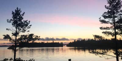
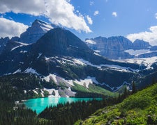
Voyageurs National Park is a land and water environment of great beauty, exceptional natural and cultural resources, and abundant recreational opportunities. Located in the lake-country of northern Minnesota, the park protects 218,054 acres (88,243 ha) that include roughly 134,000 acres (54,227 ha) of forest, 84,000 acres (33,993 ha) of water, 655-miles (1,054 km) of undeveloped shoreline, and hundreds of islands. The park's 55-mile (89 km) northern boundary is the international border between the United States and Canada and includes an important segment of the "transcontinental highway" traversed by French-Canadian voyageurs during the late 1700s and early 1800s. There are four distinct seasons in Voyageur country. The air is mild during June, July, and August when periods of fine, warm weather prevail. The frost-free season averages 120 days from June to mid-September. The average ice-out date is May 3 but varies year to year. Annual precipitation (rain and snow) averages 25-28 inches (63-71 cm) in the park and average snowfall ranges from 55-70 inches (140-180 cm), but is highly variable. The first measurable snowfall occurs in late October and the last in late April or early May.
Contact Info
For facility specific information, please call (218) 283-6650.
Nearby Attractions
Unique attractions near Voyaguers National Park: The City of International Falls sits on the U.S.-Canada borde r, across from Fort Frances, Ontario. You can have a picnic lunch in Smokey Bear Park, and then tour the Bronko Nagurski Museam and Koochiching County Historical Museum, which both sit on site. Don't forget to take a photo with the 26-foot statue of Smokey the Bear himself - a well-known and beloved national symbol of fire prevention and forest conservation. There are many unique businesses and shops along main street, as well as some great coffee shops and restaurants. Heading eastward out of town, you will pass the village of Ranier and numerous resorts where you can find delicious lake-side dining, fishing guides, hotel and cabin accomodations, houseboat rental companies and much more. The Historic Port Village of Ranier is a quaint little community situa ted right where Rainy Lake empties into the Rainy River underneath a cantilever-style train bridge that spans from the U.S. into Canada. Here you will find lodging, an RV park, a park and playground, a public beach, public docks, delicous food, an ice cream parlor and a lakeside brewpub, all packed into one small charming town of about 150 residents. Be sure to take a photo with Big Vic, the 25-foot (8 m) tall statue of a French-Canadian voyageur, who stands at the entrance to this unique little town. The communites of Kabetogama , and Ash River , and Crane Lake are located 30 to 60 miles south of International Falls, and serve as gateways to the southern district Voyageurs National Park. Be sure to stop and take a photo of yourself "riding" the walleye statue at the entrance to Kabetogama on Highway 53.
Charges & Cancellations
CANCELLATION POLICY: Cancellations and/or modifications to an existing reservation can easily be made online via your recreation.gov account. Log in to your account, click on your name in the upper right, and select My Reservations. Click on the "Modify or Cancel" button next to the reservation needing to be changed. The national recreation.gov call center at (877) 444-6777 can also assist. You cannot call a park office to cancel a reservation. THE FOLLOWING FEES APPLY: Reservation system fee of $10 charged at time of reservation is non-refundable Any change (i.e. trip dates, campsite) to your reservation more than 3 days prior to your trip: No charge Any change (i.e. trip dates, campsite) to your reservation less than 3 days prior to your trip: $10 service fee per Cancel reservation more than 3 days prior to arrival date: additional $10 cancellation fee; receive refund of remaining amenity fees Cancel reservation less than 3 days prior to arrival date: additional $10 cancellation fee + forfeit first nights fee; receive refund of remaining amenity fees Once permit has been printed: No refund; printing your permit confirms your reservation and must be done within 5 days of your trip start date from the My Reservations section of your recreation.gov account Once trip dates have started: No refund; if you are unable to make your trip, cancel your reservation in the My Reservations section of your recreation.gov account before your trip start date to be eligible for a refund
Fee Info
Reservation Fee: $10 (non-refundable) per transaction. Camping Use Fee: See Facility Rates section (above).Entrance Fee: Voyageurs National Park does not charge an entrnace fee.HOW TO MAKE A RESERVATION: Reservations can be made online or through the call center at (877) 444-6777 from 9:00 a.m. to 11:00 p.m. CST March 1 - October 31, and from 9:00 a.m. to 9:00 p.m. CST November 1- February 28.Reservations for peak seasons (Friday before Minnesota fishing opener through October 15) go on sale the previous November 15th at 9:00 a.m. CST.__Reservations for non-peak seasons (October 16 through the Thursday before MN fishing opener) go on sale the previous April 15th at 9:00 a.m. CST.
Warning 1 Alert is In Effect
There is 1 alert for this campground. Camp safely!
Warning 1 Alert is In Effect
There is 1 alert for this campground. Camp safely!
The following campsite are released on a one-week rolling booking window to provide options for short-term trip planners.
- Rainy Lake (west end): Mio Beach R64 and Nuthatch R21
- Rainy Lake (east end): Jack Pine Bench R55 and Hitchcock R105
- Kabetogama Lake: Fox Farm K50 and Round Bear K29
- Namakan Lake: Johnson Bay N13 and Hammer Bay South N59
- Sand Point Lake: South Island S17 and Feldt Channel S5
RV Road Trip Guides

Map & DirectionsRainy Lake Frontcountry Camping is located in Minnesota near Ranier
Directions
VEHICLE:Voyageurs National Park is approximately 5 hours north of Minneapolis-St. Paul on I-35 and Hwy 53, 3 hours north of Duluth on Hwy 53, and 4 hours south from Winnipeg, Manitoba. PLANE: Falls International Airport is located in International Falls, Minnesota. Taxi service and rental cars are available here. Most flights entering the area will pass through the larger Minneapolis-St. Paul airport located around 5 hours south of Voyageurs National Park.PUBLIC TRANSPORTATION: There is no public transportation to Voyageurs National Park. No bus lines or passenger trains serve this area.
Coordinates
48.6027778 N
93.3768333 W
Connectivity
 T-Mobile5GExcellent Coverage
 VerizonLTESome Coverage
 AT&T5GGood Coverage
Connectivity
- T-Mobile5GExcellent Coverage
- VerizonLTESome Coverage
- AT&T5GGood Coverage
Access
- Drive-InPark next to your site
- Hike-InBackcountry sites.
- Boat-InSites accessible by watercraft.
Site Types
- Tent Sites
Features
For Campers
- Picnic Table
- Reservable
- Pets
- Fires
For Vehicles
- Sewer Hookups
- Water Hookups
FREE established camping
Enjoy camping on government land. Limited or no services at this camping area.
PERMIT might be REQUIRED
We curate permit requirements across the US for our PRO members. Try PRO to see if Rainy Lake Frontcountry Camping — Voyageurs National Park needs a permit.
Drive Time
- 2 hrs 43 min from Duluth, MN
- 3 hrs 45 min from Grand Forks, ND
- 4 hrs 6 min from Fargo, ND
- 4 hrs 17 min from St. Cloud, MN


