Russell Sage Wildlife Management Area

SUMMARY PRESENTED BYT-Mobile

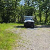
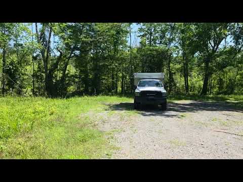
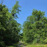
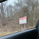
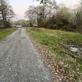
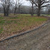
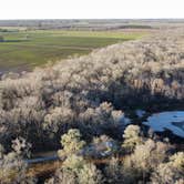
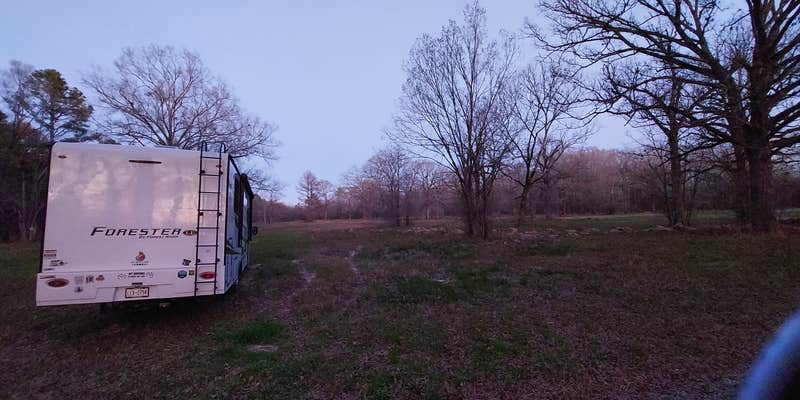
A long unpaved drive off a two-lane road leads into this free dispersed camping area within the Russell Sage Wildlife Management Area outside Monroe, Louisiana. The entry is marked by a large sign, and the camping area itself is a wooded loop with limited formal infrastructure. No gravel parking pads, no hookups. Just trees, soft ground, and room for a handful of rigs if needed.

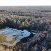
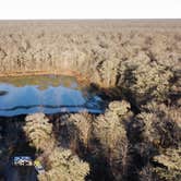
Road conditions are worth noting before you go. The access track can be muddy after rain, and the soft ground has caught at least one camper off guard. Reviewers have flagged wildlife sightings in the area, including bears, though one camper set up a camera and came away empty-handed. Cows and dogs from nearby properties are occasionally audible but haven't caused sleep issues. A pond sits at the end of the turnaround, giving the site a bit of natural character without requiring any effort to find.

Debbie S. noted: "Just a circle turn around back in the woods. I was the only car." That sums up what most visitors find here: a low-traffic, low-expectation overnight stop that works well for solo campers or anyone passing through the campgrounds around Monroe corridor along I-20. Campfires are allowed, pets are welcome, and cell service is available. Alcohol is permitted under state wildlife management area rules.

Campers with full-size rigs should verify road conditions before committing, especially after wet weather. Bug spray is non-negotiable in Louisiana, regardless of season.

Suggest an Edit

Map & DirectionsRussell Sage Wildlife Management Area is located in Louisiana near Monroe

Detail location of campground
Dispersed Camping

Coordinates

32.51445500004468 N
91.93716801589187 W

Open in Google Maps

Connectivity

Presented byT-MobileT-Mobile is introducing T-Satellite to extend coverage in the outdoorsLearn More
  • signal strength bars
    T-Mobile5G
    Excellent Coverage
  • signal strength bars
    VerizonLTE
    Some Coverage
    Verified by 2 users
    Last on 8/6/26
  • signal strength bars
    AT&T5G
    Excellent Coverage
    Verified by 6 users
    Last on 8/6/26

Connectivity

Presented byT-MobileT-Mobile is introducing T-Satellite to extend coverage in the outdoorsLearn More
  • signal strength bars
    T-Mobile5G
    Excellent Coverage
  • signal strength bars
    VerizonLTE
    Some Coverage
    Verified by 2 users
    Last on 8/6/26
  • signal strength bars
    AT&T5G
    Excellent Coverage
    Verified by 6 users
    Last on 8/6/26

Access

  • Drive-In
    Park next to your site
  • Walk-In
    Park in a lot, walk to your site.

Site Types

  • Dispersed

Features

For Campers

  • Phone Service
  • Alcohol
  • Pets
  • Fires

For Vehicles

  • Pull-Through Sites

DISPERSED CAMPING

Enjoy dispersed camping on government land and leave no trace. Pack in and pack out. No (or limited) services at this camping area. Permit may be required.


PERMIT might be REQUIRED

We curate permit requirements across the US for our PRO members. Try PRO to see if Russell Sage Wildlife Management Area needs a permit.

Drive Time


2026 Explorer Giveaway

Review Campgrounds. Win Prizes.

Enter to Win

Reviews6 Camper Reviews - Russell Sage Wildlife Management Area

Add Review

5 Stars

4 Stars

3 Stars

2 Stars

1 Star

33%
50%
17%
0%
0%

4.0

out of 5

6 Reviews

Basic free roadside camping with easy highway access and quiet surroundings. Several guests observed cleanliness issues with trash and waste, while others found it perfectly adequate for overnight stops.

SUMMARY PRESENTED BYT-Mobile
Reviewed Jun. 2, 2026

Not the worst

These were once nice, now they are a little underwhelming. The spot is out of the way with one way In and out. Bring bug spray but its Louisiana.

Month of VisitJune
  • Review photo of Russell Sage Wildlife Management Area by John H., June 2, 2026
  • Play button icon
  • Review photo of Russell Sage Wildlife Management Area by John H., June 2, 2026
Reviewed Dec. 31, 2024

Absolutely nothing there!

Easy to find with the link in Dryt. Don’t even try to find it on your own with Apple Maps! It’s just a longish drive off of a nice paved two lane. There is a big sign at the mouth. Just a circle turn around back in the woods. I was the only car and we (me and my doggo) slept and drove away!

SiteRussell Sage. only one site. room for several vehicles .
Month of VisitDecember
  • Review photo of Russell Sage Wildlife Management Area by Debbie S., December 31, 2024
  • Review photo of Russell Sage Wildlife Management Area by Debbie S., December 31, 2024
Reviewed Mar. 7, 2024

Dispersed and quiet

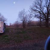
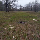
I ended up in the hunting-open dispersed area. There is plenty of space to fit quite a few campers there, but the ground was soft. There were no gravel parking areas, etc. I read the reviews about bears and put my ring doorbell out in hopes of a glimpse, but no such luck.

We could hear local cows and dogs but nothing so loud as to disrupt our sleep.

Month of VisitFebruary
  • Review photo of Russell Sage Wildlife Management Area by Lea B., March 7, 2024
  • Review photo of Russell Sage Wildlife Management Area by Lea B., March 7, 2024
  • Review photo of Russell Sage Wildlife Management Area by Lea B., March 7, 2024
Reviewed Jan. 5, 2023

Nice and secluded

This is a nice site at end of turn around. Next to a nice pond. About 5 miles from I20. No amenities. Beware only one camp site.

Month of VisitJanuary
  • Review photo of Russell Sage Wildlife Management Area by Eric G., January 5, 2023
  • Review photo of Russell Sage Wildlife Management Area by Eric G., January 5, 2023
  • Review photo of Russell Sage Wildlife Management Area by Eric G., January 5, 2023
Reviewed Dec. 15, 2020

It’s a good one

For quick free road side camping this is the spot! Easy parking, Zero cops, had a campfire, cooked food, slept in my hammock right between the wildlife sign. No complaints would stay again!

  • Play button icon

Frequently Asked Questions

What camping regulations and permits are required at Russell Sage WMA?

Camping at Russell Sage WMA requires a $5 fee. The area has minimal regulations compared to developed campgrounds. It's primarily set up for dispersed camping with no formal reservation system in place. The WMA includes hunting-open dispersed areas where camping is permitted. As with all Wildlife Management Areas, visitors should follow standard public land etiquette including proper waste disposal and fire safety. For the most current regulations, contact the Louisiana Department of Wildlife and Fisheries before your visit.

Is there a map of Russell Sage WMA showing camping areas and trails?

Official maps of Russell Sage WMA are available through the Louisiana Department of Wildlife and Fisheries, which show the designated camping areas and any established trails. These maps typically highlight the hunting-open dispersed areas, the circle turnaround camping spot, and the pond location. The Dyrt provides location links that help navigate to the main camping area. For the most detailed and current maps, contact the Louisiana Department of Wildlife and Fisheries directly or check their website before your visit. Physical maps may also be available at entrance kiosks or from local ranger stations.

What outdoor activities can visitors enjoy while camping at Russell Sage Wildlife Management Area?

Russell Sage WMA offers several outdoor activities for visitors. Hunting is a primary activity, with designated hunting-open areas throughout the management area. Fishing opportunities exist at the pond near one of the camping sites. Wildlife viewing is popular, with possibilities of spotting various wildlife including bears. Visitors can also enjoy hiking through the natural surroundings. The area's proximity to Historic Highway 80 makes it convenient for road trippers looking for a nature break. Night activities include stargazing and campfires in designated areas.

Where is Russell Sage Wildlife Management Area located and how do I access the camping areas?

Russell Sage Wildlife Management Area is located in Louisiana, approximately 5 miles from Interstate 20. Access is via a longish drive off a paved two-lane road with a big sign marking the entrance. The camping area is situated at the end of a circle turnaround back in the woods. There's a camping spot next to a pond at the end of the turnaround. The location is relatively easy to find using The Dyrt directions, though standard map applications like Apple Maps may not accurately guide you to the site.