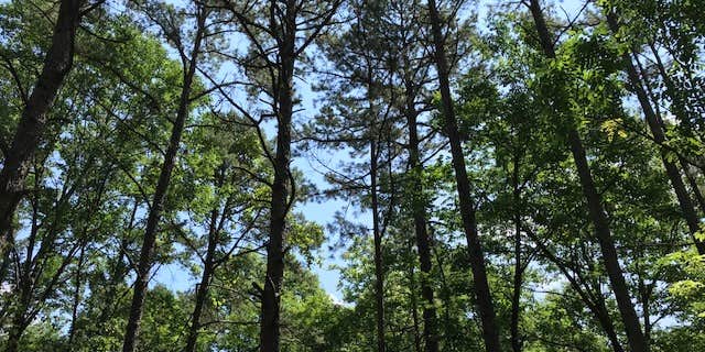
Within the Shawnee National Forest, Johnson Creek operates as a US Forest Service campground positioned on three loops near Kincaid Lake. The facility accommodates multiple access methods including drive-in, walk-in, and boat-in options, with sites scattered throughout wooded terrain rather than concentrated along the shoreline.
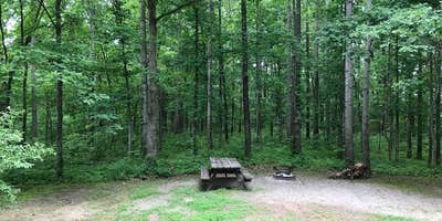
Campers find basic amenities including vault toilets, potable water at the entrance, and individual site amenities like fire rings and picnic tables. Most sites include non-potable water spigots, though seasonal availability varies. The campground maintains a self-check-in system at $10 per night, with discounts available for Golden Pass holders. Stacia R. notes "No need to worry about finding firewood, as it is plentiful within the forest."
Two loops feature smaller, more forested sites while the third accommodates equestrian camping with more open terrain. Sites are situated uphill from the lake rather than waterfront, though Johnson Creek and lake access remain nearby. Reviews consistently mention owl calls at night, adding to the forest atmosphere. The campground connects to several trails and provides access to both water recreation and forest exploration.
For different accommodations, Johnson Creek Campground offers an alternative just east of this location.
Description
Located on a northwest finger of beautiful Kinkaid Lake, Johnson Creek Recreation Area offers a variety of outdoor activities. Here you will find something for everyone in the family, from camping and kayaking to hiking along the lake, biking the scenic roads and horseback riding. Recreation Area Brochure/Map
RV Road Trip Guides

Map & DirectionsJohnson Creek is located in Illinois near Ava
Directions
From Murphysboro: Take Highway 149 west 7 miles to Highway 3; then north 4.5 miles on Highway 3 to Highway 151. Turn right onto Highway 151 and go 4 miles to recreation area. From St. Louis: Take either Highway 3 or Highway 4 south to Chester, IL. Then south 18 miles on Highway 3; turn left onto Highway 151 and go 4 miles to recreation area.
Coordinates
37.83400039 N
89.52100097 W
Connectivity
 T-MobileNo CoverageVerified by 8 usersLast on 7/20/26
 VerizonLTESome Coverage
- AT&TNo Coverage
Connectivity
- T-MobileNo CoverageVerified by 8 usersLast on 7/20/26
- VerizonLTESome Coverage
- AT&TNo Coverage
Access
- Drive-InPark next to your site
- Walk-InPark in a lot, walk to your site.
- Hike-InBackcountry sites.
- Boat-InSites accessible by watercraft.
Site Types
- Tent Sites
- RV Sites
- Standard (Tent/RV)
- Group
- Equestrian
Features
For Campers
- ADA Access
- Trash
- Picnic Table
- Phone Service
- Reservable
- Drinking Water
- Toilets
- Alcohol
- Pets
- Fires
For Vehicles
- Sanitary Dump
Drive Time
- 53 min from Cape Girardeau, MO
- 1 hr 29 min from Paducah, KY
- 1 hr 30 min from St. Louis, MO
- 2 hrs 18 min from Evansville, IN


