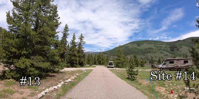
Accessible via forest roads at 9,200 feet elevation, this 21-site US Forest Service campground operates from May through October with a $21 nightly fee and 14-day stay limit. The facility accommodates RVs up to 60 feet and accepts reservations, though no drinking water is available on-site. Campers can access hiking trails, OHV routes, and historical sites, with Leadville a short drive away.
The open terrain setting provides firewood sales and ADA-accessible facilities. Pet owners will find pet-friendly camping near White River National Forest throughout the broader region. Camp Hale works well for RV travelers seeking forest access with modern conveniences at high elevation.
Description
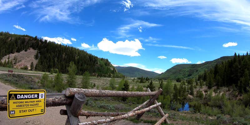
Camp Hale was the center of mountain and winter warfare training developed by the United States Army during World War II. The camp was located here because of the site's natural features and ready access. When the war broke out this valley was served by both a federal highway and the Denver and Rio Grande Western Railroad. Moreover, the large open valley had adequate room for the camp including more than 1,000 buildings and structures as well as parade grounds, weapons ranges, and other spaces needed by the Army. There is a self-guided tour with 10 stops that take you in a loop around Camp Hale. Each stop has an interpretive sign with history of that area. Their is a larger interpretive site just off Highway 24 marked by stone pillars at the main entrance to Camp Hale about 17 miles south of the intersection of I-70 and Hwy 24.
RV Road Trip Guides


Map & DirectionsCamp Hale National Historic Site is located in Colorado near Red Cliff
Directions
Off Interstate 70, take Exit 171 for Minturn and Hwy 24. Turn right and continue about 17 miles to Camp Hale, passing through Minturn. Enter Camp Hale on the left at the main entrance marked by stone pillars.
Coordinates
39.44111179 N
106.32333397 W
Connectivity
 T-MobileNo Coverage
- VerizonNo Coverage
- AT&TNo CoverageVerified by 1 userLast on 6/8/26
Connectivity
- T-MobileNo Coverage
- VerizonNo Coverage
- AT&TNo CoverageVerified by 1 userLast on 6/8/26
Access
Site Types
- Tent Sites
Features
For Campers
- ADA Access
- Firewood Available
- Pets
Drive Time
- 1 hr 59 min from Denver, CO
- 2 hrs 9 min from Boulder, CO
- 2 hrs 44 min from Fort Collins, CO
- 2 hrs 44 min from Colorado Springs, CO


