Within Los Padres National Forest, Campo Alto Group Campground provides a forest setting for organized camping groups. This US Forest Service facility requires advance reservations and operates under a no-pets policy, making it distinct from many nearby options.
The campground sits among forested terrain with drive-in access. Campo Alto Campground offers individual sites just south for campers preferring non-group arrangements. For those exploring campsites near Pine Mountain Club, several additional Forest Service campgrounds operate within a few miles of this location.
Description
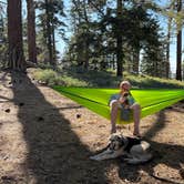
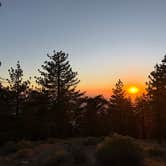
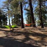
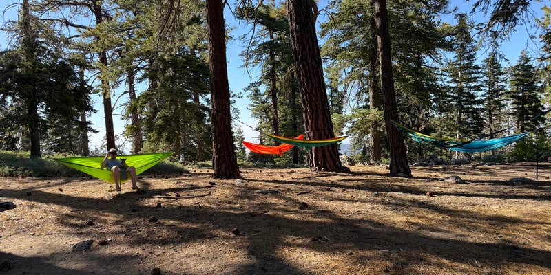
Tucked away high atop the Cerro Noroeste you___ll find solitude, serenity and unsurpassed scenery at Campo Alto Campground. Beautiful scenic mountain vistas from the campground.Campo Alto Campground is located in Kern County approximately ten miles from Pine Mountain Club, CA and approximately thirty-five miles west of Interstate 5 at the end of Cerro Noroeste Road (9N07). The campground is on the summit of Cerro Noroeste at an approximate elevation of 8,200 feet. The surrounding vegetation consists of old growth Jeffrey Pine and white fir forest with smaller brush and shrub species.Recreation use at Campo Alto Campground__is primarily weekend camping. The western end of Tumamait Trail (21W03), located near the campground entrance, accesses the Chumash Wilderness. Most users come from the Los Angeles Basin, Santa Maria area and southern San Joaquin Valley.This area has two group camping areas within its boundary; combined capacity of both group camps is approximately 70 people. There is a large parking area that can accommodate cars or RV___s near the group campgrounds for use by group campers or as overflow parking for individual campsites if needed. The fee per night is $100. Includes 10 cars in the cost of the campsite.The campground is normally closed during the winter season as the only access is via Cerro Noroeste Road, which is not maintained in the winter. The normal operating season is late April thru November.Water is not available.
RV Road Trip Guides


Map & DirectionsCampo Alto Group Campground is located in California near Pine Mountain Club
Directions
__Located off Mil Potrero Highway, approximately three miles west Pine Mountain Club. Take Forest Road 9N27 south for 6 miles.
Coordinates
34.83333333 N
119.2041667 W
Connectivity
 T-MobileLTESome Coverage
 VerizonNo Coverage
- AT&TNo Coverage
Connectivity
- T-MobileLTESome Coverage
- VerizonNo Coverage
- AT&TNo Coverage
Access
- Drive-InPark next to your site
Site Types
- Tent Sites
- RV Sites
- Standard (Tent/RV)
- Group
Features
Drive Time
- 55 min from Bakersfield, CA
- 1 hr 24 min from Los Angeles, CA
- 1 hr 37 min from Santa Maria, CA
- 1 hr 40 min from Oxnard, CA