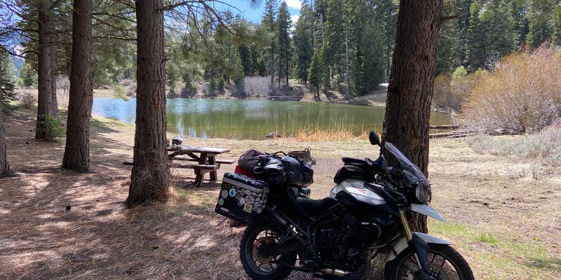
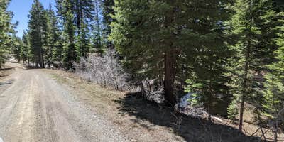
Anglers and boaters heading to Stough Reservoir will find this small US Forest Service campground positioned right along the water's edge. The facility sits approximately one mile up a gravel road from Highway 299, with about 10 sites scattered around the small reservoir within Modoc National Forest.
The campground features vault toilets, drinking water, and picnic tables at each site, with fire pits available for evening gatherings. One standout site sits across the water from the main camping area, offering more privacy along with its own dedicated toilet facility. RVs up to 22 feet can navigate the access road and fit in select sites, though Ariel & John W. notes there are "no hookups but there's water around the campsites." The Warner Mountains provide a backdrop for the camping area.
Cell service remains unavailable here, creating a disconnected experience for visitors. Snow can linger into late spring, potentially blocking road access through May. The $15 nightly fee now applies during the May through October season. Campers can explore dispersed camping options at higher elevations by continuing up the forest road, though these areas require smaller vehicles. The location provides access to campgrounds around Cedarville for those planning extended stays in the region.
Description
Stough Reservoir Campground is only 1 mile off Hwy 299 on a gravel road. At 6,200 feet it provides relief from the heat of the valleys on either side. Small trailers and motorhomes will find access and turn-arounds manageable. The reservoir is small but is kept stocked by the California Department of Fish and Wildlife. Water is provided and campsites sit away from the shore with nice views of the reservoir. Stough Reservoir is Number 4 on the Basin & Range Birding Trail. Bring you camera and binoculars and expect to see Prairie Falcons, Rufous Hummingbirds and Wild Turkeys.
RV Road Trip Guides


Map & DirectionsStough Reservoir Campground is located in California near Cedarville
Directions
From Alturas go north 5 miles on US Hwy 395 to Hwy 299. Turn east on Hwy 299 toward Cedarville and go approximately 13 miles to Forest Road 43N07. Turn north and the campground is 1 mile on the left.
Coordinates
41.56200052 N
120.25400097 W
Connectivity
 T-MobileNo Coverage
- VerizonNo Coverage
- AT&TNo Coverage
Connectivity
- T-MobileNo Coverage
- VerizonNo Coverage
- AT&TNo Coverage
Access
- Drive-InPark next to your site
Site Types
- Tent Sites
- RV Sites
- Standard (Tent/RV)
- Equestrian
Features
For Campers
- Trash
- Picnic Table
- Drinking Water
- Toilets
- Alcohol
- Pets
- Fires
For Vehicles
- Pull-Through Sites


