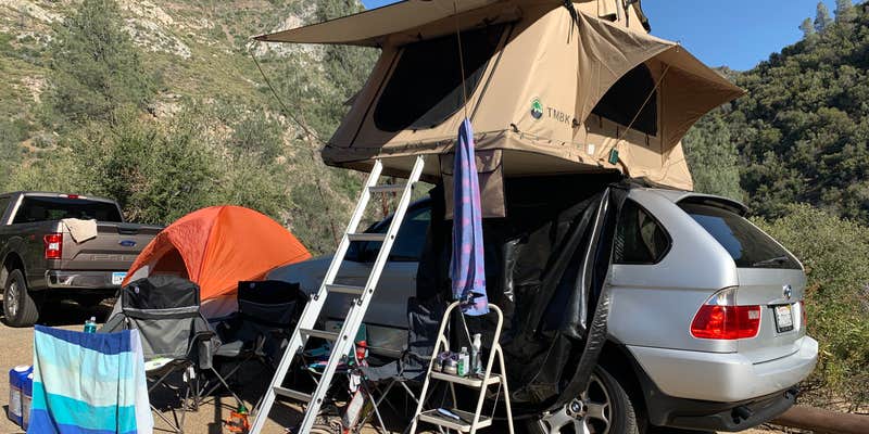
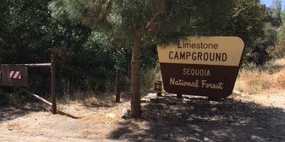
White water rafting and fishing enthusiasts will find Limestone Campground positioned along the Kern River in Sequoia National Forest. The Forest Service facility operates from April through October, charging $36-38 per night for sites that accommodate RVs up to 40 feet with water and sewer hookups available.
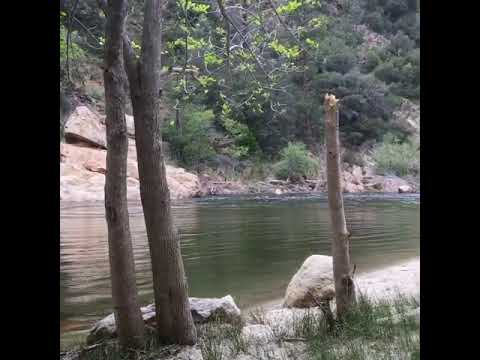
Sites sit above the river in what Coleen B. describes as "a pretty narrow canyon" with "a short hike to the water." Most sites provide shade from surrounding trees, though some elevated spots offer views down to the flowing Kern River. The campground fills quickly during summer weekends, making advance reservations essential through the Forest Service system. Several campers note the proximity to Highway noise, particularly at night.
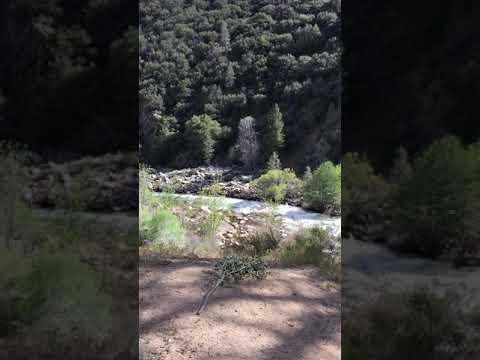
Vault toilets serve the campground, but no electrical hookups or potable water taps exist at individual sites. Cell service remains unavailable, though WiFi can be accessed at a market three miles away. The river provides swimming holes and calm pools between rapids, with fishing opportunities throughout the corridor. Bears frequent the area at night, requiring proper food storage in vehicles. For those planning extended stays in the region, pet-friendly campgrounds around Sequoia National Forest offer additional options with leash requirements throughout the forest.
The campground's location provides access to the Seven Teacups trail and canyoneering routes, making it a practical base for multi-day Kern River adventures.
Description
Overview
Limestone Campground sits in an area dotted with oak and gray pine along the Upper Kern River, a designated Wild and Scenic River, at an elevation of 3,500 feet.
Recreation
Whitewater rafting and kayaking on the Upper Kern River are popular activities. To learn more about the Upper Kern River, including safety and permitting requirements and a listing of local outfitters, visit the Sequoia National Forests overview of the area.
Facilities
The campground, located 16 miles north of Kernville, has 19 paved sites. Picnic areas, vault toilets are provided.
Natural Features
The Sequoia National Forest, located at the southern end of the Sierra Nevada in central California, takes its name from the giant sequoia, the world's largest tree, which grows in more than 30 groves on the forest's lower slopes. The forest comprises about 1.1 million acres, and elevations range from about 1,000 to 12,000 feet creating precipitous canyons and mountain streams with spectacular waterfalls such as Salmon Creek Falls and Grizzly Falls. At various points along the river, gray pines, scrub oaks, grass and dry climate shrubs cling to steep canyon walls, while cottonwoods and willows line the water's edge.
Nearby Attractions
The campground provides a good base for day trips to the Sequoia National Park Trail of 100 Giants. The Giant Sequoia Mercantile offers a wide variety of books, maps, gifts, local art, camping supplies and other merchandise.
Contact Info
For facility specific information, please call (760) 376-1269.
Warning 1 Alert is In Effect
There is 1 alert for this campground. Camp safely!
Warning 1 Alert is In Effect
There is 1 alert for this campground. Camp safely!
- To protect natural resources and provide for public safety, the following acts are prohibited below 5,000 feet in elevation within the Sequoia National Forest.1. Building, maintaining, attending, or using a fire, campfire, or stove fire, except in the designated Campfire Areas listed in Exhibits A, B or C. C.F.R. 261.52(a).2. Smoking, except within an enclosed vehicle or building or within the areas listed in Exhibits A, B or C. 36 C.F.R. 261.52(d).3. Operating an internal combustion engine, except on a designated National Forest System road, trail, or within the areas listed in Exhibits A, B or C. 36 C.F.R. 261.52(g).4. Welding, or operating an acetylene or other torch with an open flame, except within the areas listed in Exhibits A, B or C. Alert Start Date: June 10, 2026 Alert End Date: November 30, 2026
RV Road Trip Guides


Map & DirectionsLimestone Campground is located in California near Johnsondale
Directions
Off of Highway 99 in Bakersfield, California, take Highway 178 east to Lake Isabella. From Lake Isabella take Highway 155 around the west side of the lake to the town of Kernville. From Kernville go north on Sierra Way/Mountain 99 for 16 miles to the campground.
Coordinates
35.962831 N
118.477293 W
Connectivity
 T-MobileNo CoverageVerified by 2 usersLast on 6/18/26
- VerizonNo Coverage
- AT&TNo Coverage
Connectivity
- T-MobileNo CoverageVerified by 2 usersLast on 6/18/26
- VerizonNo Coverage
- AT&TNo Coverage
Access
- Drive-InPark next to your site
- Walk-InPark in a lot, walk to your site.
- Boat-InSites accessible by watercraft.
Site Types
- Tent Sites
- Standard (Tent/RV)
- Group
Features
For Campers
- Trash
- Picnic Table
- Reservable
- Drinking Water
- Toilets
- Alcohol
- Pets
- Fires
For Vehicles
- Sewer Hookups
- Water Hookups
- Big Rig Friendly
Drive Time
- 1 hr 31 min from Bakersfield, CA
- 2 hrs 7 min from Visalia, CA
- 2 hrs 16 min from Hanford, CA
- 2 hrs 38 min from Fresno, CA