Bureau of Land Management's Bakersfield Field Office manages Chimney Creek Campground, a remote camping area accessible via 20 miles of dirt road. The campground sits at the foot of the Sierra Mountains with a small creek running nearby. Most of the original 30 sites have become overgrown, leaving about six to eight usable spots scattered throughout the area and spaced well apart from each other.
Sites 19 through 36 offer the best conditions according to campers, with several providing natural shade from trees. The creek proximity brings insects during warmer months, including ants, gnats, and mosquitoes. Pit toilets remain functional, though water service has been intermittently available following fire damage from several years ago. Jon J. describes it as "spacious, sparsely used, remote tent or car camping, some space for RV but NO hookups."
The campground typically sees light use, with visitors often finding themselves among only a handful of other campers even during holiday weekends. Fire restrictions frequently reach extreme levels, limiting campfire opportunities. Rattlesnakes are common in the area. The access road proves manageable for larger vehicles, including transit vans and some RVs, though no hookups are available.
For a more developed alternative, Walker Pass Campground provides additional amenities about 12 miles south.
Description
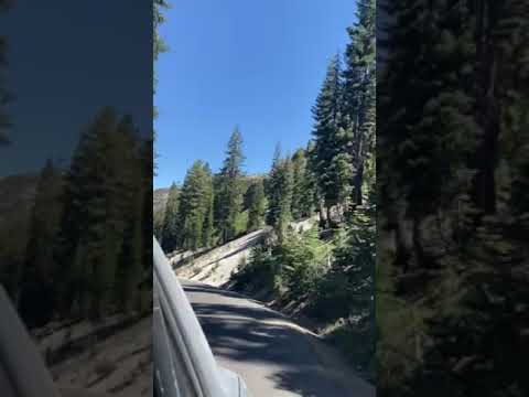
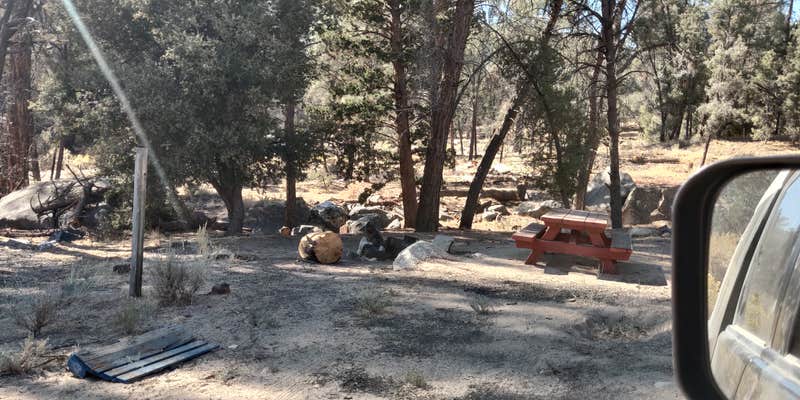
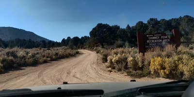
Chimney Creek Campground is located within Chimney Peak Recreation Area and is cherry stemmed out of Owens Peak Wilderness. The campground contains 36 sites and is nestled among beautiful pinyon pines, grey pines, and oaks along Chimney Creek at 5,700 feet in elevation. Each site in the campground has a picnic table and fire ring. Potable water is available during the summer months near the very end of the campground loop at site 36. During the summer, days can be warm and dry. The Pacific Crest National Scenic Trail crosses Canebrake Road just south of the campground. Chimney Creek Trail, a primitive route along Chimney Creek, starts at the cattle guard a half mile from the start of the campground road.
RV Road Trip Guides


Map & DirectionsChimney Creek Campground is located in California near Little Lake
Directions
Follow highway CA-178 approximately 30 miles east of the town of Lake Isabella and turn north onto Canebreak Road. Follow this graded dirt road approximately 9 miles to the prominent junction of Canebrake and Long Valley/ Chimney Basin Roads and continue straight (right fork). The campground will be on the right in an additional 2 miles. The campground road includes spurs to numerous sites. Potable water during the summer months is located at the very end of the campground road (1 mile).
Address
Bureau of Land Management
Bakersfield Field Office
3801 Pegasus Drive
Bakersfield, CA 93308
Coordinates
35.83917 N
118.0423 W
Connectivity
 T-MobileNo Coverage
- VerizonNo Coverage
- AT&TNo CoverageVerified by 1 userLast on 8/1/26
Connectivity
- T-MobileNo Coverage
- VerizonNo Coverage
- AT&TNo CoverageVerified by 1 userLast on 8/1/26
Access
- Drive-InPark next to your site
- Walk-InPark in a lot, walk to your site.
- Hike-InBackcountry sites.
Site Types
- Tent Sites
- RV Sites
Features
For Campers
- Phone Service
- Toilets
- Alcohol
For Vehicles
- Big Rig Friendly
Drive Time
- 2 hrs 14 min from Bakersfield, CA
- 3 hrs 11 min from Visalia, CA
- 3 hrs 19 min from Hanford, CA
- 3 hrs 41 min from Fresno, CA