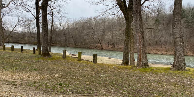
Float trip enthusiasts will find their base camp at Riverside Campground and Canoe, which sits directly on the Spring River in Mammoth Spring. The privately managed campground accommodates RVs up to 60 feet and offers both drive-in and boat-in access, with sites ranging from primitive spots to full hookup options.
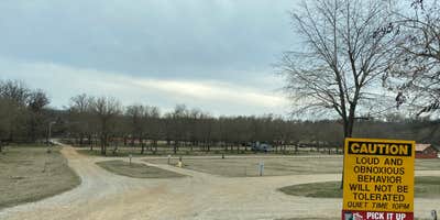
The campground operates a seasonal camp store and provides canoe rentals for river trips. Trout fishing draws many visitors to these waters. Shana D. notes this is a "large campground on Spring River with lots to offer" including "cabins, camper cabins, RV sites with water & elec and tons of primitive sites." Bathhouses stay clean according to multiple reviews. Quiet hours help families with children get rest.
Reservations are strongly recommended during warmer months when the campground fills to capacity. The facility prohibits pets entirely. Standard amenities include drinking water, restrooms, showers, and picnic tables, with firewood available for purchase. Cell service reaches most areas. Campers exploring the region can also check out camping near Cherokee Village for additional options in the Spring River corridor.
This campground works well for families wanting river access and groups planning multi-day float trips down the Spring River system.
Description
We pride ourselves for being Spring River's #1 Family Friendly Campground! So, take your time, look around, and start planning your vacation at Riverside
We offer large & camper cabins, RV sites, and tent camping as nightly rentals. With our Mercantile Store, fire rings, grills, and bathhouses, campers can settle in and relax. You're sure to see some of our furry friends along the way!
Reservation Info
We have a no pet policy. Please do not bring any pets into the campground. You will be asked to leave and will not be refunded.
RV Road Trip Guides


Map & DirectionsRiverside Campground and Canoe is located in Arkansas near Cherokee Village
Directions
From St. Louis, Missouri: Take I-44 W to exit 185 toward Rolla, MO. Turn left at MO-E. Turn right at I-44 BL. Continue on US 63 S (79.3 mi). Slight right to stay on US-63 S (signs for Thayer/West Plains/US 63 S) (50.5 mi). Turn right at CR-70/ Weatherstone Rd (1.0 mi).
Coordinates
36.36230059 N
91.59020097 W
Connectivity
 T-MobileLTESome Coverage
- VerizonLTESome Coverage
 AT&T5GExcellent Coverage
Connectivity
- T-MobileLTESome Coverage
- VerizonLTESome Coverage
- AT&T5GExcellent Coverage
Access
- Drive-InPark next to your site
- Boat-InSites accessible by watercraft.
Site Types
- Tent Sites
- RV Sites
- Standard (Tent/RV)
- Cabins
Features
For Campers
- Market
- Trash
- Picnic Table
- Firewood Available
- Phone Service
- Reservable
- Showers
- Drinking Water
- Toilets
- Alcohol
- Fires
For Vehicles
- Pull-Through Sites
Drive Time
- 1 hr 24 min from Jonesboro, AR
- 2 hrs 26 min from Little Rock, AR
- 2 hrs 26 min from Memphis, TN
- 2 hrs 30 min from Springfield, MO


