Trout fishing enthusiasts and river access campers find Cranberry Campground positioned along the Cranberry River in Monongahela National Forest. This US Forest Service facility operates from April through November, accommodating both tent campers and RVs up to 40 feet across 30 sites arranged in two loops.
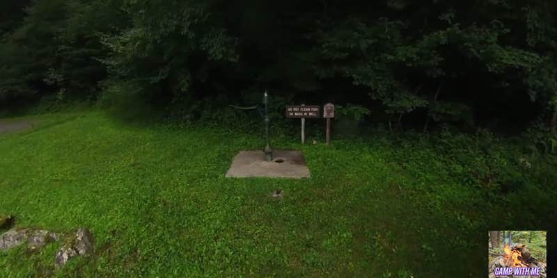
The campground sits adjacent to the river, though most sites are set back from the water's edge. Each site includes a picnic table, fire ring, and lantern post. Hand-pump wells provide drinking water, while vault toilets serve the facility. A dump station operates for a $5 fee. Two walk-in tent sites across a footbridge offer more privacy in heavily wooded terrain. Jennifer B. notes the toilets are "surprising odor-free" for vault facilities.
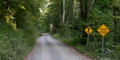
Forest Road 76 provides access, though reviewers consistently mention rough road conditions requiring careful driving. The campground experiences high demand during spring trout stocking season, operating on a first-come, first-served basis. Black bears frequent the area, requiring proper food storage. Cell service remains unavailable throughout the campground and surrounding forest roads.
Nearby Bishop Knob Campground offers a smaller alternative with five sites directly on the riverbank for campers prioritizing water access.
Description
A popular semi-primitive campground adjacent to the Cranberry River and the "lower-gate" entrance to the Cranberry Backcountry. This campground receives very high use during trout stocking from the beginning of spring through the end of June and again in the fall from September through October. During these high use times there are usually more campers waiting than there are sites available. During high use, the centrally located Bishop Knob Campground can usually accommodate campers when no sites are available along the Cranberry or Williams River Corridors.Located on Forest Road 76, 13.5 miles from Richwood, West Virginia, and 7 miles from Dyer, West Virginia.
RV Road Trip Guides


Map & DirectionsCranberry Campground is located in West Virginia near Richwood
Directions
From Richwood travel on mile east on State Route 39/55, then 12.5 miles north on Forest Road 76.From Dyer on State Route 46 take Forest Road 101 approximately 6 miles, then left onto Forest Road 76 for one mile.
Coordinates
38.32518 N
80.44171 W
Connectivity
 T-MobileNo Coverage
- VerizonNo Coverage
- AT&TNo Coverage
Connectivity
- T-MobileNo Coverage
- VerizonNo Coverage
- AT&TNo Coverage
Access
- Drive-InPark next to your site
- Walk-InPark in a lot, walk to your site.
Site Types
- Tent Sites
- RV Sites
- Standard (Tent/RV)
- Group
Features
For Campers
- Trash
- Drinking Water
- Toilets
- Alcohol
For Vehicles
- Sanitary Dump
- Big Rig Friendly


