Within George Washington National Forest, this US Forest Service campground operates seasonally from April through October at $50 per night. The site provides drive-in, walk-in, and boat-in access to forested and open terrain near Sherando Lake. Campers report that sites sit along a creek, with two stocked lakes available for fishing and swimming.
Basic amenities include drinking water, restrooms, dump station, and picnic tables, though pets are not permitted. Reservations are available for the wooded sites that reviewers describe as private. For additional camping options in the area, explore places to camp around George Washington National Forest. The campground serves as a base for hiking trails and water activities during the summer season.
Description
Overview
Sherando Lake Group Camp is a part of the Sherando Lake Recreation Area and is popular with family groups, Boy and Girl Scouts, church groups and other local organizations. The recreation area is situated in the Blue Ridge Mountains and is known locally as the jewel of the Blue Ridge Mountains, where visitors enjoy hiking, fishing, swimming and relaxing.
Recreation
The 25 acre Lower Lake offers opportunities for swimming in a designated area with a sand beach, accessible ramp to the water's edge, and a beach bathhouse with changing and shower facilities. Fishing and boating are also available outside the designated swimming area in the lake. Fishing is in stocked waters during the spring and fall seasons. Visitors will need to have the appropriate Virginia fishing license, National Forest stamp and trout stamp. Boats with gasoline motors are not permitted on the lower lake - electric troll motors, canoes, kayaks, or similar boats only. A hand-carry ramp is available for access to the lake adjacent to the parking area. Fishing only is available at the 7 acre Upper Lake. This lake is also stocked during the spring and fall seasons and the appropriate licenses are required. Boats are allowed, but there is no launch access - hand carry only. Parking is available at a small area below the group camp area and a walking trail will lead you to the lake. Swimming is not allowed in the upper lake. Hiking trails surround the area offering everything from a short walk around the lake on the Lakeside and Cliff Trails to a day hike up the mountain on the White Rock Gap Trail and the Blue Ridge Parkway. For the more adventurous hiker, more challenging day hikes and backpacking trips are available by heading up the Blue Loop Trail to the Torry Ridge Trail to Bald Mountain and beyond.
Facilities
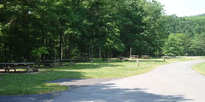
The five tent-only group campsites are located around the outside of the looping road. Each site can accommodate a maximum of 15 guests, or a large group can reserve all 5 sites to fit no more than 75 guests. Each site is delineated with fencing and is equipped with picnic tables, a grill, lantern posts, and a serving table. A bathhouse with flush toilets and showers is located at the upper end of the loop and a vault toilet is located at the lower end of the loop. The bathhouse was replaced during the 2019 season. Drinking water is available at each site. Food storage lockers are currently not available, but all food must be secured in a locked vehicle. Violators are subject to a fine.
Natural Features
The group camp is located at the upper end of the Sherando Lake Recreation Area near the 7 acre upper lake. The group campsites are located around the outer portion of the loop with a large grass field on the interior of the loop for activities and games. The open grassy field provides an excellent opportunity for night time star gazing.
Nearby Attractions
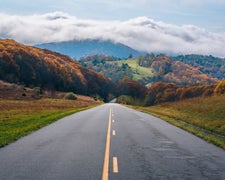
There are opportunities for gas, groceries, and firewood at convenience stores and local vendors along the state road to Sherando Lake. Ice can be purchased at the Sherando Lake Visitor Center during operating hours, which vary seasonally. Additional supplies can be obtained in Stuarts Draft, about a 15 minute drive away. The Blue Ridge Parkway with its scenic overlooks and ridgetop views is a short 3 mile drive up State Route 664 from the Sherando Lake entrance. The Wintergreen Resort offers a golf course and ski area within 10 miles of Sherando Lake.
Warning 1 Alert is In Effect
There is 1 alert for this campground. Camp safely!
Warning 1 Alert is In Effect
There is 1 alert for this campground. Camp safely!
Tent camping only in Group Camping. RVs, Pop - Ups and Camper Vans are not authorized to camp in Group Camping.
RV Road Trip Guides

Map & DirectionsGeorge Washington National Forest Sherando Lake Campground is located in Virginia near Nellysford
Directions
From I-64, take Exit 96 just east of Stuarts Draft. Go south on State Route 624, which becomes State Route 664 at Lyndhurst. Continue south on State Route 664 approximately 8 miles to the entrance for Sherando Lake Recreation Area on the right. The gatehouse is approximately 0.5 miles ahead. If the gatehouse is closed, continue through the recreation area to the group camping area at the end of the road.
Address
96 SHERANDO LAKE ROAD, LYNDHURST, VA 22952 (PHYSICAL ADDRESS)
GLENWOOD AND PEDLAR RANGER DISTRICTS (FOR INFORMATION)
27 RANGER LANE
Natural bridge, VA 24579
Coordinates
37.9297222 N
78.9797222 W
Connectivity
 T-MobileNo Coverage
- VerizonNo Coverage
- AT&TNo Coverage
Connectivity
- T-MobileNo Coverage
- VerizonNo Coverage
- AT&TNo Coverage
Access
- Drive-InPark next to your site
- Walk-InPark in a lot, walk to your site.
- Boat-InSites accessible by watercraft.
Site Types
- Tent Sites
- RV Sites
- Standard (Tent/RV)
- Group
Features
For Campers
- Trash
- Picnic Table
- Phone Service
- Reservable
- Drinking Water
- Toilets
- Fires
For Vehicles
- Sanitary Dump


