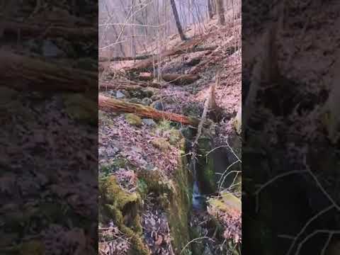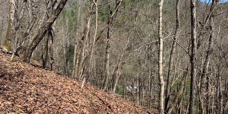
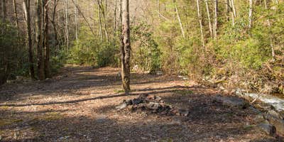
The sound of rushing creek water masks highway noise at this dispersed camping area along Highway 58 in Jefferson National Forest. Multiple first-come, first-served sites line the creek bank, each with established fire rings but no picnic tables or restrooms. Campers pull directly off the road to claim spots that vary from open pull-through areas suitable for trailers to more secluded sites tucked among the trees.
Creek access defines the camping experience here. Most sites sit within steps of the water, where campers filter drinking water and cool off during warm weather. "Bring your water filter and portable potty," advises Shari G., noting the lack of facilities. The creek runs consistently, providing both a water source and ambient noise that drowns out traffic sounds from the nearby highway.
The Virginia Creeper Trail passes within three miles of the camping area, connecting to Damascus and offering 17 miles of downhill biking to Whitetop Mountain. Hikers access the Appalachian Trail from multiple nearby points, while the Whitetop Laurel Creek provides whitewater opportunities when water levels allow. Spring visits coincide with moderate temperatures and fewer crowds, though summer brings more activity and competition for the best creek-side spots.
Sites fill on weekends and during peak seasons, particularly those closest to the water. The area stays busy enough that privacy becomes limited, especially at popular spots near creek bends. Cell service reaches most sites, and campers can purchase firewood locally. Those seeking additional options can explore campgrounds around Sugar Grove or check availability at Raccoon Branch Campground four miles south for developed amenities.
Description
This is a FREE national forest site along Hwy 58. There are quite a few of these sites within 3 miles of this site. Road side, but with the creek next to you it drowns out all road noise.
RV Road Trip Guides


Map & DirectionsMount Rogers National Recreation Area is located in Virginia near Sugar Grove
Directions
Use the maps below to help plan your trip. Mt. Rogers National Recreation Area Map of roads, trails, and boundaries
Coordinates
36.81081862 N
81.42144367 W
Connectivity
 T-MobileNo CoverageVerified by 4 usersLast on 6/30/26
- VerizonNo CoverageVerified by 1 userLast on 6/30/26
- AT&TNo Coverage
Connectivity
- T-MobileNo CoverageVerified by 4 usersLast on 6/30/26
- VerizonNo CoverageVerified by 1 userLast on 6/30/26
- AT&TNo Coverage
Access
- Drive-InPark next to your site
- Walk-InPark in a lot, walk to your site.
Site Types
- Dispersed
Features
For Campers
- ADA Access
- Trash
- Firewood Available
- Phone Service
- Alcohol
- Pets
- Fires
For Vehicles
- Pull-Through Sites
DISPERSED CAMPING
Enjoy dispersed camping on government land and leave no trace. Pack in and pack out. No (or limited) services at this camping area. Permit may be required.
PERMIT might be REQUIRED
We curate permit requirements across the US for our PRO members. Try PRO to see if Mount Rogers National Recreation Area needs a permit.
Drive Time
- 1 hr 6 min from Kingsport, TN
- 1 hr 11 min from Johnson City, TN
- 1 hr 16 min from Blacksburg, VA
- 1 hr 32 min from Beckley, WV