Public Campground
Miners Gulch
Miners Gulch is located near Duchesne in the Ashley National Forest. The terrain consists of forested areas and open spaces. Campers can explore nearby attractions such as Starvation State Park and the Uintah and Ouray Indian Reservation, with temperatures ranging from 20°F in winter to 85°F in summer.
Description
Overview
Miners Gulch Campground was affected by large debris in 2023 that cause irrepairable damage and is no longer open to the Public.
Recreation
Rock Creek offers fishing for brown, brook and rainbow trout. Whitewater rafting and kayaking opportunities are available seasonally.
Facilities
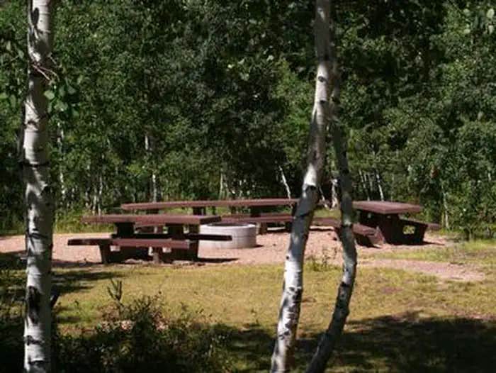
The campground is a group camping facility made up of several individual sites, which can accommodate a group of up to 40 people. Picnic tables and campfire rings are provided, as are vault toilets. The campground has no running water so campers must bring their own supply.
Natural Features
This shaded campground is set back off the main road for privacy. Dense stands of aspens shade the campground, and pines, sagebrush and wildflowers dot the landscape. Evenings in this area are cool.
Nearby Attractions
The Rock Creek Trail begins just over a mile away and connects with an accessible, paved interpretive nature trail in Yellowpine Campground. The Rock Creek Trail provides access to the High Uintas Wilderness, where hiking, backpacking, horseback riding and backcountry fishing are very popular activities. Upper Stillwater Reservoir and Lower Stillwater Ponds are nearby, offering fishing for brown and rainbow trout, swimming and picnicking. Upper Stillwater is currently accessible only by hiking in. Numerous hiking trails lead into the High Uinta Wilderness Area from here.
Location
Miners Gulch is located in Utah
Directions
From Duchesne, Utah: Take Highway 87 north for 15 miles to the Mountain Home turnoff. Turn left and continue 2.5 miles north to the Rock Creek Store. Turn left toward Rock Creek Canyon and proceed approximately 15 miles to the campground. You'll see a sign for Miners Gulch and a dirt road immediately after it. Do not take the dirt road. The campground turnoff is paved and is a few hundred yards after the sign.
Address
P.O. BOX 981
Duchesne, UT 84021
Coordinates
40.5327778 N
110.6227778 W
Connectivity
- T-MobileNo Coverage
- VerizonNo Coverage
- AT&TNo Coverage
Connectivity
- T-MobileNo Coverage
- VerizonNo Coverage
- AT&TNo Coverage
Access
- Drive-InPark next to your site
Site Types
- Tent Sites
- RV Sites
- Standard (Tent/RV)
- Group
Features
For Campers
- Picnic Table
- Fires
Drive Time
- 2 hrs 41 min from Salt Lake City, UT
- 2 hrs 42 min from Provo, UT
- 3 hrs 8 min from Ogden, UT
- 3 hrs 52 min from Logan, UT


