French Creek Flood Plain Overlook is located near French Creek in Pennsylvania. The area features flat terrain with a mix of wooded and open spaces. Campers can explore nearby attractions such as Erie National Wildlife Refuge and Pymatuning State Park, with temperatures ranging from 20°F in winter to 80°F in summer.
Description
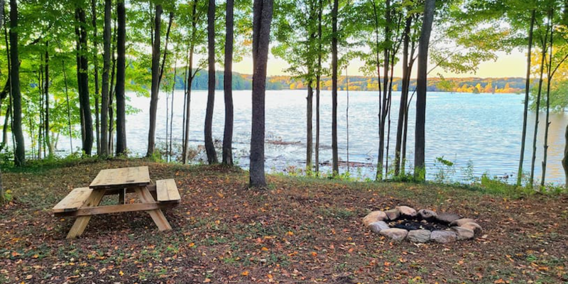
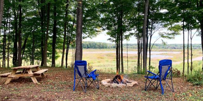
This tent site sits in the woods on a hill just above the corner of French Creek (2022 PA River of the Year!) and a small tributary creek. It faces northwest over the valley providing amazing sunset views.
This location is on the high-side of the Union City Dam which is a dry bed, flood control dam. Which means during snow melt, or rainy streaks, the dam will fill up and flood the entire valley. However during dry spells, French Creek will appear as any other creek. At peak flooding, it will make its way all the way up the tributary valley, making a beautiful lake front campsite. Unfortunately, this only occurs a few weeks out of the year (typically early spring and occasionally during wet falls) and is fairly unpredictable (you can compare the high-water vs low-water views from the photos). Most of the summer you can still enjoy the view over both the tributary valley and French Creek valley. (DISCLAIMER: Once or twice a year during the wettest streaks, the water rises high enough to flood the driveway, making it impossible to drive up directly to the campsite. If this happens, you will be notified before so you can choose either to be refunded and not stay or you can park 100 yards up the road and hike into the campsite to enjoy the unique and rare lakefront views. Again, these are natural events that are infrequent and unpredictable, but also provide a truly spectacular setting.)
Located at the end of a dead end dirt road, adjacent to 100's of acres of federal protected land, and within sight of agriculture fields, there is an abundance of wildlife. For over 20 years, an active eagles nest has been located 1 mile north providing amazing opportunities to see either adult or juvenile eagles flying over French Creek hunting for fish. Deer can be seen early morning and late evening in the fields, as well as frequently crossing both valleys. All types of waterfowl flock the lake when it's flooded. I've personally seen up to 1000 geese at one time.
Beyond relaxing and wildlife watching, there are plenty of other activities to explore in the area. Access to many nature walking trails. The Union City Dam, less than 1.5 miles down the road, provides walking, biking, scenic driving, and picnic opportunities. Kayaks/canoes can be used to float the creek when dry or paddle up and down the reservoir lake when flooded. Centrally located between the 2 small towns of Union City and Waterford with gas stations, grocery stores, great local dinning options, and more. About a half an hour drive to Erie and Presque Isle State Park.
Come enjoy this extremely unique stretch of French Creek and Pennsylvania woods!
DISCLAIMER: There is an active gravel pit to the North of the campsite. During weekdays from about 7 AM-5 PM, you will likely hear and possibly see some activity from the gravel pit.
Location
Private CampgroundFrench Creek Flood Plain Overlook is located in Pennsylvania
Directions
Make sure you are turning onto Middleton Rd from Route 97 (if you come from Kimball Hill Rd you will have to turn around, Middleton road is closed from that direction). Drive North to the end of Middleton Rd. You will come to a cul-de-sac at the end of the road (look for the wooden "Campsite" sign), and 2 yellow posts with signs for a gravel pit. Proceed past the cul-de-sac by continuing straight down the gravel pit road (only about 100 yards) to the first driveway on the right going up into the woods (look for the second "Campsite" sign). Park where ever you like, if it seems wet, stick to the driveway. Do not travel north past the campsite driveway on the gravel pit road.
Coordinates
41.93683484429974 N
79.89394850278467 W
Connectivity
- T-Mobile5GGood Coverage
- VerizonLTESome Coverage
- AT&T5GGood Coverage
Connectivity
- T-Mobile5GGood Coverage
- VerizonLTESome Coverage
- AT&T5GGood Coverage
Access
- Drive-InPark next to your site
Site Types
- Tent Sites
Features
For Campers
- Picnic Table
- Firewood Available
- Reservable
- Pets
- Fires
Drive Time
- 26 min from Erie, PA
- 1 hr 32 min from Youngstown, OH
- 1 hr 38 min from Buffalo, NY
- 1 hr 39 min from Cleveland, OH


