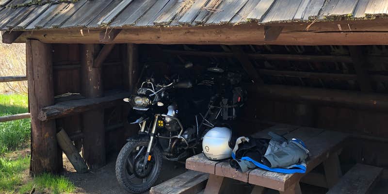
Within Fremont National Forest, Happy Camp provides first-come, first-serve camping along Dairy Creek from May through October. The US Forest Service manages this nine-site campground with electric hookups, drinking water, and several sites featuring old log lean-to covers over picnic tables.
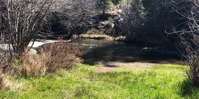
The forested campground sits directly on the creek, though rough access roads require careful navigation. Campers report beaver activity in the area, with the animals' evening sounds audible throughout camp. The site at the far back right offers direct creek access with its own small beach area. For campers wanting more developed facilities, Dairy Point sits a few miles east along the same drainage.
Description
Located one hour five minutes of Paisley, Oregon, Happy Camp is a developed campground ideally located along peaceful Dairy Creek. The stream flows through the middle of the campground, offering fishing opportunities for rainbow trout. At 5289 feet in elevation, this alpine campground features nine camping sites. All campsites include picnic tables and fire rings, but no garbage receptacles. * Remember to “pack it in, pack it out.” There are three vault toilets, and two water spigots. Fresh water is also available at Clear Springs Forest Camp, about 1.5 miles to the west on Forest Service Road 047. Besides fishing, hiking on the nearby trails, and relaxing at Happy Camp, you can toss horseshoes (bring your own) into the horseshoe pits or picnic under the historic shelters. The picnic shelters were built in the 1930’s by Civilian Conservation Corps.
RV Road Trip Guides


Map & DirectionsHappy Camp is located in Oregon near Paisley
Directions
Happy Camp Campground is located one hour five minutes south of Paisley, OR. From Paisley, OR take Highway 31 north toward Silver Lake, OR. Turn left on County Highway 2-08, Mill Street, and continue left on Forest Service (FS) Road 33. At its junction with FS Road 28, turn right. At FS Road 047, turn right to the campground. happy Camp Campground Vicinity map: Happy Camp Campground vicinity map.
Coordinates
42.47600055 N
120.682 W
Connectivity
 T-MobileNo Coverage
 VerizonLTESome CoverageVerified by 8 usersLast on 7/20/26
- AT&TLTESome Coverage
Connectivity
- T-MobileNo Coverage
- VerizonLTESome CoverageVerified by 8 usersLast on 7/20/26
- AT&TLTESome Coverage
Access
- Drive-InPark next to your site
Site Types
- Tent Sites
- Standard (Tent/RV)
- Group
Features
For Campers
- Firewood Available
- Drinking Water
- Electric Hookups
- Alcohol
- Pets
- Fires
Drive Time
- 2 hrs 36 min from Bend, OR
- 3 hrs 5 min from Medford, OR
- 3 hrs 31 min from Grants Pass, OR
- 4 hrs from Redding, CA


