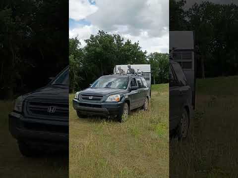
Accessible via gravel roads marked with numbered forest service signs like 1212, 1215, and 1217, this dispersed camping area spans the rolling prairie of North Dakota's largest remaining tallgrass ecosystem. Campers can set up anywhere within the grassland boundaries, though vehicle clearance helps navigate the sandy roads that develop ruts during wet conditions. The Forest Service office in Lisbon provides maps and local knowledge for trip planning.
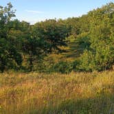
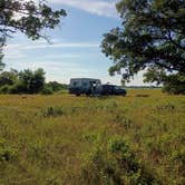
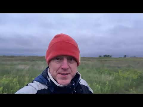
The open landscape supports roaming cattle and diverse prairie plants, with established vault toilets and fire rings scattered throughout the area. Visitors report hearing coyotes at night and encountering minimal crowds, especially on weekdays. The North Country Trail crosses the grasslands, connecting hikers to destinations like Mirror Pond and Jorgens Hollow. Matthew L. advises checking maps carefully since "the marker is not open land that is private."
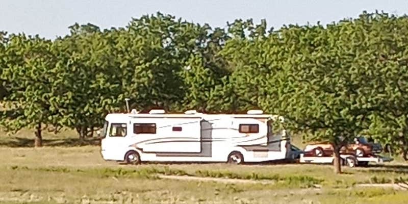
Road access requires attention to conditions, with reviewers successfully navigating everything from lifted SUVs to 40-foot RVs with trailers, though caution applies to larger rigs. Cell service reaches most areas, and campfires are permitted. The wide-open terrain offers expansive night skies for stargazing, while Mirror Pond provides a hiking destination about five miles from some entry points.
Description
Sheyenne National Grassland is located in southeastern North Dakota, comprising 70,180 acres (28,400 ha) of public land amid 64,769 acres (26,211 ha) of privately owned land. It is characterized by sandy soils, originally deposited as the delta of an ancient river as it emptied into glacial Lake Agassiz. Since that time, wind and rain have shaped the topography into a unique landscape ranging from flat deltaic plains to choppy sand dunes. It is the only National Grassland in the tallgrass prairie region of the United States. The grassland provides habitat for greater prairie chickens in North Dakota as well as several other sensitive species such as the Dakota skipper and Regal Fritillary. It also contains one of largest populations of the western prairie fringed orchid, which has been placed on the list of Threatened Species by the U.S. Fish and Wildlife Service. Other unique plants found on the grassland include other orchids and ferns. The grassland is managed with prescribed grazing, fire, and mowing. These programs are all managed in cooperation with the local grazing association. Treatment of noxious weeds is also very important and is accomplished through herbicide application, biocontrol, and sheep grazing. Recreation opportunities abound throughout the grassland. Visitors can enjoy activities such as hiking, hunting, camping, horseback riding, photography, and backpacking. See Activities section below for detailed descriptions. Some points of interest to visit while on the grassland include: Iron Springs creek, the Horseshoe Hills, Old Bridges, Owego Pioneer Cemetery, and an Old Fire Lookout Tower. The grassland is located in eastern Ransom and western Richland counties, about 12 miles (19km) east of the city of Lisbon. The grassland is administered by the Forest Service as part of the Dakota Prairie Grasslands from the Supervisor’s office in Bismarck, North Dakota. The local Sheyenne Ranger District office is located in Lisbon, North Dakota. Other places of interest in the vicinity of Sheyenne National Grassland include: The town of McLeod, North Dakota. Visitors can learn about the area’s history, including some of the Grassland’s history at the McLeod Museum Complex. The museum complex includes a Presbyterian Church built in 1909, the Soo Line Depot, a homestead house built in the late 1800s, and a one-room school house which operated from 1904-2002. McLeod is located three miles south of Highway 27 on County Road 54 or 149th Avenue SE. The Nature Conservancy operates Brown Ranchthrough their Sheyenne Delta office located just a few miles southwest of McLeod, ND. Some of this land is managed in conjunction with the Sheyenne National Grassland. Explore the Seven Wonders of Ransom County.
RV Road Trip Guides

Map & DirectionsSheyenne National Grassland is located in North Dakota near McLeod
Coordinates
46.44160008 N
97.32200018 W
Connectivity
 T-MobileNo CoverageVerified by 10 usersLast on 6/24/26
 VerizonLTESome CoverageVerified by 2 usersLast on 7/23/26
 AT&T5GGood Coverage
Connectivity
- T-MobileNo CoverageVerified by 10 usersLast on 6/24/26
- VerizonLTESome CoverageVerified by 2 usersLast on 7/23/26
- AT&T5GGood Coverage
Access
- Drive-InPark next to your site
- Walk-InPark in a lot, walk to your site.
Site Types
- Dispersed
Features
For Campers
- Phone Service
- Showers
- Toilets
- Alcohol
- Pets
- Fires
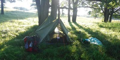
DISPERSED CAMPING
Enjoy dispersed camping on government land and leave no trace. Pack in and pack out. No (or limited) services at this camping area. Permit may be required.
PERMIT might be REQUIRED
We curate permit requirements across the US for our PRO members. Try PRO to see if Sheyenne National Grassland needs a permit.
Drive Time
- 47 min from Fargo, ND
- 1 hr 47 min from Grand Forks, ND
- 2 hrs 43 min from Bismarck, ND
- 2 hrs 45 min from St. Cloud, MN