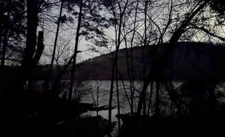
Uwharrie National Forest provides extensive free camping near Raeford, North Carolina, with primitive sites scattered throughout its 51,000 acres. The forest's elevation ranges from 350 to 1,000 feet, creating moderate terrain with mixed pine and hardwood forests. Winter temperatures typically remain above freezing, making this area suitable for year-round dispersed camping when other mountain regions become inaccessible.
What to do
Off-road adventures: The forest offers dedicated OHV (off-highway vehicle) trails for Jeeps and other off-road vehicles, accessible from dispersed camping areas. "We took our Jeep on the OHV trails and had a blast. There are several places you can take a canoe or kayak on and the scenery on the lake was beautiful as well," notes Erica from Uwharrie National Forest.
Kayaking and fishing: Access the Little River via boat ramp for water-based activities and riverside camping. "Me and my friends would always float our kayaks down the river to a place we called 'Bird Dog' and camp for the night. If you are looking for a place that has very little traffic, this is the place you want to go," writes Wyatt M.
Wildlife observation: The forest supports diverse wildlife and seasonal hunting. "This area was a place that I went often to deer hunt in the fall. I have never came across another camper/hunter at this location. It is a good location if you are looking for an area that is away from camp grounds and heavy traffic," reports a regular visitor to Anderson Creek County Park- Dispersed Camping.
What campers like
Solitude and privacy: Campers consistently mention the seclusion available at dispersed sites. "We stayed in 2 different dispersed primitive sites and they were both great. Plenty of space and trees and privacy," writes a visitor to Uwharrie National Forest.
Backpacking opportunities: The trail system allows multi-day trips with regular water access. "The streams, provided one has filtration or iodine tablets, provide ample sources of drinking water," notes Sean R., who appreciates the 20-mile Uwharrie Trail for backpacking.
Established camping spots: Most dispersed areas feature basic site infrastructure. "Most sites have rock fire pits and room to set up. Love it here. Plenty of OHV trails as well," says Zachary S., who recommends arriving early to secure preferred spots.
What you should know
Seasonal considerations: Hunting seasons significantly impact camping safety and experience. "Make sure to wear bright colors during hunting season because there are a ton of people out deer hunting in this area," advises Brandon D.
Trail conditions: Trail quality varies seasonally and maintenance can be inconsistent. "The trailhead is kind of hard to follow sometimes, sections of the trail are prone to flooding and creek crossings can become difficult following heavy rains," warns a hiker who frequently visits Uwharrie National Forest.
Vehicle access limitations: Many sites require appropriate vehicles or hiking. "This is a great area for dispersed campers with 4WD or AWD. It's pretty popular so head out early to secure your spot," recommends Zachary S.
Pack out all trash: Visitor stewardship varies across sites. "Some of the sites may have a little trash left from the last user, so please try to leave it cleaner than you came to," notes a regular camper.
Tips for camping with families
Select shorter hiking routes: For families with children, consider accessibility when choosing dispersed sites. "I hiked along the creek at what was marked as campsite 1 along the Uwharrie Trail. It was a short hike and easy to moderate," shares Myron C., noting that sites closer to roads may have some traffic noise.
Bring sufficient water: No potable water exists at dispersed sites. "Obviously, there are no facilities, so I had to take my own water and a water filter. Since I was close to a stream, I had to take care of personal business about two hundred feet farther away," explains a camper at Uwharrie National Forest.
Consider recreation options: The forest offers multiple activities to keep families engaged. "There are hiking, horse, OHV, dirt bike, ATV, and mountain bike trails," notes Bart, making this no-cost camping near Raeford appropriate for families with diverse interests.
Tips from RVers
Rustic parking for small campers: Pop-up campers and smaller RVs can access some forest roads. "We used our pop-up with a generator in rustic locations," reports Bart, though he cautions most dispersed areas lack formal parking pads.
Know your RV limitations: Traditional RVs will struggle with forest access. "This is not an RV camping area, at least not the dispersed camping area. You cannot drive up to the campsites. There are no electric, water, or sewer hookups," explains Myron C., recommending developed campgrounds instead for larger vehicles seeking free camping opportunities near Raeford.