Dispersed camping near Mooresville, North Carolina offers primitive outdoor experiences within a 50-mile radius. The region features several free camping options throughout the Uwharrie National Forest and surrounding areas. Most dispersed sites in this area sit at elevations between 500-1000 feet, creating moderate temperature variations between day and night, particularly in spring and fall when temperature swings of 20-30 degrees are common.
What to do
Trail exploration: Robbins Branch Trail features multiple unmarked paths branching from the main route, allowing hikers to discover secluded camping spots. The area requires basic navigation skills as trail markings are minimal.
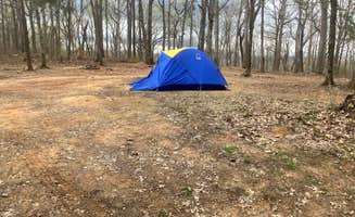
Wildlife observation: Dispersed Camping off Falls Dam Trail provides opportunities to spot native wildlife including white-tailed deer, wild turkeys, and numerous bird species. One camper noted: "Had a good time camping and enjoyed the song of wind and birds."
Stargazing: Birkhead Mountain Wilderness Area Dispersed offers excellent night sky viewing due to minimal light pollution. The higher elevation and clearing areas create unobstructed views of constellations during clear nights.
What campers like
Natural isolation: The dispersed camping areas near Mooresville provide significant distance between camping spots, often with 100+ yards of separation. Most sites require at least a short walk from parking areas.
Creek access: Multiple small waterways cross through the Uwharrie National Forest, providing water sources for filtering. Campers appreciate the practical resource and ambient sound.
Minimal regulations: Free camping near Mooresville follows standard dispersed camping rules without requiring permits or reservations. This allows for spontaneous weekend trips with flexible scheduling.
What you should know
Water planning: No potable water exists at any dispersed sites near Mooresville. Campers must either pack in all water needs (minimum 2 gallons per person per day recommended) or bring reliable filtration systems for creek water.
Navigation challenges: Cellular reception ranges from weak to nonexistent throughout most dispersed camping areas. Physical maps or downloaded offline navigation apps are essential as GPS reliability diminishes in certain valleys.
Weather considerations: The region experiences rapid weather changes, particularly during spring and fall. Afternoon thunderstorms develop quickly during summer months, sometimes with minimal warning due to the rolling terrain.
Tips for camping with families
Site selection: Choose camping spots at least 200 feet from water sources but not more than a quarter-mile from your vehicle when with children. This balances safety with manageable hiking distances.
Wildlife education: The diverse ecosystem near Mooresville provides excellent opportunities to teach children about local plant and animal species. Bringing field guides specific to North Carolina improves identification skills.
Emergency planning: Always establish clear boundaries and meeting points when camping with children. The unmarked nature of most dispersed sites requires explicit instruction about staying within visual range of the campsite.
Tips from RVers
Access limitations: Most dispersed camping areas near Mooresville restrict vehicle size due to narrow, unpaved access roads. RVs longer than 25 feet generally cannot navigate the turns and terrain safely.
Ground conditions: Seasonal changes significantly impact ground firmness. Spring camping often encounters muddy conditions that can strand vehicles, while summer and fall typically provide more stable surfaces.
Supply preparation: With no services available, RVers must arrive fully stocked with water, propane, and all necessary supplies. The nearest resupply points average 15-20 miles from most camping areas.



 Scout
Scout


