Top Free Dispersed Camping near Newcomb, NM
Want to go dispersed camping near Newcomb? The Dyrt can help you find the best dispersed campsites for your next trip. You're sure to find the perfect dispersed campsite for your New Mexico excursion.
Bisti Trailhead To reach the Bisti Trailhead, Drive NM 371 just under 36 miles south of Farmington (from the San Juan River crossing) or just under 45 miles north of Crownpoint (from the intersection of 371 and Navajo Service Route 9), and turn east on Road 7297 (a gravel road). Drive Road 7297 for approximately 2 miles to a T-intersection and turn left. Drive just under one mile to the Bisti Trailhead, which is just south of a broad wash on the east side of the road. There is another, smaller parking area 1/4 mile further north.
De-Na-Zin Trailhead To reach the De-Na-Zin Trailhead by the best route drive US 550, 12 miles south of the Speedway Gas Station south of Bloomfield or 4 miles north of NM 57 and turn west onto County Road 7500. Drive approximately 11 1/4 miles to the De-Na-Zin Trailhead (on the right side of the road). A trail leads from the parking area approximately 3/4 mile to the De-Na-Zin Wash. An alternative route that includes a section of rougher dirt roads that are more prone to weather related hazards is to drive NM 371 approximately 43 3/4 miles south of Farmington (from the San Juan River crossing) or approximately 37 1/4 miles north of Crownpoint (from the intersection of 371 and Navajo Service Route 9), and turn east on County Road 7500. Drive approximately 13 1/4 miles on Road 7500 to the De-Na-Zin parking area (on the left side of the road).”
Dispersed camping is permitted within the Glade Run Recreation Area. Both developed sites and dispersed camping require a permit within Glade Run Recreation Area.
OHV trails are all over. I am not a OHV guy, but looks to be OHV haven. Flat and hilly areas for lots of fun. I’d stay away during heavy rain.
We had the goal of exploring New Mexico back country and Bisti, which we did! The Dyrt directions to the trailhead here are perfect. There were a few folks camping at the parking lot and there is a relatively clean pit toilet there though bring TP. We drove past the lot and got over a ditch no problem with our Tacoma. Past the second lot there is dispersed camping. We picked a great spot on the left. Nearby our spot 100 yards were very cool rock formations. We hiked in the badlands and found some neat formations and petrified wood though nothing like the beautiful photos published online. It was still worth it for the unique experience. We did a 6 mile out/back hike with 2 dogs. Flat but hot and windy at times. Some of the wind got intense at our camp spot. All in all this is a worthwhile experience if you like getting off the beaten path and exploring something different. We drove from here to Alien Throne. GPS was spotty but got us there and we had on/off service in Bisti.
Bisti was magical and I’m so glad I got to experience before we move out of New Mexico. We got to do a bunch of exploring and then headed straight off the “trail” to make dinner in our camper.
We stayed here on a Thursday night and shared the parking lot with a handful of other campers. The bathrooms were clean and well stocked with TP.
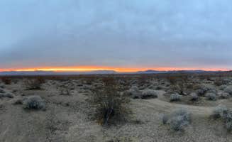
We were not able to have a campfire but did witness a magical sunset. This area is such a gem!
there is no trash collection out here. Please pack it out!
We are full-timers in a 36 ft Class A with a Cherokee Trailhawk tow. We were here for a few days in mid April. The gravel road is rougher than it appears to the eye. We camped in the large area on the West side of the road a short distance from the trailhead. It was very windy the day we arrived, with wind speeds of 28 mph and gusts of 45 mph.
AT&T coverage showed 1-2 Bars of LTE service, but I was unable to get a connection without a booster. We had an unobstructed view of the sky and so we were able to receive all 3 SW Dish satellites and Starlink had up to 12 MB/s. We didn’t try to load any OTA channels.
We are full-timers in a 36 ft Class A with a Cherokee Trailhawk tow. We were here for a few days in mid April. The roads in can be pretty rough in places, but not too awful bad in others for dirt and gravel road anyway. I wouldn’t attempt it in anything other than a 4WD if the area were to get any significant rain, as the ruts in the road were pretty significant. There are basically two ways to get here, one is at Nageezi on CR 7800 to NM 57(aka ISR 451 on some maps) from US 550, which is the way we came in. The 1st 4 of the 15 miles are paved, the rest is gravel and/or dirt. I was able to go between 20 and 30 mph most of the way, except in some really rough sections and at a couple of the cow guards. The other way, that BLM suggests on their website https://www.blm.gov/visit/ah-shi-sle-pah-wilderness, is to just take NM 57 off of US 550 several miles north of Nageezi, which we tried on the way out. Parts were better, but most of it was just as bad and a longer drive than CR 7800. The last 5 miles were“paved” or used to be and is some of the worst parts. The entrance to the trailhead is a fairly tight turn from the east, narrow, somewhat U-shaped and sporty(see photo looking NE, which really doesn’t do it justice), but after dropping our tow, we managed to get our 36’ MH up and in on the second attempt. Arriving from the east, I would suggest trying to turn around as we did and entering the trailhead from the west. To get to the wash and hoodoos it’s about a 0.6 mile walk from the trailhead. The trailhead area is nothing special, but the Wilderness Area, wash and hoodoos are really cool.
AT&T coverage was actually quite good, with 1-2 Bars of 5G service and speeds of up to 9 MB/s without a booster. We had an unobstructed view of the sky and so we were able to receive all 3 SW Dish satellites and Starlink had up to 10 MB/s. We didn’t try to load any OTA channels.
Can park overnight at trailhead when planning a day hike. Don't miss the cracked eggs!
Pulled into this site shortly after midnight. There's a bathroom near the parking area where there were half a dozen campers. On the way in there were a handful more. Looks flat and empty at night. You can see all the neat formations in the day. It was pretty cold in the mid-march but our propane heater got us through the night. It was 38 the next day but felt nice in the sun.
This is a free campground with bathrooms near by. There is also some more dispersed camping in the BLM areas, but 4x4 is recommended to reach them. There is no visitors office and the landmarks/features are not marked on the trail map.
This is a great place to stay.
I was expecting a visitor office, but went in too early before dawn and didn’t see one. We entered and kept walking: realized we were way too off from the good spots. Yet, good hike and I hope I get to be there in the right spot the next time!
This free campground positioned us well to beat the heat and hike through the badlands first thing in the morning! Pit toilets available next to the parking lot as well as a pavilion area with tables.
A handful of dispersed sites were available once in the BLM boundaries as well as plenty of space in the trailhead parking lot to spend the night.
The hike to the various features of the badlands are not marked, however good GPS signal allowed us to plug in coordinates to follow during the hike. Land forms looked like they should be from a different planet!
I was pretty confused getting here, google and Apple Maps seemed to struggle with me coming from Ah-Shi-Sle-Pah trailhead. It kept trying to take me down a road covered in cattle that led to de-na-zin parking lot. Finally found my way here by using online instructions from the blm website instead of using the pin. Once there it was really nice though. Plenty of stars and a bathroom to use, which is always appreciated at a free spot.
This place is haunting and beautiful. Very dry, very much a sun-baked desert. The soil at the top of the bluffs was oddly soft and puffy, and I’m honestly not sure how they haven’t been destroyed by foot traffic and erosion. That aside, there isn’t a good path to all the various landmarks and monuments so I highly recommend getting a hiking map or downloading one before you get to the site. Other reviewers said they had service but once we left the paved highway we didn’t have any, and since I hadn’t downloaded the map, I wasn’t able to find the big hoodoo that I wanted to see.
There is a large flat area that is great for tents, and many of the campers who parked there went further into the actual badlands to camp on the hills.
The covered picnic area has three tables and a grill.
An interesting feature is a tiny stream of clear water that meanders around the picnic area, but leaves all the plants it touches covered in a crusty white stuff.
This campground is more like a parking lot with extended canyons for camping. You can set up shop right on the outskirts of the parking lot on the flat ground or in the nearby canyons or turnoffs on the road to get the the parking lot.
There is a pit toilet located there that is really well taken care of. There is also a picnic shelter for those super hot days when you are in need of shade.
You can also backpack across the wilderness area as well. You will need to check the weather and supply extra water since there is not much shade and no water sources.
For Hiking: We used Gaia GPS to pinpoint our coordinates to the "cool" spots and ended up getting detoured due to really cool formations all over the place. We were like moths to flames. It is such a cool spot and LOTS to see!
Gear review: Banner and Oak Freedom to Explore hat
Occasionally as a Ranger we get the opportunity to test out some gear from time to time. I got this hat for my partner and he wanted to test it out for a while before we reviewed it so we thought this was the perfect opportunity. You can find the hat here: https://bannerandoak.com/collections/hats/products/horizon-olive
This hat is extremely fashionable and comfortable. The color is a perfect Olive with black writing that says "Freedom To Explore". There is a mesh lining on the inner front of the hat that helps with sweat and heat. It also keeps you from getting a line across your forehead when removing the hat. He wore it all day and didn't take it off once for it being too loose or too tight. Even after a week fo wearing it everyday it didn't get that gross sweat smell that normal hats get.
The back of the hat has a buckle closure instead of snaps so it lays nice on the back of your head and doesn't dig in.
Camping near Newcomb, New Mexico, offers a unique blend of stunning landscapes and outdoor adventures. Whether you're looking for a quiet spot to unwind or a base for exploring the area's natural wonders, there are plenty of options to consider.
Camping near Newcomb, New Mexico, has something for everyone, from families to solo adventurers. Just remember to plan ahead and enjoy the beautiful surroundings!
Frequently Asked Questions
Which is the most popular dispersed campsite near Newcomb, NM?
According to TheDyrt.com, the most popular dispersed campground near Newcomb, NM is Bisti/De-Na-Zin Wilderness | Dispersed Camping with a 4.5-star rating from 2 reviews.
What is the best site to find dispersed camping near Newcomb, NM?
TheDyrt.com has all 4 dispersed camping locations near Newcomb, NM, with real photos and reviews from campers.