SUMMARY PRESENTED BY
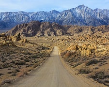
Part of Humboldt National Forest, Camp Draw Trailhead operates as a dispersed camping area managed by the US Forest Service. The site serves as a launch point for the Jarbidge Wilderness Area, with vault toilets and packed dirt parking areas but no water source available. Snow can persist well into June at this elevation, making weather monitoring essential for trip planning. The nearest resupply point sits back in Jarbidge, requiring campers to pack all water and supplies for their stay. No formal operating schedule exists due to the dispersed nature of the site. Other campsites near Humboldt National Forest provide additional options for those exploring the region.
RV Road Trip Guides

Map & DirectionsCamp Draw Trailhead is located in Nevada near Owyhee
Coordinates
41.75440084 N
115.4496 W
Connectivity
 T-MobileNo Coverage
- VerizonNo Coverage
- AT&TNo Coverage
Connectivity
- T-MobileNo Coverage
- VerizonNo Coverage
- AT&TNo Coverage
Access
Site Types
- Tent Sites
Features
Drive Time
- 4 hrs 23 min from Boise, ID
- 4 hrs 47 min from Twin Falls, ID
- 6 hrs 6 min from Pocatello, ID
- 6 hrs 9 min from Ogden, UT
