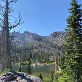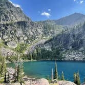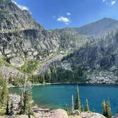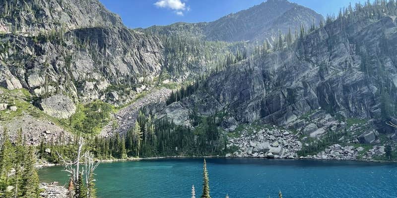
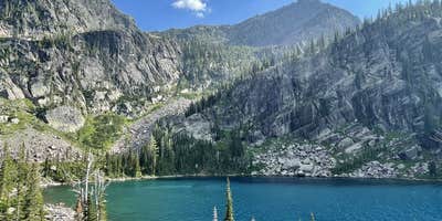
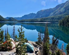
Reaching Turquoise Lake requires roughly six miles of hiking into Flathead National Forest, and the terrain at the lake itself is rugged enough that most flat spots accommodate only a single-person backpacking tent. Larger groups may find usable sites, but expect to walk some distance from your tent to set up a cook area or bear hang. Food storage is essential here: mountain goats are a regular presence. Drinking water is available by filtering from the lake, though hiking in with a supply is a practical precaution. No pets are permitted. Campers exploring campgrounds near Flathead National Forest will find this one well-suited to experienced backpackers comfortable with dispersed, high-country conditions. June visitors should prepare for insects.
Description
Camping can be limited due to the rugged terrain. If camping, please use Leave No Trace ethics, as this is an extremely fragile environment and a pristine area.
Backpacking is the perfect way to visit some very beautiful and unique areas in remote locations such as in designated wilderness. Please remember to bring adequate gear and supplies, and remember to check the weather before you strike out on the trail. Trail condition reports area start, but remember to call the ranger district for the area in which you will be traveling before you go for any specific information and current conditions.
This trail is typically clear and snow-free by early to mid-July
Follow Trail 690 as though heading to Glacier Lake through the mature forest along Glacier Creek. In about one mile the trail will approach the junction of Trail 690 and Trail 742, stay right on Trail 690 and start heading up the numerous, but well-graded switchbacks. While on the switchbacks don’t forget to look down onto Glacier Lake and into the basin in select locations. Trail 690 takes off to the hikers’ right towards Crescent Lake, while trail 708 will continue contouring the hillside, crossing rocky slopes and offering fantastic views of the area ahead. After climbing a couple more switchbacks, the forest becomes sparse and opens up into an alpine environment. Keep a close eye out for mountain goats on this trail. The trail then narrows and descends along rocky ledges down to Lagoon Lake. Due to rocky conditions, stock use in not recommended past Lagoon Lake From Lagoon Lake, an unmaintained trail skirts around, over, and down rock ledges to the roaring outlet of Turquoise Lake.
RV Road Trip Guides

Map & DirectionsTurquoise Lake Backcountry Site is located in Montana near St. Ignatius
 Public Campground
Directions
From Hwy 83, south of mile marker 38, turn west onto Kraft Creek Rd also called Forest Service Road #561, the trailhead is about 11.5 miles at the end of the road. Turquoise Lake trail #708 starts 3 miles up the Glacier Creek trail #690. It is 6 miles from the trailhead to Turquoise Lake.
Coordinates
47.35443598 N
113.84482036 W
Connectivity
 T-MobileNo Coverage
- VerizonNo Coverage
- AT&TNo Coverage
Connectivity
- T-MobileNo Coverage
- VerizonNo Coverage
- AT&TNo Coverage
Access
- Walk-InPark in a lot, walk to your site.
- Hike-InBackcountry sites.
Site Types
- Tent Sites
- Dispersed
Features
For Campers
- Drinking Water
- Fires
Drive Time
- 2 hrs 13 min from Missoula, MT
- 2 hrs 59 min from Helena, MT
- 3 hrs 30 min from Great Falls, MT
- 4 hrs 39 min from Coeur d'Alene, ID