Public Campground
Bear Creek Campground Mt — Beaverhead Deerlodge National Forest
Bear Creek Campground is located in the Beaverhead-Deerlodge National Forest near Ennis, MT. The terrain consists of forested areas with nearby creeks and mountain views. Campers can explore Yellowstone National Park and the Madison River, both accessible within an hour, while experiencing temperatures ranging from 30°F in winter to 80°F in summer.
Description
Overview
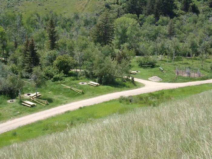
Bear Creek Campground is a First Come - First Served facility located at the base of the western slope of the Madison Range in southwest Montana. It's part of an administrative site that also includes the Bear Creek and Bear Creek Bunkhouse rental cabins and a trailhead for entry to the Lee Metcalf Wilderness Area. The small campground features 12 campsites, 6 on each side of the creek. The six sites north of the creek include facilities for horses/stock, while those south of the creek are non-horse use only. This is the only campground on the west side of the Madison mountain range so it can be expected to be crowded and busy during hunting season. There is very little firewood available anywhere near the campground.
Recreation
Hiking, horseback riding and hunting are very popular activities by visitors to this campground and parking may be difficult to find during peak season. The Middle Fork and Trail Fork trailhead is located only steps away. Because the trails lead to designated Wilderness, no motorized or mechanized use is allowed on the trails. The trailhead is the starting point for those climbing Sphinx Mountain. From December 2 until noon of May 15, the Wildlife Management Area just north of the campground is closed to all entry except to those who stay strictly on the trail and are only passing through to Forest lands. It is open for recreational use the remainder of the year.
Facilities
The campground will be undergoing improvement installations in the spring/early summer of 2023. Each campsite will have a parking site, picnic table and fire ring. There are two centrally located water hydrants, with water usually being available fro mid-May through September and a centrally located bear box for food storage. There are two SST outhouses, one on each side of the creek. Campsites 7 - 12, on the north side of the creek, are equipped with hitchrails and corrals for horses. Horses are not permitted at Campsites 1 - 6. Additional corrals are planned to be installed at the trailhead but there may not be a corral guaranteed for each campsite.
Natural Features
At the base of the Madison mountain range, the campground is situated in a draw between hills on the edge of the National Forest. The Lee Metcalf Wilderness is immediately to the east and a State wildlife management area to the north. The trailhead, at the site, provides access to the Middle Fork and Trail Fork trails, as well as access to ascend Sphinx Mountain, a prominant peak in the range. Most campsites are shaded by Douglas fir and aspen trees.
Nearby Attractions
The Lee Metcalf Wilderness is adjacent to the campground. The west entrance to Yellowstone National Park is about 70 miles to the southeast. Lewis and Clark State Caverns is about 60 miles to the north.
Contact Info
This location is unstaffed. To speak with our main office for general information, please call: (406) 682-4253.
Fee Info
Scan and pay is available for credit card users with the recreation.gov app. Otherwise, payment is by cash or check at the fee tube, with the exact dollar amount. No change is available.
Location
Bear Creek Campground Mt — Beaverhead Deerlodge National Forest is located in Montana
Directions
From Ennis MT, travel south on US Highway 287 eleven miles to Cameron. Turn left onto Bear Creek Road and travel on pavement for 3 miles, turn right and pavement ends. Travel 1.5 miles and turn left. Travel one mile and turn right. Travel just under one mile and turn left at the old school house. Finally travel 2.3 miles to the campground. All turns have Bear Creek signs and, along the last 2.3 miles, landowner signs indicate private roads. Coming from the south, follow US Highway 287 to Cameron and follow previous directions from there.
Address
Madison Ranger District
5 Forest Service Road
Ennis, MT 59729
Coordinates
45.11003 N
110.59965 W
Connectivity
- T-MobileNo Coverage
- VerizonNo Coverage
- AT&TNo Coverage
Connectivity
- T-MobileNo Coverage
- VerizonNo Coverage
- AT&TNo Coverage
Access
Site Types
- Tent Sites
- RV Sites
Features
For Campers
- Pets
- Fires
For Vehicles
- Water Hookups
Drive Time
- 1 hr 46 min from Bozeman, MT
- 3 hrs 6 min from Billings, MT
- 3 hrs 10 min from Helena, MT
- 5 hrs from Idaho Falls, ID


