Managed by the Bureau of Land Management, this established campground operates from May through October in open terrain alongside a creek. The BLM setting provides free camping with basic amenities typical of federal land management. Road access details and specific site configurations aren't documented in available reviews.
Creek proximity offers water access for fishing and cooling off during warmer months. The campground sits within the broader camping near BLM Land — Pocatello Field Office system. Sage Hen Flats Campground lies 2 miles southeast for campers comparing nearby options.
Description
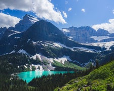
3 primitive campsites and 3 picnic areas on the Blackfoot River. Take out for those floating from the dam, or put-in for those floating to Trail Creek or to Cedar Creek. This section of the river is Class II, and makes for easy floating or tubing, when the water is low. Nesting golden eagles, prairie falcons, red-tailed hawks, and great horned owls inhabit the cliffs of this steep canyon. Outside the canyon, upland game birds live in the sage grasslands. Pets must be on leash at all times, 14 day camping limit within a 28 day period, No ATV/UTV riding allowed in campground, Fire in fire rings only, No garbage collection- pack it in / pack it out, No Shooting of fire arms, No Fire Works.
RV Road Trip Guides

Map & DirectionsCutthroat Trout Campground is located in Idaho near Bancroft
Directions
From Soda Springs, go north on ID 34 11 miles, west on China Cap Road 4 miles, northwest on Government Dam Road 14 miles, then 14 miles north on Corral Creek Road, Lincoln Creek Road, and Trail Creek Road. A short spur crosses the river to the campground
Coordinates
43.03934898 N
111.85600375 W
Connectivity
 T-MobileNo Coverage
- VerizonNo Coverage
- AT&TNo Coverage
Connectivity
- T-MobileNo Coverage
- VerizonNo Coverage
- AT&TNo Coverage
Access
Site Types
- Tent Sites
Features
Drive Time
- 2 hrs 6 min from Pocatello, ID
- 2 hrs 18 min from Idaho Falls, ID
- 3 hrs 11 min from Logan, UT
- 3 hrs 39 min from Ogden, UT

