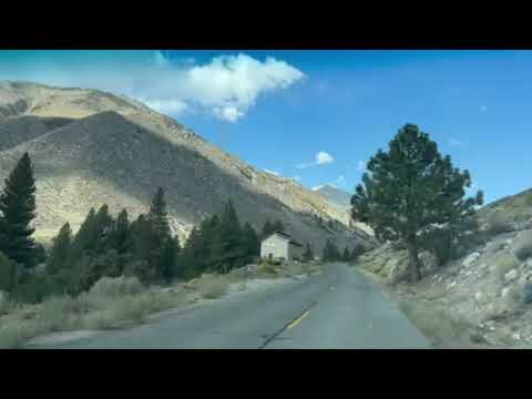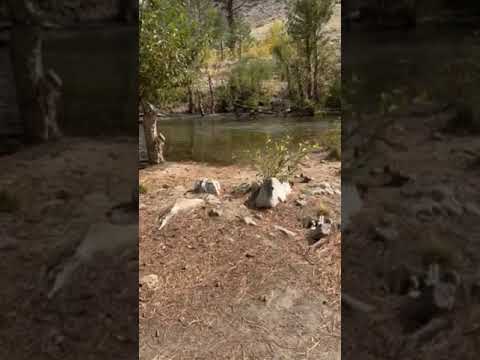
Creek-side camping at 7,700 feet elevation draws visitors to Upper Sage Flat Campground, where Big Pine Creek flows directly past several campsites. The campground sits at the end of a steep, winding seven-mile road that climbs 3,500 feet from the town of Big Pine, creating a natural barrier that keeps crowds manageable.
Sites divide into two distinct categories. The creek-side sites (particularly 14-19) provide direct water access and tree cover, while roadside sites offer minimal shade and sit on exposed dirt and gravel pads. Edward R. found sites 2 and 4 were "real nice and next to the creek." A single restroom serves the entire campground, positioned centrally for reasonable access from most sites.
The access road demands attention, especially for RV drivers. The narrow, guardrail-free route challenges larger rigs, with a 35-foot maximum length enforced. Several reviewers mention white-knuckling the drive and burning brakes on the descent. Sites vary significantly in their ability to accommodate RVs, making careful reservation planning essential.
A bridge crosses the creek, connecting to the Big Pine Creek Trail system. Campers exploring the area can find campgrounds around Big Pine for additional options. The campground operates seasonally from late April through October, with a camp host managing day-to-day operations and selling firewood on-site.
Description
Overview
Take the family to Upper Sage for a pleasant camping trip along the banks of Big Pine Creek. Here, visitors can experience the beauty of the creek that runs along the base of a narrow canyon. Visitors can swim or fish, in the creek that is stocked annually with trout, or head to a nearby lake for power boating.
Recreation
Rainbow, brown, brook and alpers trout swim in the stream, enticing anglers. Hikers are fans of the Big Pine Creek Trail, a 1.5-mile footpath that provides access to the John Muir Wilderness trails.
Facilities
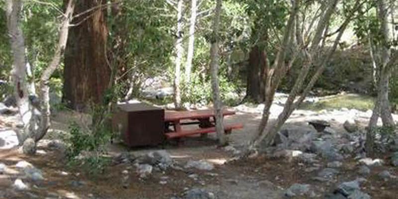
Parking aprons are paved and most are 40 feet long. Amenities include flush toilets, drinking water, picnic tables and campfire rings.
Natural Features
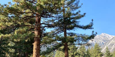
The campground is sprawled out along Big Pine Creek beneath shady Jeffrey pines and cottonwoods, just 9 miles west of the town of Big Pine. Inyo National Forest is home to many natural wonders, including Mt. Whitney, Mono Lake, Mammoth Lakes Basin, and the Ancient Bristlecone Pine Forest atop the White Mountains. Bristlecone pines rank as the oldest trees in the world and have achieved immense scientific and cultural importance.
Contact Info
For facility specific information, please call (760) 872-4552.
Nearby Attractions
Head to the neighboring John Muir Wilderness for incredible views of Palisades Glacier, the southern-most glacier in the country. Nearby Tinemaha Reservoir provides additional fishing opportunities.
RV Road Trip Guides


Map & DirectionsUpper Sage Flat Campground is located in California near Big Pine
Directions
In Big Pine, on US Highway 395, turn west at the yellow flashing traffic light onto Crocker Street (Big Canyon Road). Continue on this road for 9 miles to campground, on your left.
Address
INYO
CA
Coordinates
37.1258333 N
118.4338889 W
Connectivity
 T-MobileNo CoverageVerified by 1 userLast on 6/25/26
- VerizonNo Coverage
- AT&TNo Coverage
Connectivity
- T-MobileNo CoverageVerified by 1 userLast on 6/25/26
- VerizonNo Coverage
- AT&TNo Coverage
Access
- Drive-InPark next to your site
- Walk-InPark in a lot, walk to your site.
Site Types
- Tent Sites
- RV Sites
- Standard (Tent/RV)
Features
For Campers
- Trash
- Firewood Available
- Reservable
- Drinking Water
- Toilets
- Alcohol
- Pets
For Vehicles
- Big Rig Friendly
Drive Time
- 4 hrs 31 min from Visalia, CA
- 4 hrs 39 min from Hanford, CA
- 4 hrs 43 min from Merced, CA
- 5 hrs 1 min from Fresno, CA