The Whiskeytown-Shasta-Trinity National Recreation Area encompasses Oak Bottom Tent Campground, a walk-in facility that requires campers to haul gear from parking areas down to individual sites. This National Park Service campground operates year-round and accommodates tents only, with some sites offering direct shoreline access to Whiskeytown Lake.
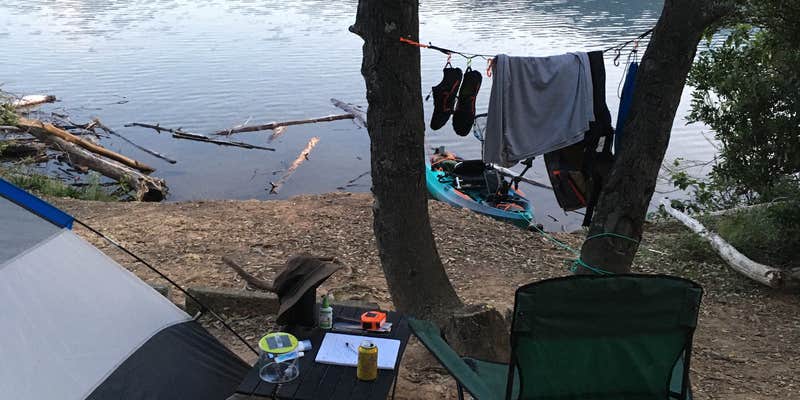
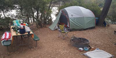
Site spacing varies considerably throughout the campground. Dan G. notes that "the non shoreline sites are pretty close together" and suggests the area "becomes a madhouse in the summertime." Several waterfront sites provide private lake access, though campers report uneven, sloped terrain that requires strategic tent placement. Sites include picnic tables, fire rings, and bear boxes, with most amenities positioned in full sun exposure.
The campground features restrooms, showers, and a dump station, plus a small store that sells firewood and supplies. Highway 299 runs nearby, contributing some road noise during overnight hours. Water levels fluctuate seasonally, affecting shoreline access for activities like kayaking and paddleboarding. "Once we were in, it was perfect," describes Chloe T. regarding the lake conditions.
Wildlife sightings include foxes and various waterfowl around the lake area. The facility works best for tent campers who prioritize water access and don't mind carrying gear to their sites. Those seeking additional options can explore campgrounds near Whiskeytown.
Description
Oak Bottom Campground is the only campground within the boundaries of Whiskeytown NRA that are located on the shores of Whiskeytown Lake. The campground is operated by a concessionaire and is open year-round. 92 sites available, there is one ADA accessible site. Seasonal coin operated showers are available within walking distance at Oak Bottom Beach.
RV Road Trip Guides


Map & DirectionsOak Bottom Tent Campground is located in California near Whiskeytown
Directions
From jct I-5 & Hwy 299: Go 15 mi NW on Hwy 299.
Address
14412 Kennedy Memorial Drive
French Gulch, CA 96033
Coordinates
40.64920023 N
122.59052475 W
Connectivity
 T-MobileNo Coverage
 VerizonLTESome CoverageVerified by 10 usersLast on 7/23/26
- AT&TLTESome CoverageVerified by 4 usersLast on 7/23/26
Connectivity
- T-MobileNo Coverage
- VerizonLTESome CoverageVerified by 10 usersLast on 7/23/26
- AT&TLTESome CoverageVerified by 4 usersLast on 7/23/26
Access
- Drive-InPark next to your site
- Walk-InPark in a lot, walk to your site.
- Hike-InBackcountry sites.
Site Types
- Tent Sites
- RV Sites
- Standard (Tent/RV)
- Group
Features
For Campers
- Market
- ADA Access
- Trash
- Picnic Table
- Firewood Available
- Phone Service
- Reservable
- Showers
- Drinking Water
- Toilets
- Alcohol
- Pets
- Fires
For Vehicles
- Sanitary Dump
- Pull-Through Sites
- Big Rig Friendly


