Within Whiskeytown-Shasta-Trinity National Recreation Area, Dry Creek Group Campground operates as a National Park Service facility designed for larger camping parties. The campground sits in a forested setting near both Dry Creek and Whiskeytown Lake, though campers should expect rough access conditions on the approach road. Open from April through October, the site accommodates groups at $80 per night and requires advance reservations.
Basic amenities include drinking water, trash service, and designated fire rings, while pets are welcome throughout the campground. The location provides direct access to fishing and kayaking opportunities on nearby waters. For additional options, campers can explore campgrounds around Whiskeytown or visit Brandy Creek less than a mile southeast.
Description
Overview
This tent-only group campground is located on the southern shore of Whiskeytown Lake in Whiskeytown National Recreation Area, 14 miles west of Redding, California and three hours north of Sacramento. The cool, clear waters of Whiskeytown Lake provide endless water activities. The picturesque mountain setting and extensive forested backcountry offer ample opportunities for hiking and biking.
Recreation
During the summer heat, swimming, kayaking, sailing, paddle boarding and water skiing are popular on the 3,200 acre lake. Year round, hiking, mountain biking, horseback riding, gold panning, fishing and picknicking attract visitors. Boats may be launched at nearby Brandy Creek Marina and moored at the campground.
Facilities
There are two spacious tent-only sites available at Dry Creek. Each site contains two large serving tables, numerous picnic tables, small and large charcoal barbecue grills, a cleared fire pit area, bear-proof storage lockers, vault toilets and drinking water.
Natural Features
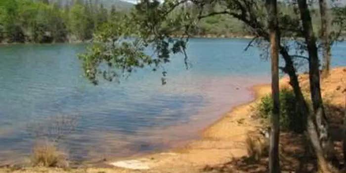
Dry Creek Group Campground affords beautiful lake-side views and a canopy of conifer, oak and maple trees, which offer pleasant shade for campers. Whiskeytown Lake is located where the Klamath Mountains, Cascade and Coast Mountain Ranges, and the Sacramento Valley meet, creating a wide variety of wildlife and landscapes.
Contact Info
For facility specific information, please call (530) 246-1225.
Nearby Attractions
Brandy Creek Beach is located one mile from the campground and features sandy beaches and a large swimming area. From Memorial Day through Labor Day, there are showers, a store with food and supplies and rentals of paddleboards and kayaks. The trailhead for Brandy Creek Falls is located four miles away.
Warning 1 Alert is In Effect
There is 1 alert for this campground. Camp safely!
Warning 1 Alert is In Effect
There is 1 alert for this campground. Camp safely!
Fire restrictions are currently in effect that prohibit charcoal fires, wood-burning camp stoves and campfires, and charcoal grills. Only gas or propane stoves are permitted.
RV Road Trip Guides


Map & DirectionsDry Creek Group Campground is located in California near Whiskeytown
Directions
From Interstate 5 in Redding, CA, take State Route 299 west and drive approximately 10 miles. Turn left onto Kennedy Memorial Drive at the Whiskeytown visitor center. Continue 5.6 miles on Kennedy Memorial Drive until the road ends at the access to Dry Creek Group Campground.
Address
PO Box 188
Whiskeytown, CA 96095188
Coordinates
40.6255556 N
122.5808333 W
Connectivity
 T-Mobile5GGood CoverageVerified by 2 users
 VerizonLTESome CoverageVerified by 8 usersLast on 7/4/26
 AT&T5GExcellent Coverage
Connectivity
- T-Mobile5GGood CoverageVerified by 2 users
- VerizonLTESome CoverageVerified by 8 usersLast on 7/4/26
- AT&T5GExcellent Coverage
Access
- Drive-InPark next to your site
Site Types
- Tent Sites
- Group
Features
For Campers
- Trash
- Reservable
- Drinking Water
- Pets
- Fires

