Accessible via Foresthill Divide Road, this USDA Forest Service campground sits in forested terrain with sections of open ground near both river and lake access points. The established site provides a mix of wooded and cleared areas for different camping preferences.
Campers can explore water activities at nearby lakes or follow river corridors for fishing and hiking opportunities. Finnon Lake Recreation Area offers a developed alternative just over a mile northeast for those wanting more amenities and structured recreation facilities.
Description
The recreation information for the Tahoe National Forest is primarily provided by travel corridor. The main travel corridors are: Interstate 80, Highway 49, Highway 20, Highway 89 (North and South), Foresthill Divide Road, Mosquito Ridge Road, Bowman Road, Marysville Road, and Gold Lakes Road. The Gate at China Wall is OPEN Foresthill Divide Road The Foresthill Divide Road extends from the town of Foresthill east to Robinson Flat Campground and then veers to the north and intersects old Highway 40 near Soda Springs. Much of the north eastern part of this corridor is not paved. Campgrounds, picnic sites, reservoirs, OHV trails, and access trails into the North Fork American Wild and Scenic River are available along the Foresthill Divide Road. Activities such as camping and hiking are listed below for this corridor.
RV Road Trip Guides

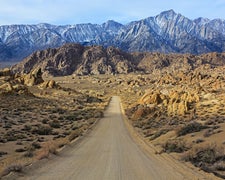
Map & DirectionsForesthill Divide Road is located in California near Placerville
Coordinates
38.80067972 N
120.76202682 W
Connectivity
 T-Mobile5GGood Coverage
 VerizonLTESome Coverage
 AT&T5GExcellent Coverage
Connectivity
- T-Mobile5GGood Coverage
- VerizonLTESome Coverage
- AT&T5GExcellent Coverage
Access
Site Types
- Tent Sites
- RV Sites
- Standard (Tent/RV)
Features
Drive Time
- 1 hr 5 min from Sacramento, CA
- 1 hr 25 min from Yuba City, CA
- 2 hrs from Reno, NV
- 2 hrs 31 min from Carson City, NV

