Shasta National Forest maintains Gumboot Lake Campground as a drive-in site with walk-in access, set in forested and open terrain alongside a lake in the Mount Shasta region. The campground runs from June through October and accommodates RVs up to 16 feet. Amenities are basic: toilets, campfire rings, and pets are welcome. Among the campsites near Shasta National Forest, this one suits campers who want direct lake access without extensive facilities. Gumboot Campground sits immediately adjacent and may offer additional spots if this site is full.
Description
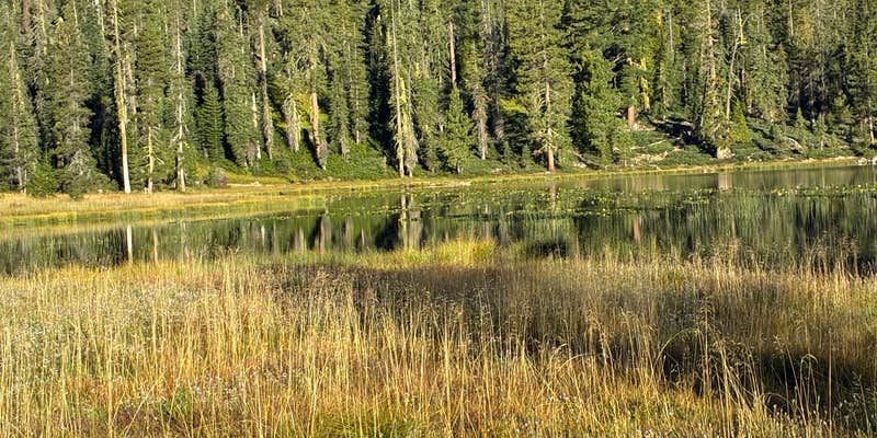
Description : The area on the north side of this shallow alpine lake is open for camping from June to October, depending on snow. There are at least 6 undeveloped sites (no tables) with user-created fire rings and a vault toilet. Bring your own water or purify the lake water. Suitable for tents and mid-size RV's or trailers. No fee. Usually opens around the end of May and closes due to snow by the first of November. Features : This is one of three alpine lakes on the district that can be reached by passenger car. The lake sits in a broad open bowl surrounded by grassy areas and mixed conifer forest. A smaller lake lies only a short distance to the west. Fishing and non-motorized boating are the most popular activities. Hikers can drive 2 miles from the lake to the Gumboot Trailhead to access the Pacific Crest Trail. Views of Mt. Shasta and the Trinity Alps abound. It is an easy 2 ½ miles (one-way) south on the PCT to view and explore the Seven Lakes Basin.
RV Road Trip Guides


Map & DirectionsGumboot Lake Campground is located in California near Castella
Directions
From Mt. Shasta city, head west on Lake Street over the freeway and to the stop sign at Old Stage Road. Turn left (south) and drive 1/4 mile to a fork in the road. Stay to the right at the fork and continue on this road (W.A. Barr Road). In 2 miles, you will cross the dam at Lake Siskiyou. Keep driving around the lake, past the entrance to the Lake Siskyou Camp Resort. Continue on this paved road (Forest Route 26) for approximately 10 miles. The road follows the canyon of the South Fork of the Sacramento River. It is narrow in places so use caution and watch of on coming vehicles. When you reach a fork in the road, take the road to the left 1/2 mile to Gumboot Lake.
Coordinates
41.21300033 N
122.50900028 W
Connectivity
 T-MobileNo Coverage
 VerizonLTESome Coverage
- AT&TNo Coverage
Connectivity
- T-MobileNo Coverage
- VerizonLTESome Coverage
- AT&TNo Coverage
Access
- Drive-InPark next to your site
- Walk-InPark in a lot, walk to your site.
Site Types
- Tent Sites
Features
For Campers
- Toilets
- Pets
- Fires
Drive Time
- 2 hrs 33 min from Redding, CA
- 3 hrs 58 min from Medford, OR
- 4 hrs 24 min from Grants Pass, OR


