Boulder Creek in Plumas National Forest features terrain with dense forests and flowing streams. Temperatures range from lows in the 30s Fahrenheit during winter to highs in the 80s in summer. Nearby, visitors can explore the scenic Lake Almanor and the Lassen Volcanic National Park.
Description
Overview
Boulder Creek Campground is located in the northern Sierra Nevada Mountains, where ancient glaciers gave way to numerous mountain lakes and vast granite peaks. Year round, outdoor enthusiasts are attracted to the area's many streams and lakes, beautiful deep canyons, rich mountain valleys, meadows and lofty peaks.
Recreation
The campground provides educational campfire programs at the amphitheater. It offers several single-family campsites and while none are directly on the lake, a few sites have a limited view of the water. Antelope Lake provides ample opportunities for swimming, canoeing, kayaking, boating and water skiing. A multi-lane boat ramp is available less than two miles from the campground. Anglers enjoy fishing for large and smallmouth bass, bluegill and a variety of trout. The rugged terrain and dusty mountain trails are perfect for mountain biking, but offer limited opportunities for hiking near the campground.
Facilities
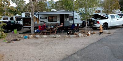
The campground offers several single-family sites open to both tent and RV camping, a short walk from the lake. Several sites are also available on a first-come, first-served basis. Tables and campfire rings are provided, as well as vault toilets and drinking water.
Natural Features
The campground is located near Antelope Lake, which is a small, remote lake with about 15 miles of forested shoreline. Surrounding the lake are mountains blanketed with Jeffrey and lodgepole pines and fir trees. Protected coves around the lake attract several species of migratory birds. The site sits at an elevation of 5,000 feet.
Nearby Attractions
Fishing is also plentiful in Indian Creek, below the spillway at nearby Antelope Dam. The nearest gas and phone is 25 miles from the campground in Taylorsville, CA.
RV Road Trip Guides


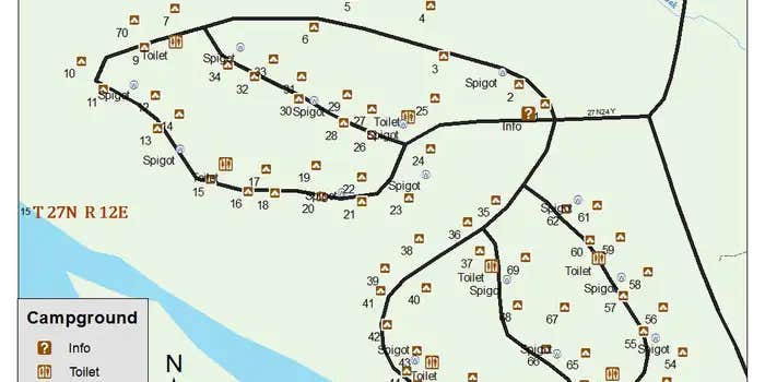
Map & DirectionsBoulder Creek (CA) is located in California near Janesville
Directions
From Oroville, take Highway 70 and head east 72 miles to Highway 89. Turn left and go 8 miles. Turn right on Road A22 (Arlington). Go 7 miles through Taylorsville to a \"T\" at the rodeo grounds. Turn right and head 20 miles to Antelope Lake. Follow the signs to the campground.
Coordinates
40.1833333 N
120.6119444 W
Connectivity
 T-MobileNo Coverage
- VerizonNo Coverage
- AT&TNo Coverage
Connectivity
- T-MobileNo Coverage
- VerizonNo Coverage
- AT&TNo Coverage
Access
- Drive-InPark next to your site
Site Types
- Tent Sites
- RV Sites
- Standard (Tent/RV)
Features
For Campers
- Picnic Table
- Reservable
- Drinking Water
- Toilets
- Pets
- Fires

