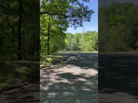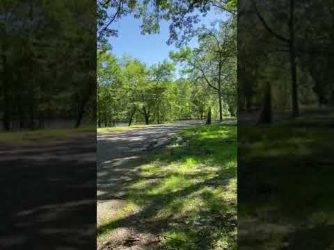

Free camping in the Mike Freeze Wattensaw Wildlife Management Area comes with a significant planning caveat: navigation apps frequently disagree on the coordinates, sometimes pointing to locations more than half an hour apart. Campers arriving for the first time, especially after dark, should approach slowly on the gravel roads and watch for small roadside signs marking designated camping areas. Trees with blue rings painted around them also indicate established spots. The gravel road surface is rough in places, with some sections featuring large loose rock that has concerned drivers with low-clearance vehicles.
The WMA covers a large forested tract with dozens of dispersed sites, so the experience varies considerably depending on where campers end up. Sites closer to the water sit near ponds and marshy areas, which brings wildlife like ducks and beavers but also heavier insect pressure, particularly flies and mosquitoes in warmer months. Sites farther from the water tend to be more open and less buggy. Several spots are gravel-surfaced, which may be less comfortable for tent camping but works well for RVs and big rigs. Reviewers who arrived on weekdays found the area nearly empty. Tavi C. notes that at her site, "I could not hear cars at all."
The campground is free, allows pets and campfires, and cell service is available. Nearby, White River Rest Area and North Webb Lake Camp offer additional options for campers moving through the Arkansas lowlands. Anglers, hunters, and anyone needing a low-cost overnight stop along I-40 will find this WMA worth the extra attention required to navigate it well.
Description
There are 38 primitive campsites maintained by area personnel.
There are approximately 270 acres of old beaver ponds that provide valuable habitat for furbearers and waterfowl. There are 2024 acres of old fields managed on a rotational basis by control burning, bush hogging, disking and planting. There is 14,419 acres of timber, primarily oak and hickory; 96 acres in streams and 113 acres in ponds and lakes. The main streams include; Wattensaw Bayou, Hurricane Creek, Miller Creek, Clark Creek, Barkley Branch and Bell Branch. There are numerous small ponds, 9 ponds created by removing dirt for I-40 construction and Webb and Mooreês lake which are oxbow lakes off the White River on the east side of the area
RV Road Trip Guides


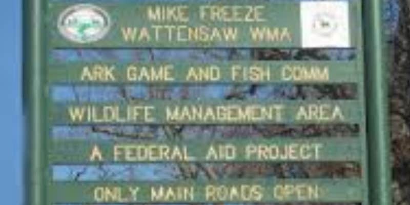
Map & DirectionsMike Freeze Wattensaw WMA is located in Arkansas near McRae
Directions
Access to the west side of the area is from Highway 11 off I-40 exit at Hazen. One access road is 1.5 miles north of the exit and the other is 3 miles north of the exit. The southeastern portion is accessed from US Highway 70 via Webb Lake Road 1 mile west of DeValls Bluff.
Coordinates
34.868803690536 N
91.49534042074819 W
Connectivity
 T-MobileNo CoverageVerified by 1 userLast on 3/20/26
 VerizonLTESome CoverageVerified by 2 usersLast on 7/31/26
 AT&T5GGood Coverage
Connectivity
- T-MobileNo CoverageVerified by 1 userLast on 3/20/26
- VerizonLTESome CoverageVerified by 2 usersLast on 7/31/26
- AT&T5GGood Coverage
Access
- Drive-InPark next to your site
- Walk-InPark in a lot, walk to your site.
Site Types
- Tent Sites
- Standard (Tent/RV)
- Group
Features
For Campers
- Phone Service
- Alcohol
- Pets
- Fires
For Vehicles
- Big Rig Friendly
FREE established camping
Enjoy camping on government land. Limited or no services at this camping area.
PERMIT might be REQUIRED
We curate permit requirements across the US for our PRO members. Try PRO to see if Mike Freeze Wattensaw WMA needs a permit.
Drive Time
- 1 hr 12 min from Little Rock, AR
- 1 hr 56 min from Memphis, TN
- 1 hr 56 min from Jonesboro, AR
- 1 hr 58 min from Hot Springs, AR